
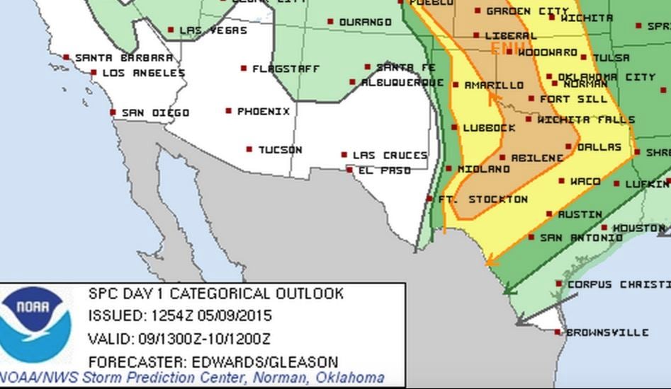
Today’s threat for severe weather will be concentrated over two regions…panhandle and north/west central Texas with several rounds of storms expected…ongoing and this afternoon/evening and overnight as well. Widespread storms ongoing this morning across the panhandle is expected to move quickly northeast and out of the region by around lunchtime this afternoon. The same is expected for ongoing storms across northern Texas this morning. With this morning’s remaining activity, a few of the embedded storm cells have the potential to become severe with mainly a hail and damaging wind gust threat, although a tornado spin-up or two cannot be completely ruled out. Additional storm development is expected this afternoon along the dryline once again…mainly impacting parts of west central, central and northern Texas. The main threats once again will be large hail and damaging winds, along with the threat of a few isolated tornadoes. Flooding rains will also be likely. Very similar to what we’ve experienced the past several days. A third round of widespread rain with embedded storms is possible overnight into early Sunday as well. The Storm Prediction Center’s latest update indicates an Enhanced Risk primarily across the northeastern panhandle down into north/northwest and west central Texas for today. Early day convection its stabilizing effects on the atmosphere has limited the severe potential for this afternoon; however, if we can get some good surface heating and clearing this afternoon, we’ll see a better chance for strong storm development in these risk regions as the dynamics for strong storms will be in place.


0 Comments