

Showers and thunderstorms will be possible from South-Central Texas through Northeast Texas this morning into this afternoon. Severe thunderstorms are not anticipated but a few stronger storms are not out of the question. Skies will remain mostly cloudy across the Rio Grande Valley, South Texas, Central Texas, North Texas, Northeast Texas, East Texas, and Southeast Texas much of today. The Texas Panhandle, all of West Texas, into the Permian Basin and Far West Texas will see mostly clear skies and thus the warmest temperatures. A few lower 90s will be possible in the Texas Panhandle today with upper 80s across West Texas into the Permian Basin including Midland and Odessa. Low to mid 80s across Northwest Texas, the Big Country, Concho Valley, into North Texas. Upper 70s to around 80 across Central, South, Northeast, East, and Southeast Texas into the Rio Grande Valley.
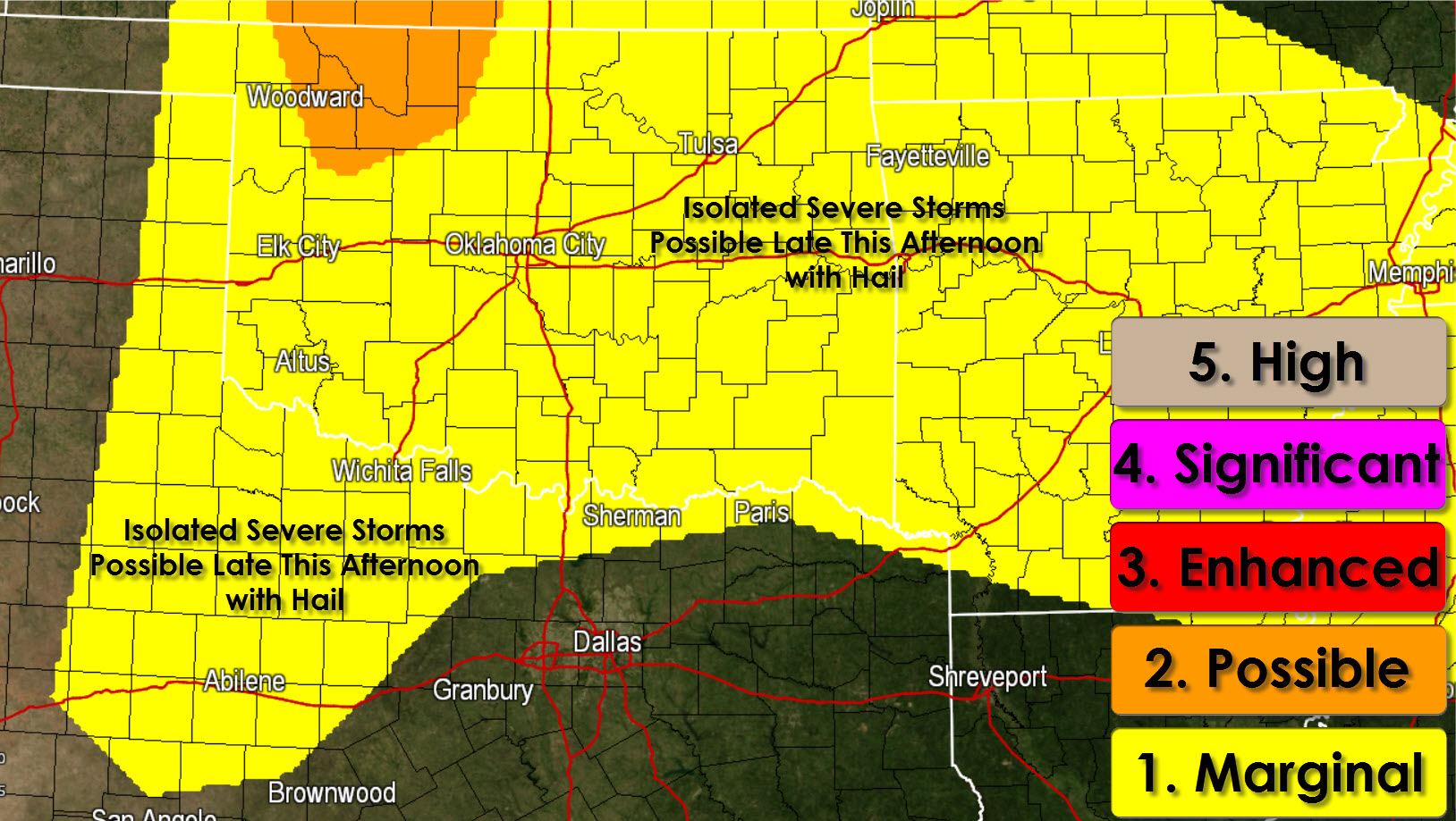
Isolated thunderstorms will once again be possible late this afternoon just east of a surface dryline from the eastern Texas Panhandle onto the Caprock. The capping inversion will be stronger today so the chance of storms is lower than Monday. Nevertheless any storm that manages to pop through the cap will likely be severe with a hail risk. Any storms would die down not too long after sunset.


0 Comments