
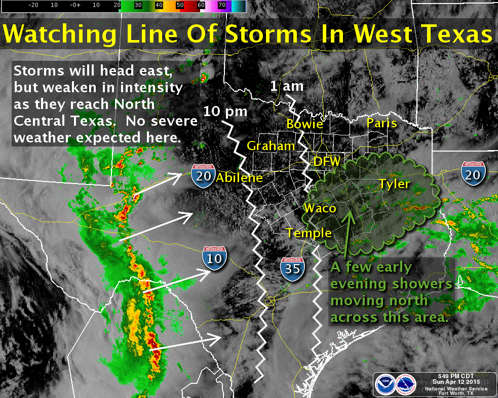
The radar has been busy this afternoon across west and southwest Texas with numerous storms developing in advance of an upper level disturbance near the Rio Grande. These storms will continue to move east across west and southwest/south central Texas throughout the evening and overnight. Some of these storms could also impact parts of north central Texas overnight, but at this point, most of the short-range models are showing only minimal storm coverage. We also have a cold front that will move slowly through the panhandle this evening and overnight, and into north Texas tomorrow. The front is expected to arrive across north Texas tomorrow afternoon and stall out across central Texas by Tuesday.
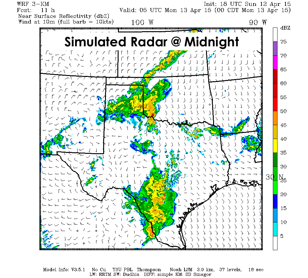
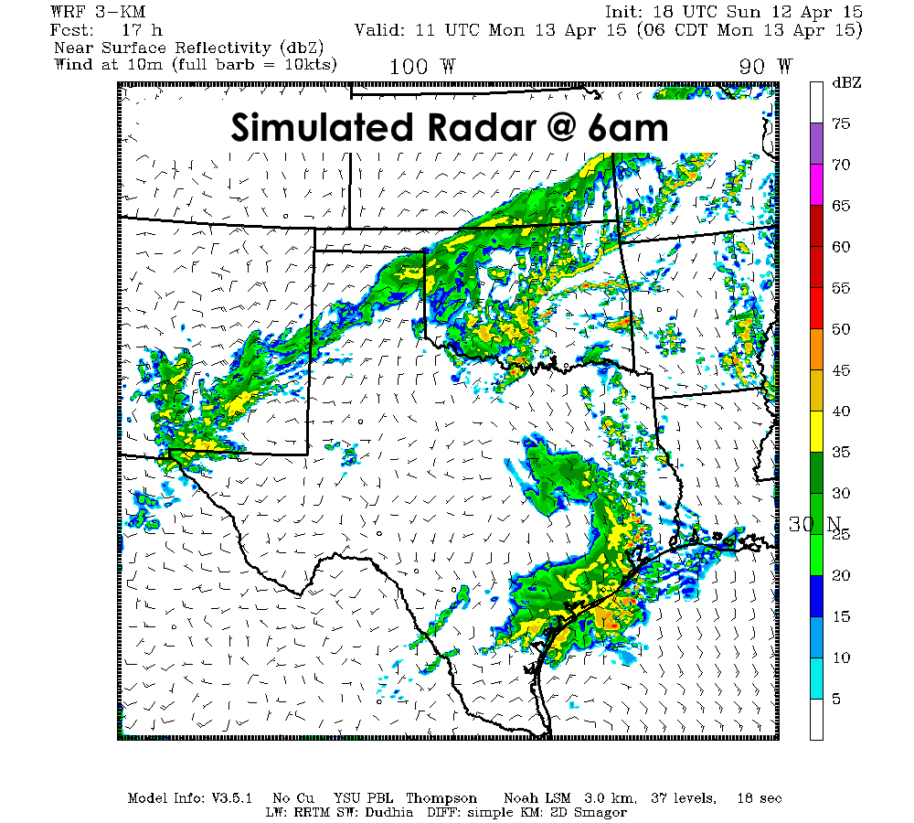
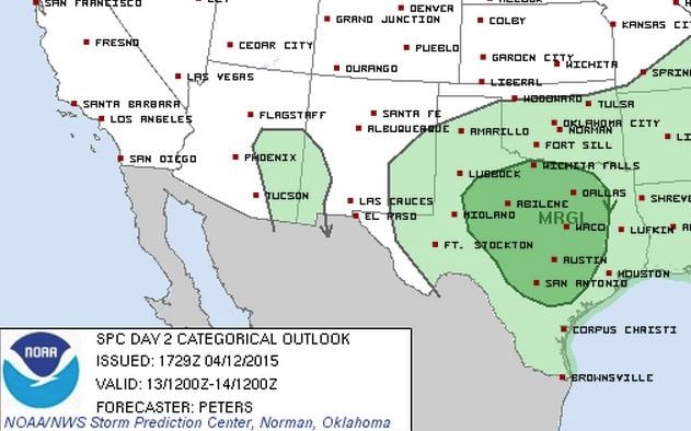
Additional widespread storm development is likely on Monday as the aforementioned upper level disturbance tracks northeast across the state. The Storm Prediction Center has placed parts of north and central Texas under a Marginal Risk of severe weather tomorrow afternoon with damaging winds and hail being the main threats. This includes Wichita Falls, Abilene, Dallas/Ft. Worth, Waco, Austin and San Antonio and surrounding communities. We’ll need to keep an eye on the storm chances tomorrow because how worked over the atmosphere becomes with tonight and tomorrow morning’s storms will have an effect on how unstable the atmosphere will become by tomorrow afternoon. Rain cooled air tends to stabilize the atmosphere, so if we receive less than anticipated rain across central and northern Texas overnight, we could be looking at a higher threat for stronger storms. We’ll be keeping an eye on this and update you if anything changes!


0 Comments