
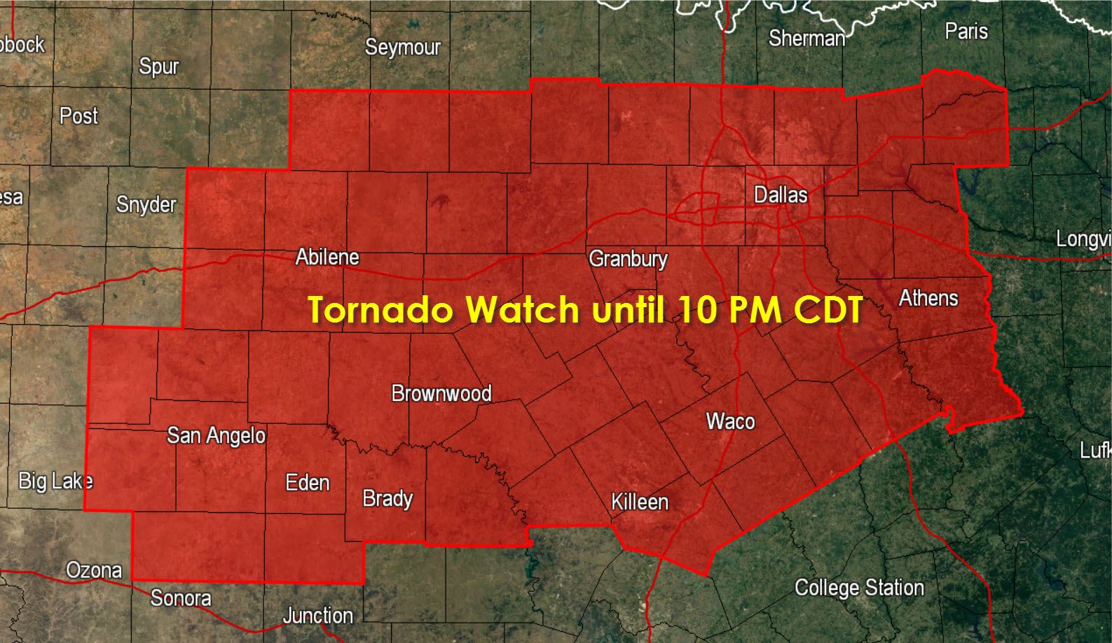
A Tornado Watch has been issued for the Big Country and North Texas until 10 PM. This includes San Angelo, Abilene, Brownwood, Stephenville, Mineral Wells, Fort Worth, Dallas, Athens, Hillsboro, Waco, and Killeen. A busy severe weather day is setting up with the potential for all modes of severe weather. Line segments will have the potential to produce hail up to the size of golfballs and wind gusts over 70 MPH. Discrete supercells will have the potential to produce hail larger than baseballs, wind gusts up to 70 MPH, and tornadoes. If a supercell is able to latch onto the warm front or boundary there is the potential for a strong/significant tornado. Even with widespread cloud cover the atmosphere has destabilized with a very moist airmass in place. As upper level forcing arrives from the west we should see an increase in thunderstorm coverage this afternoon into this evening.
TORNADO WATCH NUMBER 100
NWS STORM PREDICTION CENTER NORMAN OK
210 PM CDT FRI APR 24 2015
THE NWS STORM PREDICTION CENTER HAS ISSUED A
* TORNADO WATCH FOR PORTIONS OF
WESTERN AND NORTH TEXAS
* EFFECTIVE THIS FRIDAY AFTERNOON AND EVENING FROM 210 PM UNTIL
1000 PM CDT.
* PRIMARY THREATS INCLUDE…
A FEW TORNADOES LIKELY WITH A COUPLE INTENSE TORNADOES POSSIBLE
SCATTERED LARGE HAIL AND ISOLATED VERY LARGE HAIL EVENTS TO 3
INCHES IN DIAMETER LIKELY
SCATTERED DAMAGING WINDS AND ISOLATED SIGNIFICANT GUSTS TO 75
MPH POSSIBLE
SUMMARY…SCATTERED STORMS FORMING OVER THE EASTERN PERMIAN BASIN
WILL INTENSIFY THIS AFTERNOON INTO EARLY EVENING ACROSS THE BIG
COUNTRY TO NORTH-CENTRAL TEXAS. ADDITIONALLY…A FEW DISCRETE STORMS
SHOULD DEVELOP ACROSS PARTS OF CENTRAL TEXAS IN THE LATE AFTERNOON.


0 Comments