
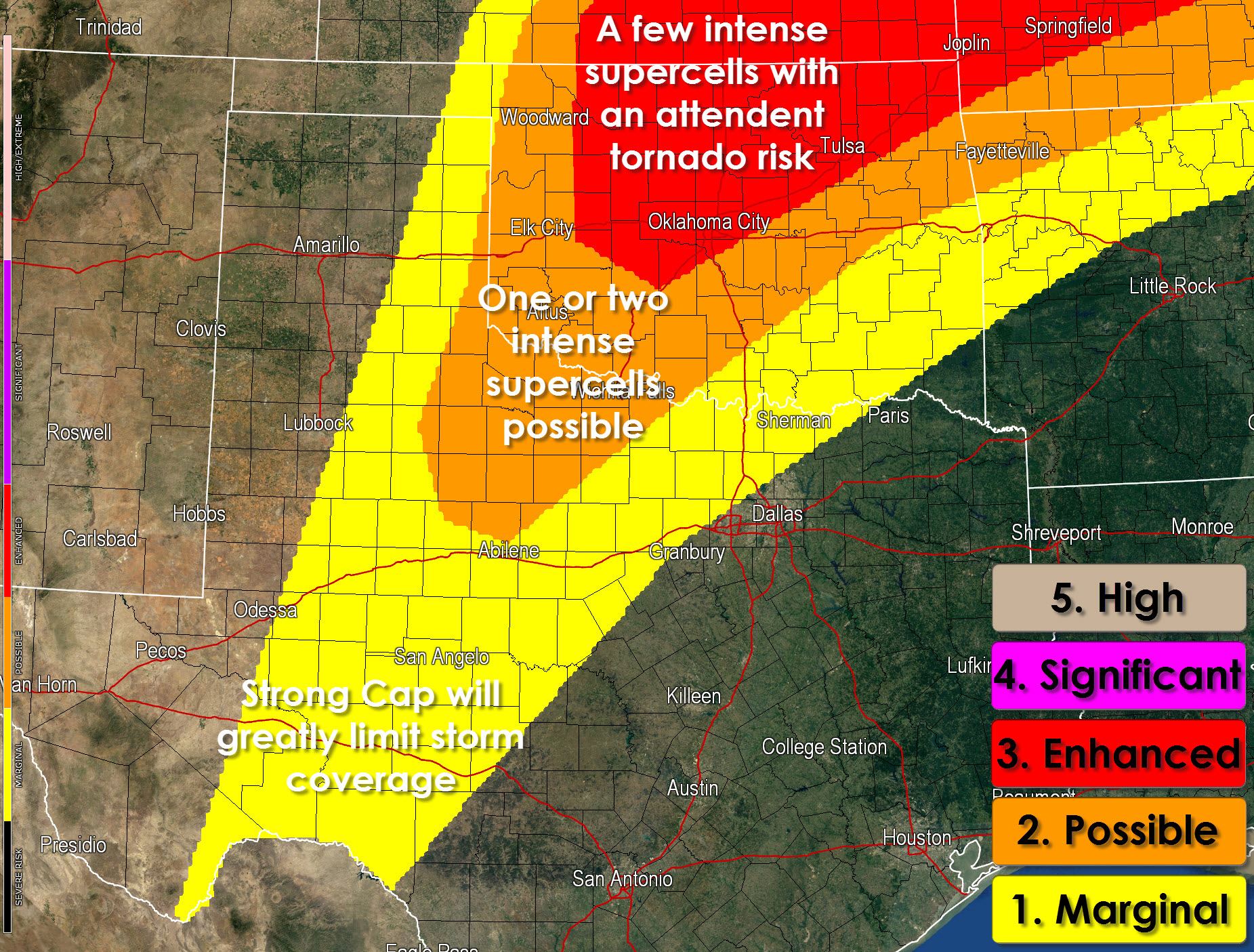
An upper level disturbance will bring the chance for showers and thunderstorms to the Hill Country, Concho Valley, and parts of North Texas later this morning into this afternoon. This activity will actually help keep the severe weather threat partially lower in Texas since most of this activity will occur before primetime heating. By early this evening additinoal thunderstorms may fire up just east of the dryline in Northwest Texas into the Permian Basin. The strength of the cap will determine whether or not we see any storms actually develop. Should storms fire up off the dryline late this afternoon they would likely become supercellular with baseball size hail and some tornado risk. This zone is highlighted in the Storm Prediction Center’s outlook below. Check back for updates later this morning into this afternoon since the cap’s strength along with any other convection will create forecast adjustements. If thunderstorm coverage early this afternoon is widespread the overall threat for severe weather would be more marginal – but the strongest storms could still produce hail.
We’ll be chasing in Oklahoma where the tornado risk will be higher today. To keep up with storms in your area bookmark our free interactive weather radar at texasstormchasers.com/radar


0 Comments