
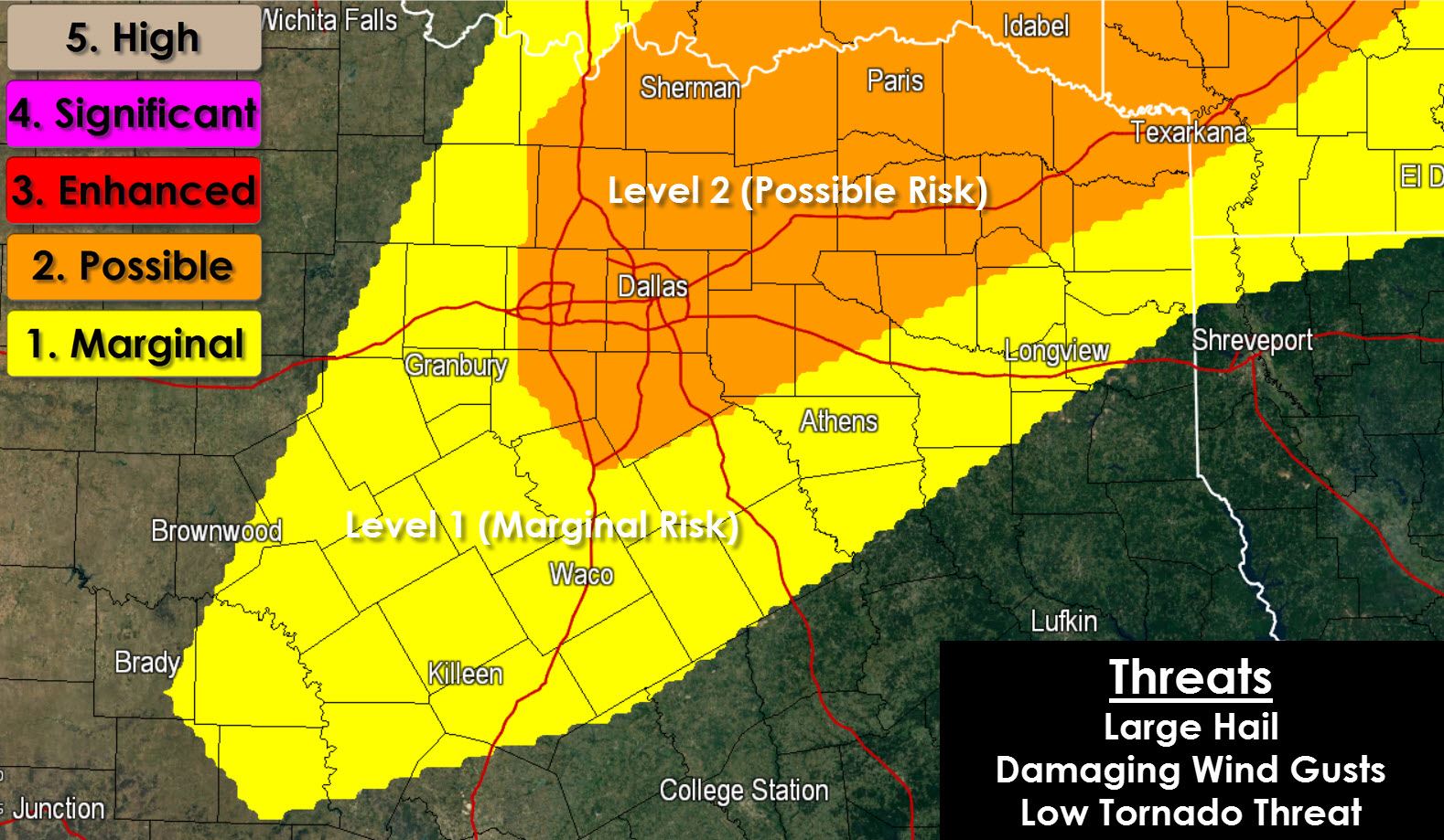
A few forecast adjustements are required thanks to the storms that impacted North and Northeast Texas this morning. Several small areas of low pressure developed from this morning’s storms. Those small low pressure areas along with several outflow boundaries present several possible initiation points for thunderstorms this afternoon. Meanwhile an upper level storm system (shortwave) will be moving into North Texas later this afternoon. That shortwave should help initiate an area of thunderstorms after 3 PM west/southwest of the D/FW Metroplex into parts of Central Texas. These storms would move northeast through the D/FW Metroplex during rush hour and then continue into East/Northeast Texas early this evening. Both atmospheric instablity and winds aloft will support an organized convective mode. That means we will have the risk for some severe weather with this afternoon’s storms. Quarter to half-dollar size hail and localized damaging wind gusts over 60 MPH will be possible with the strongest storms. A brief tornado cannot be ruled out but the overall tornado threat is pretty low but not zero.
Here is a simulated radar forecast from the 11 AM run of the HRRR (High Resolution Rapid Refresh) showing the general idea we have for this afternoon.

weatherbell.com


0 Comments