
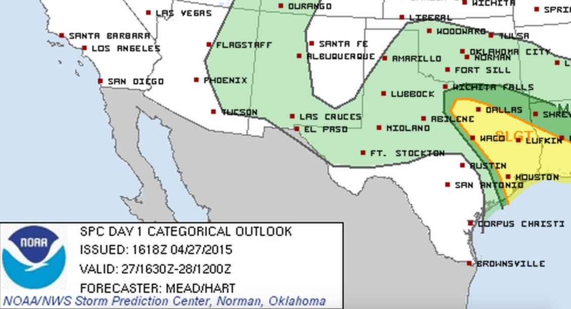
Compared to yesterday, today is expected to be a cakewalk, although there still is some threat of a few strong to severe storm development this afternoon and evening across north central and into east Texas. The Storm Prediction Center has placed parts of north central into east Texas under a Slight Risk this afternoon as we reach peak daytime heating. The airmass over us was pretty well worked over with last night’s storms; however, there appears to be at least some destabilization possible by later this afternoon with sufficient instability parameters, and especially wind shear, to create an environment favorable for at least a few strong to severe storms to develop. This development is expected to arise out of a line of storms, currently hanging out just west of the DFW metro, as it moves east/southeast this afternoon and evening. Large hail and damaging winds will be the two primary threats; however, a brief tornado or two cannot be completely ruled out. As always during this time of the year, we remind everyone to pay attention to the weather as we get into the afternoon hours. Have a way to receive weather warnings if any are issued and seek shelter immediately if one is issued for your location.


0 Comments