
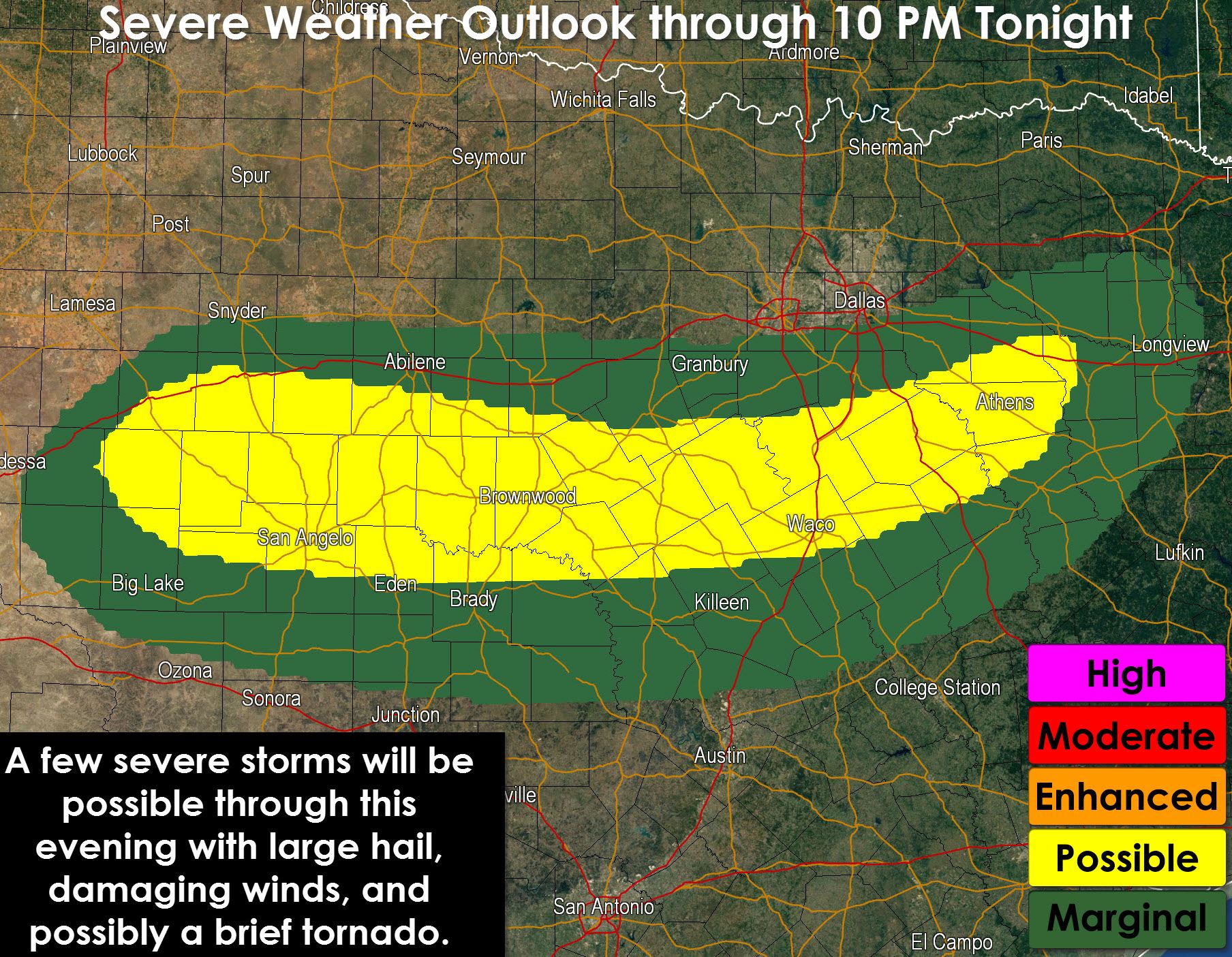
While not shown on the graphic I do want to mention the potential for one or two supercells in the Rio Grande Valley. We already have one storm northeast of Zapata producing extremely large hail. Luckily its in a rural area but still a problem for the livestock and folks out in that area. Compared to earlier outlooks we’ve seen the severe weather risk zone considerably shrunk. This is due to the stabilizing effects from rain this morning and drier air that is moving across CEntral Texas. The main focus point for thunderstorm develop through this evening will be along/near a southward moving cold front that is south of Interstate 20. We’ve already seen some stronger storms near Abilene and we may see additional storms fire up through early evening. The strongest storms could become severe with large hail and locally damaging wind gusts. While low level wind shear is not particularly favorable for tornadoes there is the threat for a brief tornado due to boundaries left over from storms this morning. North of the cold front the severe weather threat is much lower due to the cooler temperatures and stabilizing effects from rain this morning. We’ll see another round of storms tonight north of the front but they are not expected to be severe.


0 Comments