
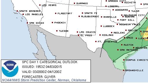
The Storm Prediction Center has removed the Slight Risk of severe thunderstorms from east/southeast Texas this afternoon, but a Marginal Risk for widely scattered strong storms remains. The cold front which blew through the panhandle and northern Texas this morning is now slowing and is drooped from northeast to southwest along a line from about Sulphur Springs, Corsicana, Waco, Kerrville and down into Del Rio. We have a few showers beginning to develop across northeast Texas between Texarkana and Longview, with more development across southeast Texas from Beaumont towards Houston. Additional scattered development is likely this afternoon across these areas and further west towards Austin/San Antonio. Not expecting much in the way of severe weather as the capping inversion has kept most of the storm development at bay so far, but if one or two of these storms can break through the cap and become strong enough, we could see an isolated large hail and damaging wind threat. We’ll be keeping an eye on the radar and will post updates when necessary. Overall though, it looks like a great day for most of the state!


0 Comments