
We’ve had two days of severe weather potential now and for the most part we’ve kept the storms outside our largest cities. That will change tomorrow as a strong upper level storm system combines with near record-high moisture levels and an unstable airmass. The atmosphere will be spinning like a top and with dewpoint values in the lower 70s it will also be quite unstable. The makings are in place for a severe thunderstorm outbreak but that doesn’t necessarily mean we’ll be dealing with many tornadoes. By late morning to early afternoon tomorrow a dryline will be somewhere west of Interstate 35. The dryline stayed way far west of where we thought it would end up today so you’ll understand when I say there is some uncertainty on where it will be by lunchtime tomorrow afternoon. I do believe it will be several counties west of Interstate 35. Another factor will be when will storms fire up. Some indications are we’ll have storms firing up by 12 PM while others say maybe closer to 2 PM. How early thunderstorms develop will determine how far west the risk of severe thunderstorms extends. Likewise an earlier initiation means the atmosphere won’t be ‘as unstable’ compared to a few hours later. As you can see we have several questions that need answering. Hopefully we’ll get those answers with tonight’s weather model guidance.
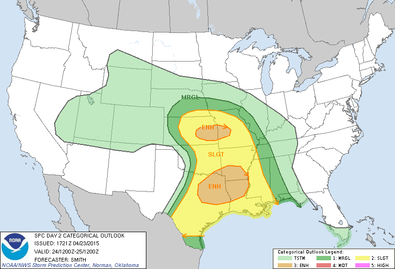
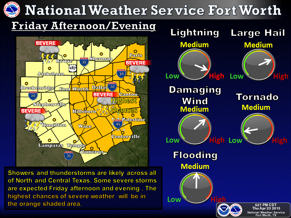
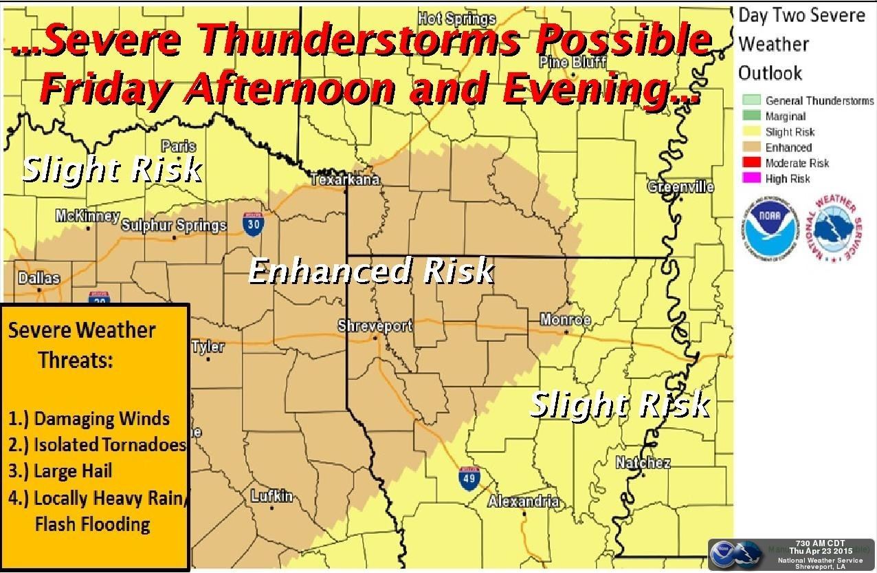
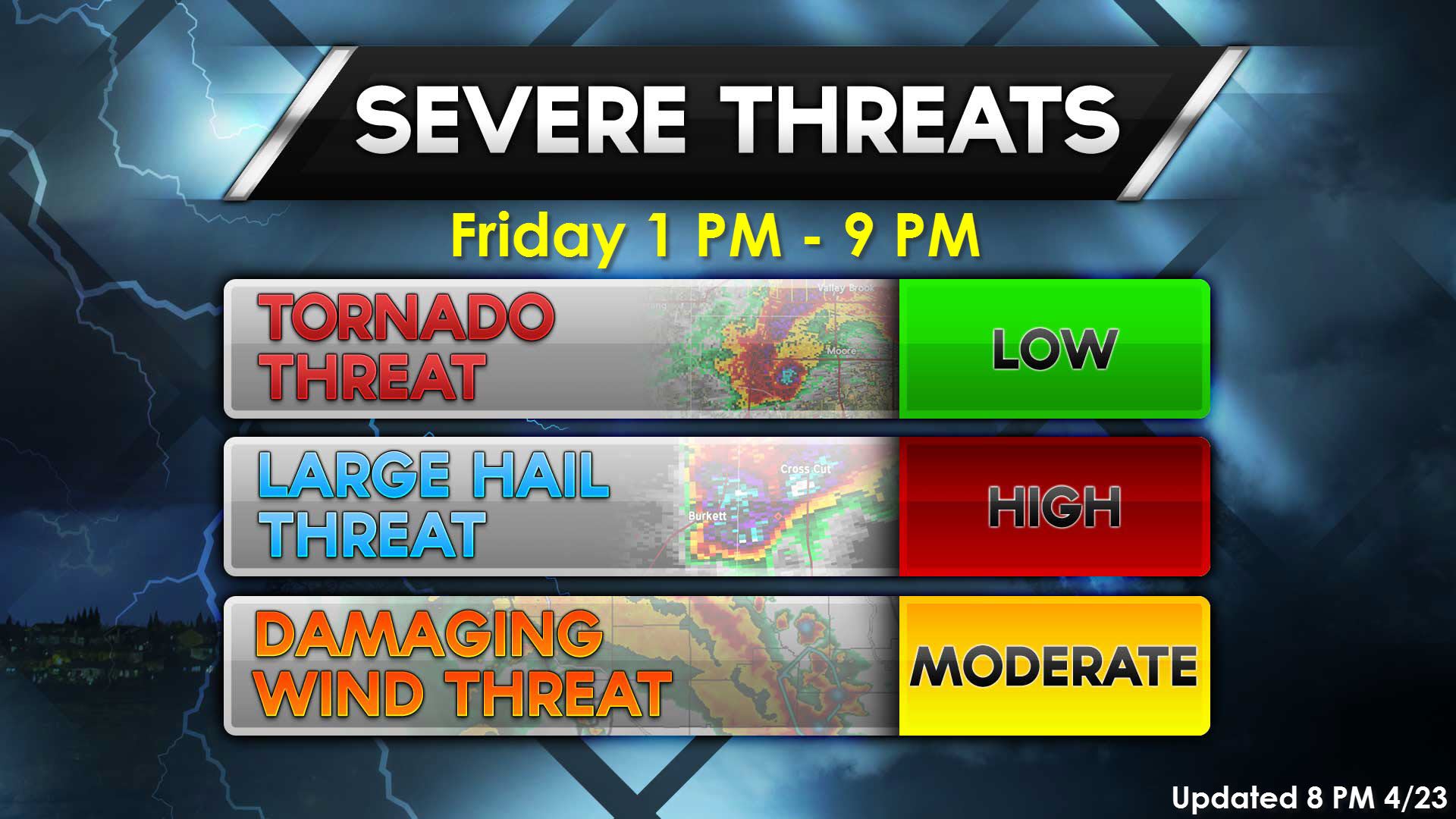
Regardless of the questions above there is an enhanced severe weather risk along and east of Interstate 35 with the ‘possible’ severe weather risk extending 50-75 miles west of Interstate 35 from the Red River south to the Mexico border. The enhanced severe weather risk includes Northeast and East Texas. Depending on trends tonight and where things set up we could see these risks extended further west or shoved east. The primary severe weather hazards will be large hail up to the size of baseballs and destructive wind gusts up to 75 MPH. There will be the threat for a few tornadoes especially with discrete thunderstorms or intense cells in a squall line.
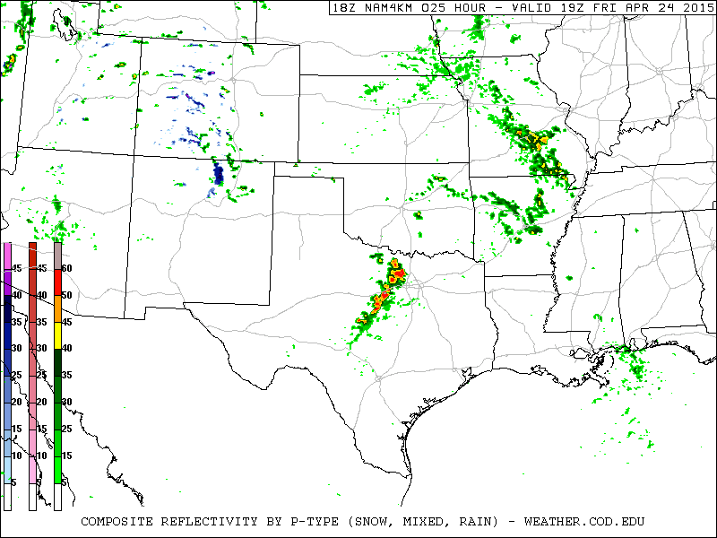
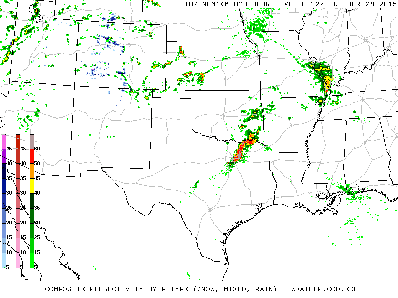
These graphics depict what the afternoon run of the North American Model shows tomorrow afternoon. Keep in mind this is only model guidance and shouldn’t be taken as a literal forecast of what the radar will look like. If it is correct we’ll see storms fire up west of I-35 and west of D/FW early Friday afternoon. Storms would be intensifying and probably severe as they move east into the D/FW Metroplex around 3 PM. They could be quite intense as they move across East and Northeast Texas
Simulated Radar Forecast at 2 PM Friday
Simulated Radar Forecast at 5 PM Friday

Simulated Radar Forecast at 7 PM Friday
Tomorrow has the potential to feature a widespread severe weather potential along and east of Interstate 35 across North, Northeast, and East Texas. Large hail up to the size of baseballs will be possible with discrete supercells along with a tornado risk. Damaging wind gusts up to 70 MPH are possible with discrete storms as well. Destructive and an enhanced wind damage threat up to 80 MPH is possible with the squall line along with brief tornadoes. If we ended up dealing with a more discrete thunderstorm event tomorrow the threat for giant hail and tornadoes would increase. Likewise a more linear mode (squall line) will keep hail and damaging wind gusts the primary threats with a brief tornado also possible. Time will tell.


0 Comments