
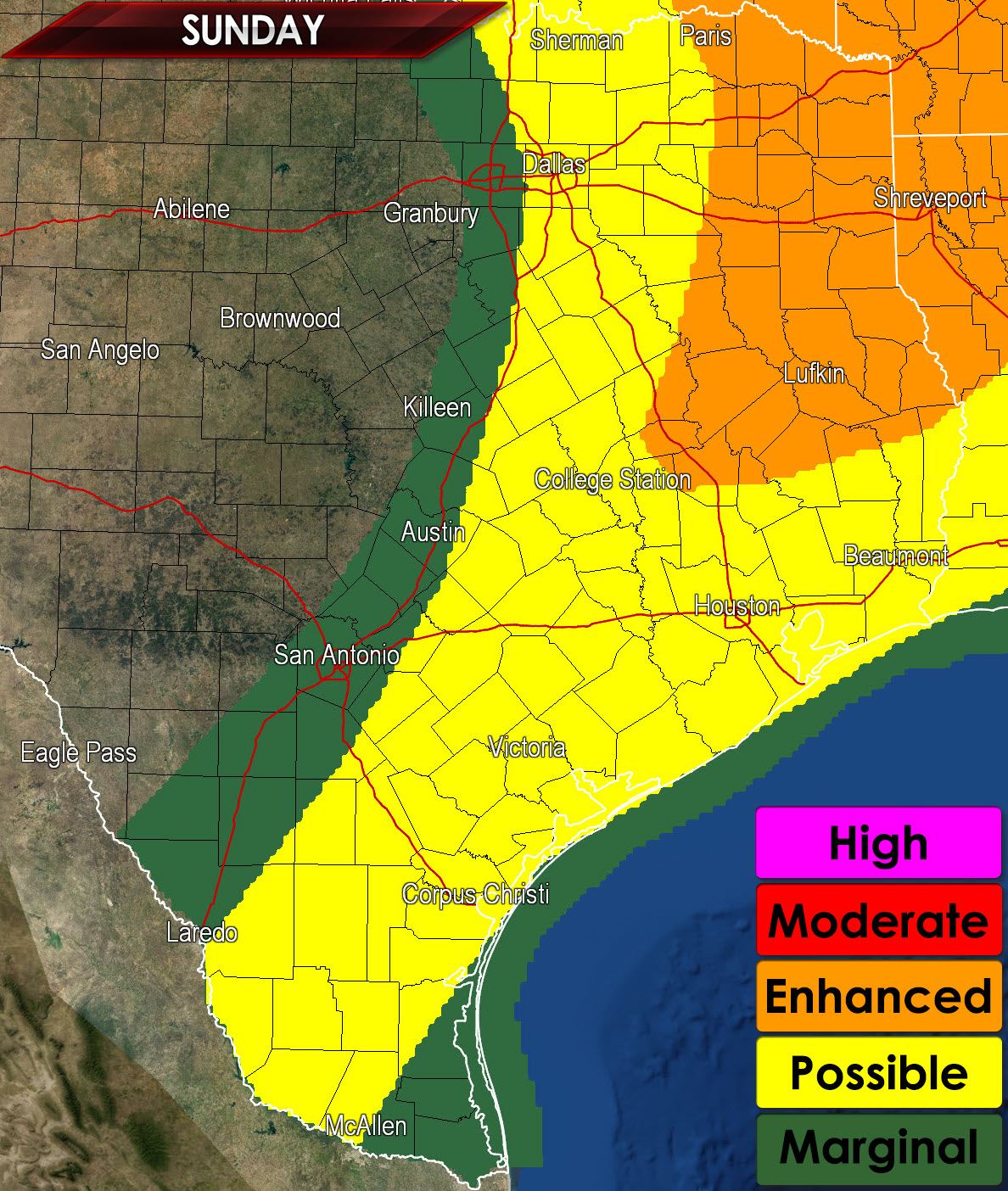
Another active severe weather day is expected from Northeast Texas south to the Gulf Coast back into Deep South Texas. The Storm Prediction Center has placed Northeast and East Texas in an enhanced risk for severe weather this afternoon. Surrounding that we have a ‘possible’ risk zone from I-35 and the D/FW Metroplex south through the Brazos Valley, Southeast Texas, Coastal Bend, into Deep South Texas. A marginal severe weather threat extends just west of I-35. The primary threat will be large hail with the initial discrete thunderstorms along with a low tornado threat. As thunderstorms congeal into clusters or a squall line the threat for damaging straight-line wind gusts will increase along with a continued threat for hail.
By early afternoon we should have a weakening cap along with ample wind shear and instablity to support organized thunderstorms. Once we get storms to fire they could become strong to severe quickly in a favorable environment. The strongest initial storms will likely be supercellular with a threat of destructive hail up to the size of baseballs. The tornado threat isn’t high today but it is a concern especially in Northeast Texas where low level wind shear will be maximized. Localized damaging wind gusts and heavy rain are also on the threat list.
As the cold front continues to move southeast we should see thunderstorm coverage become more widespread – especially in the enhanced risk zone. As additional thunderstorm development occurs we should see a squall line begin to develop. Once storms line out the threat for tornadoes and destructive hail will become secondary to the straight-line wind threat and coin-size hail threat. This squall line will continue to move south and east into the evening hours.


0 Comments