
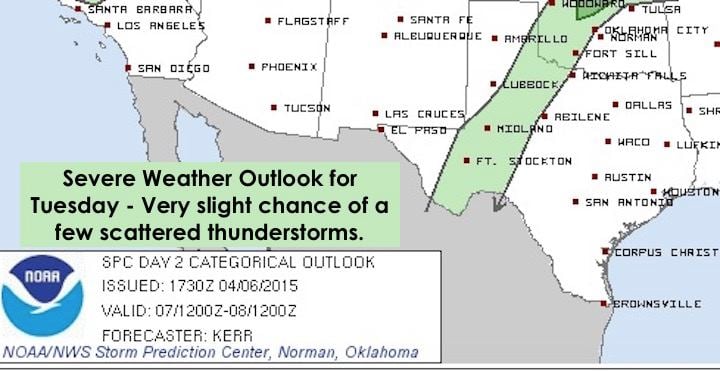
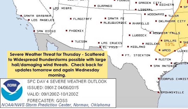
For the next couple of days, conditions will be mainly warm and dry across most of the state. We’ll have a very slight chance of seeing a couple of storms pop up tomorrow just east of the dryline across west central Texas…a few more chances on Wednesday a little further east…then more widespread chances on Thursday for north central and northeast Texas. I have to stress that the greatest threat for severe weather will be up into Oklahoma and parts of Kansas and Missouri over the next couple of days, but there is a reasonable threat here as we’re about to explain. The atmospheric capping inversion that we talk about a lot during the spring and summer months…not so affectionately known as “Capzilla” sometimes…is what will keep a lid on most of the convective chances each afternoon, but a strong upper level system is expected to enter the central and south central plains by mid-week which will help to increase lift and loosen up the cap somewhat. The air above Capzilla each afternoon will be quite unstable through Thursday. In simple terms, that means the air cools rapidly with height which can allow warmer surface parcels of air to rise very quickly and develop into intense thunderstorms…that is, IF they can either break through our Capzilla, or the cap can be weakened by an approaching upper level system or other means. There is a chance of that happening right along the dryline tomorrow and Wednesday. Not everyone will see storms, but those that develop could go quickly severe with very large hail and damaging wind threats. Here’s the latest batch of Outlooks from the Storm Prediction Center for tomorrow through Thursday. As always, we will continue to keep an eye on things and will update throughout the week.

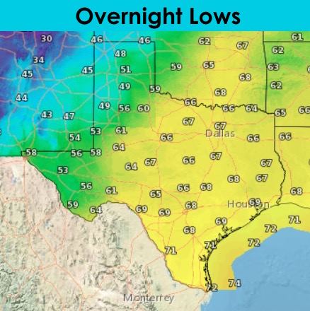
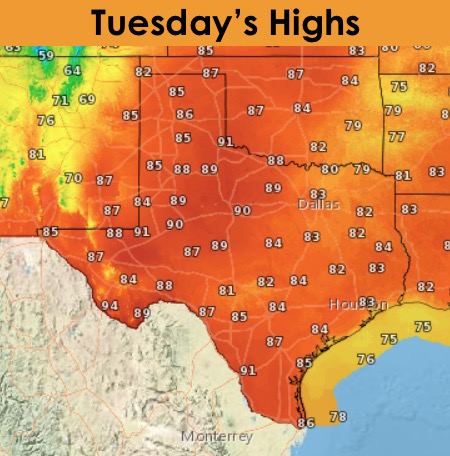
Lows tonight, warm and muggy east of the dryline. West of the dryline with much less humidity, temps will quickly drop into the upper 40s and 50s. Cloudy conditions will prevail once again tomorrow morning across most of the state in the warm and humid regions east of the dryline, but we’ll see those clouds scatter out by the afternoon. Could see some patchy fog develop early tomorrow morning across much of east Texas, and also down in deep south Texas. Other than that, really no other weather hazards tomorrow unless a severe storm or two pops up.


0 Comments