
The active weather pattern we’ve been in will continue this week as the sub-tropical jet stream remains overhead. While today will be relatively quiet weather-wise the chance for strong to severe thunderstorms will return on Tuesday. Beyond Tuesday chances of thunderstorms look probable over parts of Texas every day this week with an associated severe weather risk also possible daily. This is mid-April and we’re in the heart of our severe weather season. Having daily thunderstorm chances shouldn’t be a surprise. We’ll talk more about storm chances but first lets take a look at whats in store today.
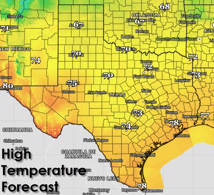
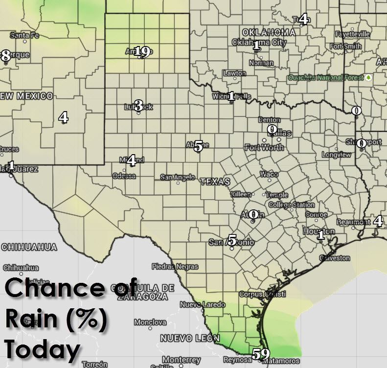
A few showers and thunderstorms are possible in the Rio Grande Valley and in the Texas Panhandle. Severe weather is not expected to be a problem with today’s storms. The remainder of Texas will remain dry today with pleasant temperatures. In fact the cold front that pushed through yesterday has dried out the atmosphere which means today will feature less humidity. That chances tonight into tomorrow as southeast winds bring back the moisture and keep it in place most of this week. High temperatures will range from the upper 60s in the Panhandle with 70s everywhere else in Texas. It really will be a pretty nice spring day.
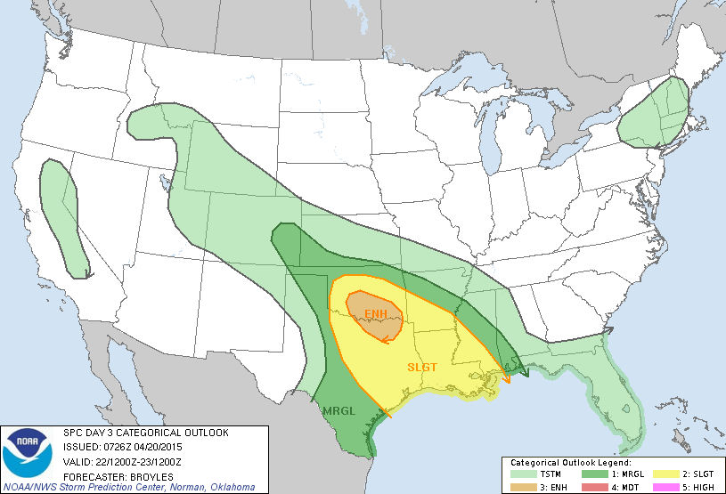
The chance for a few strong to severe thunderstorms will return to the eastern Texas Panhandle, Caprock, and West-Central Texas during the late afternoon hours on Tuesday. Moisture will still be returning after the cold front pushed it out into the Gulf yesterday. Widespread thunderstorm development is not expected with coverage remaining isolated. Any storms that do manage to pop up on Tuesday could be severe with large hail, localized damaging winds, and perhaps a tornado. A more widespread severe weather threat is possible on Wednesday across North Texas, Northeast Texas, and perhaps Central Texas depending on how far south the cap breaks along the dryline. The atmosphere will be very unstable with ample wind shear in place to support severe thunderstorms capable of producing baseball size hail, damaging wind gusts over 70 MPH, and a few tornadoes. Forecast refinements for both Tuesday and especially Wednesday are likely as we get closer to each event. The chance for thunderstorms, some possibly severe, will continue into Thursday and Friday but details remain too murky at this time and will depend on each previous day’s event.

Tuesday’s Severe Weather Outlook
Wednesday’s Severe Weather Outlook
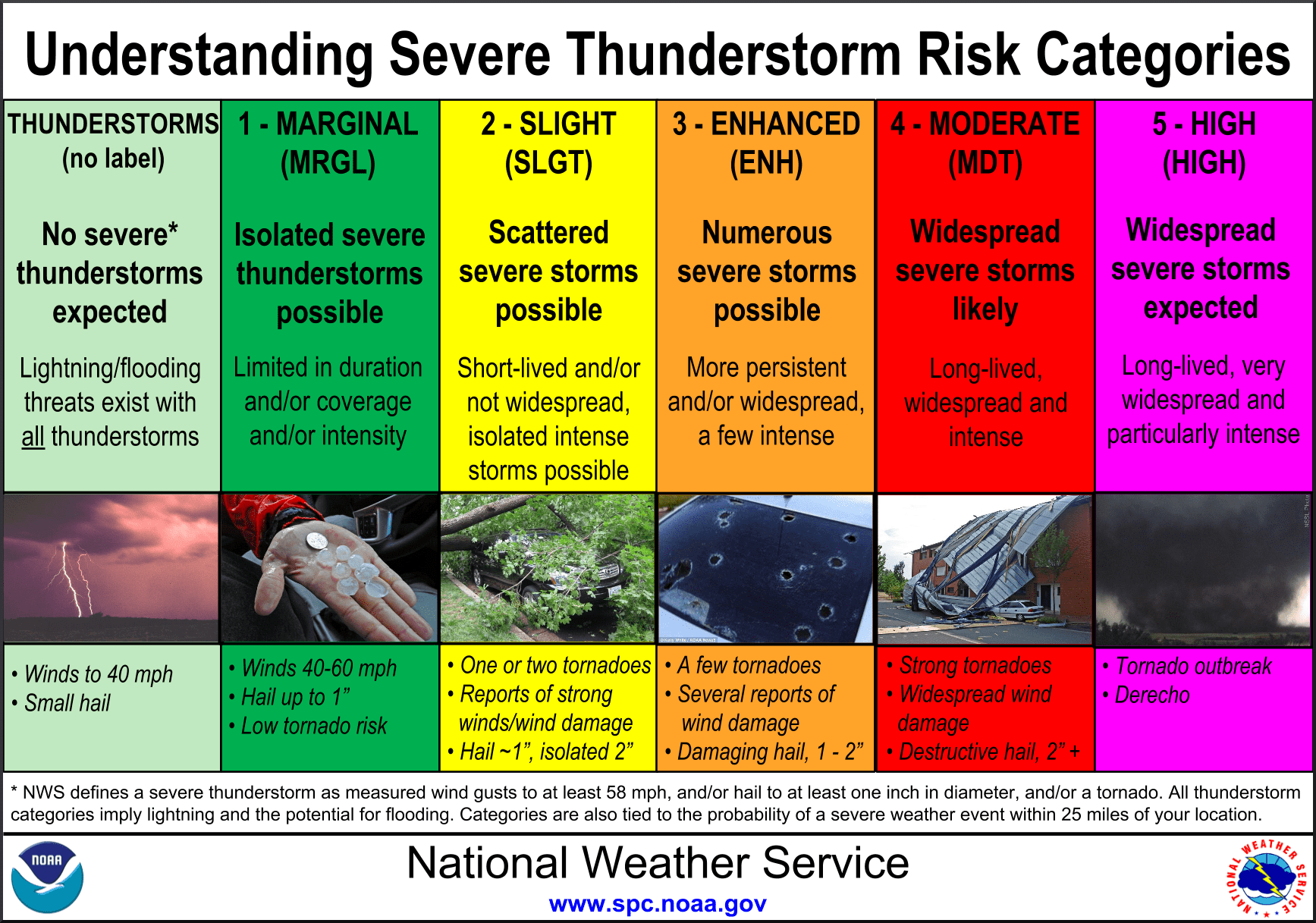
Risk definitions for severe weather outlook


0 Comments