
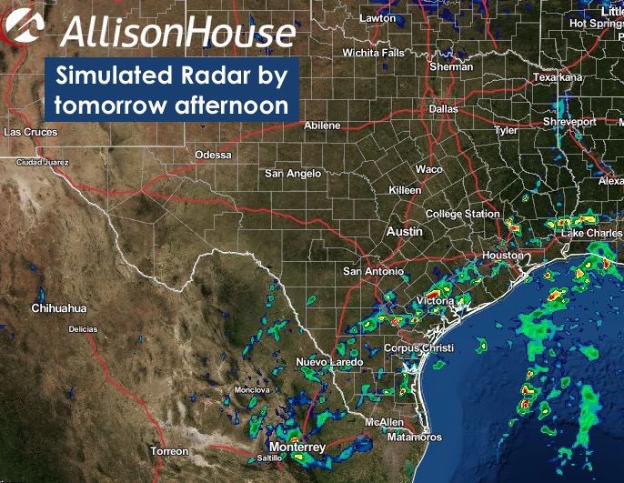
Tuesday looks to be yet another busy thunderstorm day. Today’s cold front is expected to stall out across central/south central Texas by tomorrow afternoon with the upper low beginning to track northeast across the state. Best upper level forcing and atmospheric instability will be across the southern 1/3rd of the state with widespread showers and thunderstorms expected to develop once again tomorrow afternoon as we reach peak daytime heating. There will be at least some pockets of moderate instability to work with by tomorrow afternoon, and any breaks in the clouds will allow additional surface heating and has the potential to increase instability even further. The storm Prediction Center currently has a Marginal Risk of severe weather across this region with downburst winds being the main threats. Folks inland from Houston, Corpus and Brownsville/deep south Texas will all need to keep an eye on the weather tomorrow afternoon for the threat of severe weather. Same as today, we’ll keep an eye out for any upgrade to the risk outlook and will keep you notified.


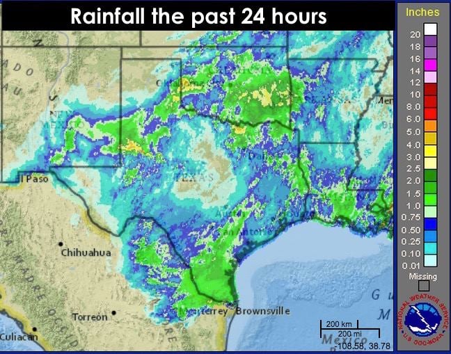
Here’s a look at the rainfall we’ve had over the past 24 hours. I know some folks across south/southeast Texas are screaming for the rain to stop. I sure wish we could convince Mother Nature to make it rain exactly where we need it the most and get our lakes and watersheds filled again.


0 Comments