
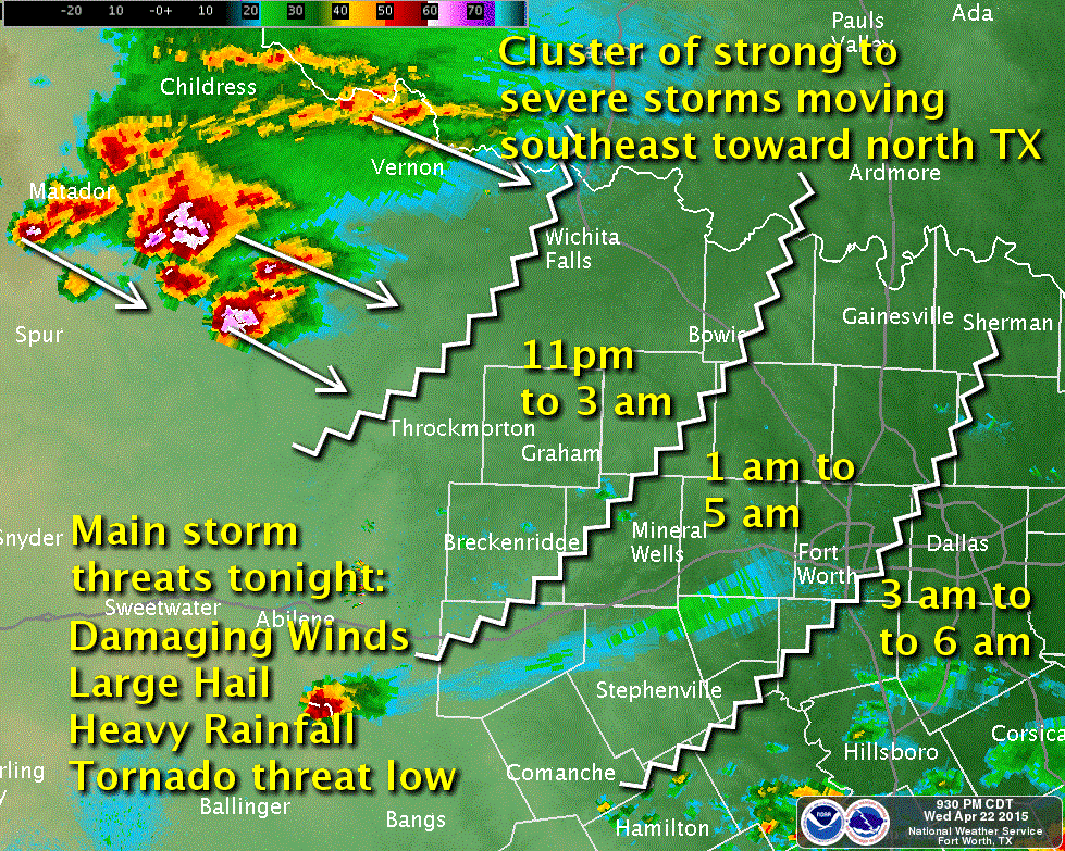
 Storms continue to affect parts of the south rolling plains and far northwest Texas this evening. The tornado threat will diminish over the next couple of hours, but the threat for high winds, hail, dangerous lightning and heavy rain will continue through the late evening and nighttime hours as this complex of storms moves east southeast across north Texas. The NWS office in Ft. Worth has put together a graphic with estimated timing of impacts across north Texas overnight. Folks across this area will need to be prepared overnight for this severe weather threat…have your NOAA Weather radios on…or your smartphone volume turned up so you can hear any alerts that come across for your area. Again, the tornado threat is expected to diminish greatly within the next couple of hours, so it’s not likely that we’ll be dealing with that as a nighttime threat, thank goodness! But you’ll probably wake up a few times with thunder and lightning along with the potential for large hail.
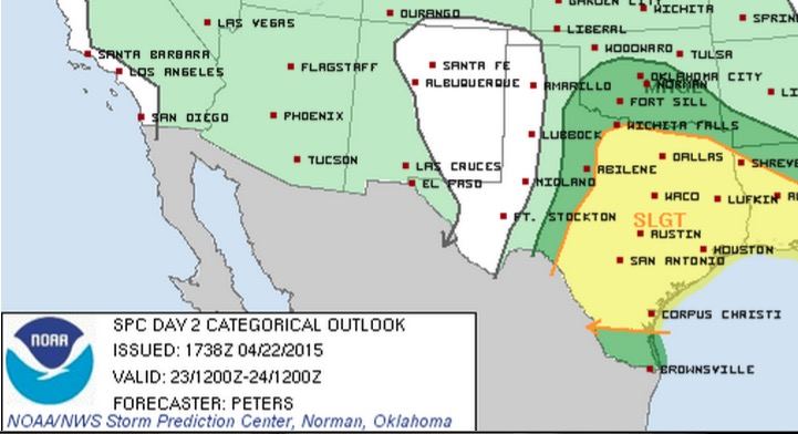
 For tomorrow, we still have the threat for another round of severe storms. Once again, large hail, damaging winds and a few tornados will be possible. Very much like today, tomorrow’s setup for best chances of seeing severe storm development will be heavily impacted by outflow boundaries left over from tonight’s storms. These boundaries act like mini-cold fronts and work to stabilize the air which inhibits storm formation. There’s no way to tell for sure ahead of time where these boundaries will end up, so be sure to look tomorrow for updates once we get a handle on how things look tomorrow morning. For now, the Storm Prediction Center has the locations below under a Slight Risk outlook for tomorrow. Stay tuned!


0 Comments