
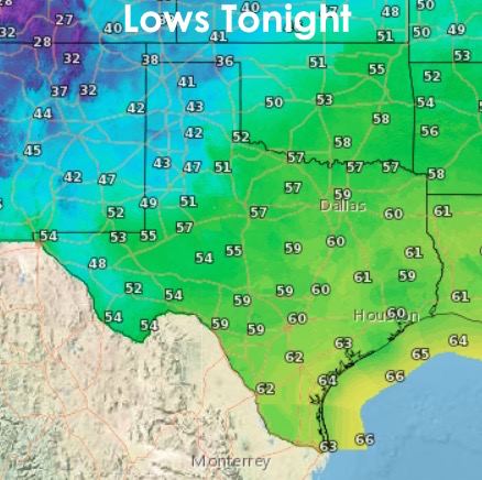
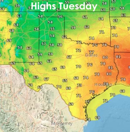
A pleasant day, weather-wise across much of the state today. Increasing clouds across south and central Texas kept things on the cool side, while further north and ahead of the cloud layer, plenty of sunshine helped to elevate temps into the 70’s and low 80’s. We’ve had a few showers/drizzle across south and central Texas this afternoon and evening, but other than that, nothing too concerning. For tonight, temps will drop into the 40’s across the panhandle and south plains, 50’s across north, central and west Texas, with 60’s across the coastal plains and deep south Texas. A cold front sneaks into the panhandle tomorrow and by noon should be draped across the south plains and dipping into the northern parts of west central Texas. This will impact highs across the region with readings a good 10 to 20 degrees cooler than was reached today. Elsewhere, even with increasing cloud cover, highs will creep into the upper 60’s and 70’s…with a few 80 degree readings expected across the eastern 1/4 of the state.
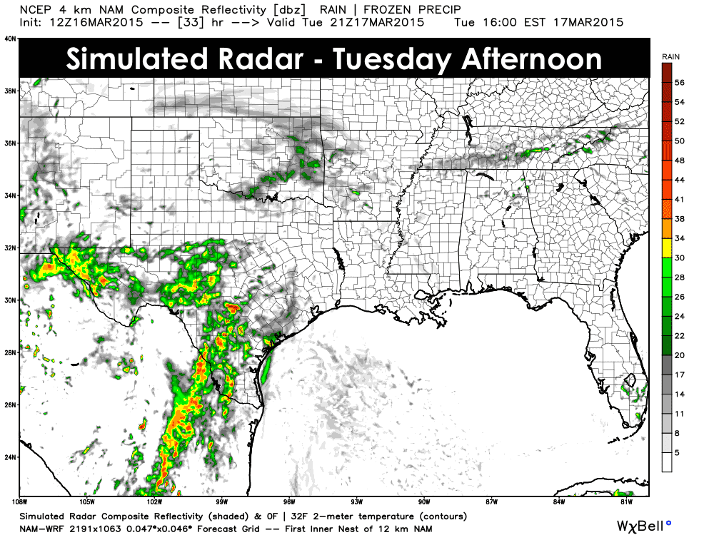
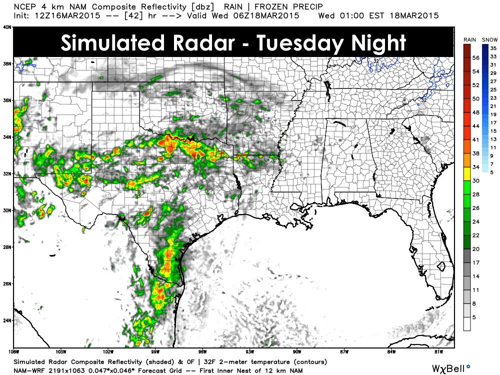
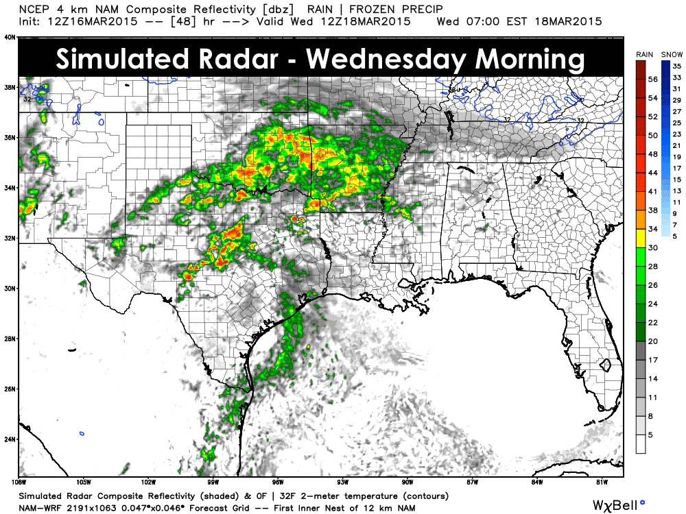
Rain will be on the increase beginning late tonight across the Rio Grande Valley region and slowly working its way north during the day. Drizzle transitioning over to light/moderate rain should arrive across central Texas by early afternoon and across north Texas by mid to late afternoon. The forecast models are still struggling a bit with this system, both with timing and location of the best chances for rain. The graphics below represent what we feel, at this time, will be the best projection of what to expect. Thunder is not very likely with this first wave of rain for Tuesday and Wednesday. At this time, it appears the best chances for seeing any thunderstorms will arrive Thursday evening…and current model forecasts have the best instability parameters along and south of I-20 across west central and southern north Texas…mainly from around Sweetwater east towards Stephenville. That’s subject to change as the models continue to grasp on a solution, so stay tuned for updates on that. For now, here’s a peek at how the current short-range models are shaping up for Tuesday into early Wednesday.


0 Comments