
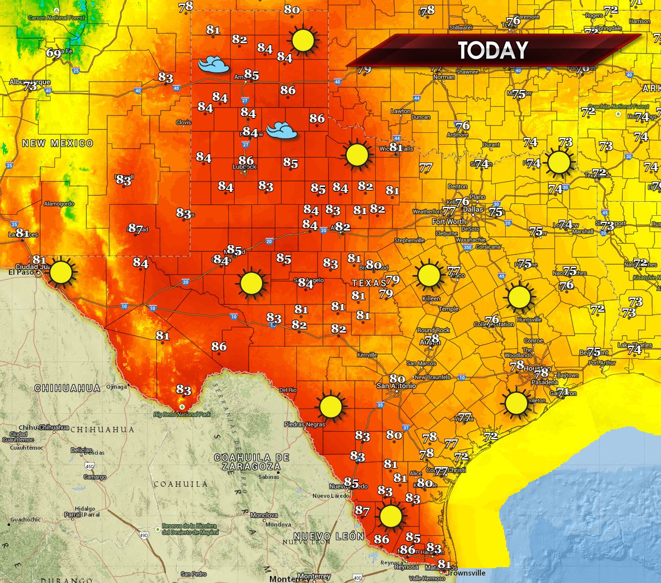
Spring has arrived in Texas with fog present in areas that have clear skies and enough ground moisture to support the development of fog. I’d give some driving tips but I’m expecting that most of you know how to drive in lower visibilities. Fog should burn off by mid-morning as the spring sun helps warm things up. Speaking of warming up we’re going to see high temperatures well above normal today across all of Texas. The warmest locations will be the Texas Panhandle south into Northwest Texas, the Big Country, Permian Basin and Rio Grande Valley where high temperatures will climb into the mid 80s. The remainder of Texas will see high temperatures climb into the 70s. South winds will become gusty this afternoon across the Panhandle and West Texas. A dryline will set up across the eastern Texas Panhandle south into the Concho Valley and Big Country. Moisture east of the dryline will result in humid conditions while west of the dryline moisture levels will plummet resulting in skyrocketing temperatures and elevated fire danger. A strong cap will prevent thunderstorm development today in Texas. There’s a small chance one or two storms may develop in the extreme eastern Texas Panhandle late this afternoon. Should that occur the storm would likely be severe but would skedattle over into Oklahoma in a hurry.
A cold front combined with a strong upper level storm system will result in a line of strong to possibly severe thunderstorms moving into North Texas. This will likely be Wednesday Night with a strong cap keeping a lid on things until the cold front arrives. We’ll continue to monitor model data and refine the forecast. Wednesday could be the first severe weather episode for portions of Texas. At this time the threat for large hail and gusty winds is the primary threat with the strongest storms.


0 Comments