
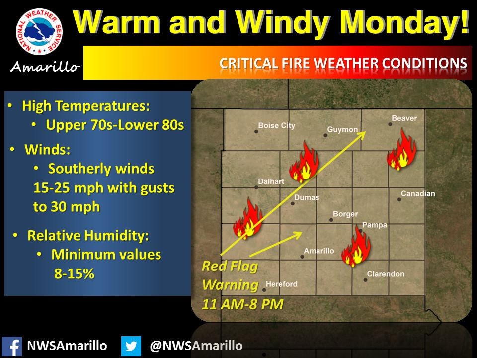
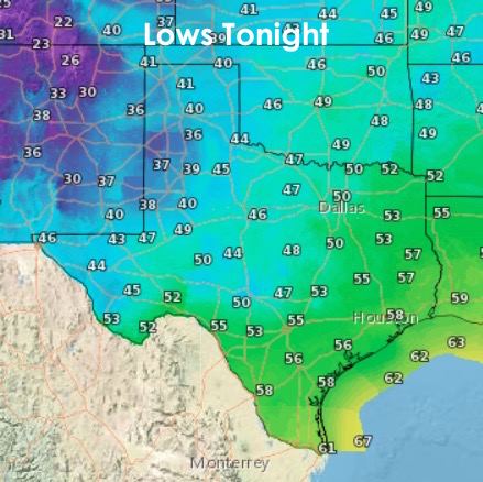
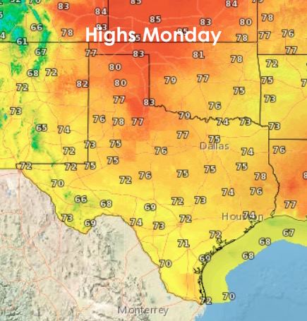
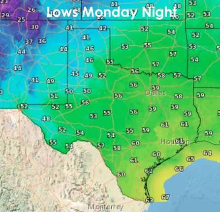
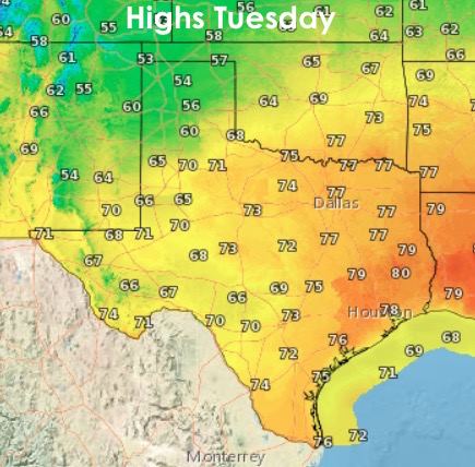
Roller coaster temps and widespread rain chances will be the predominant theme this week for our state. Temps during the day will be trending above seasonal norms, but nighttime lows will be trending in the opposite direction and below seasonal norms. Overall though, this up and down pattern is pretty typical and to be expected this time of the year. The good news, temp-wise, we don’t see any arctic intrusions on the horizon…just a couple of weak cool fronts…so I think it’s pretty safe to say that we’re done with the hardcore winter temps for the rest of the season. I hope I didn’t just jinx it. Tomorrow will be quite windy and dry across the panhandle, and Red Flag Warnings for wildfire concerns have been issued across the entire region. Tuesday, a weak cool front moves down into the panhandle, rolling plains and into west central Texas. Not expecting much of a temperature drop, but Tuesday will be a few degrees cooler. Here’s a look at our overnight lows and daytime highs for the next couple of days.
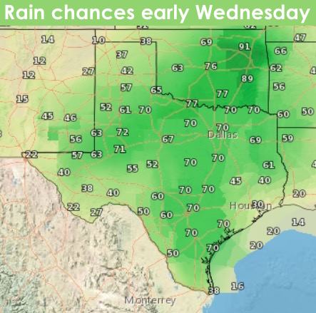
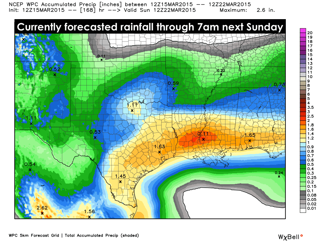
For those heading out on Spring Break this week…we’ll have a couple of rain events that will probably impact your outdoor plans beginning Tuesday into Wednesday, then again late Thursday and into Friday. Both will offer widespread precipitation covering a large portion of Texas by the time both events have ended. There’s also a chance for a few thunderstorms, but overall, not really expecting any severe spring-like storms. Looks like we’ll have to wait until towards the end of the month or early April before the atmospheric Kraken awakes!


0 Comments