
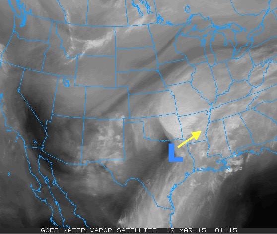
The upper level system that has been generating rain across the state since Sunday will move out tonight and we’ll finally begin to see rains end across the eastern/southeastern half of the state by early tomorrow. A surface low will also move off to the northeast of the state. This will put us on the backside of its counterclockwise motion with north winds at the surface dragging drier air into the state. Drier and sunnier conditions for the central and western portions of the state are expected for the remainder of the work week with temps gradually climbing each day. Eastern/southeastern Texas will still have to contend with remnant cloud cover, but at least the heavier rains will cease. This will be great news for all the folks starting Spring Break this week who are ready to hit the road and enjoy some outdoor activities!

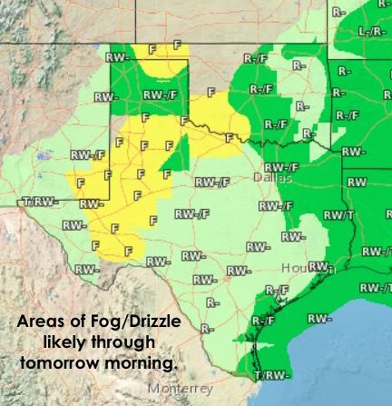
For tonight, foggy conditions are expected once again along the coast (marine fog) and across the panhandle and rolling plains. Some of this may take its time to clear out tomorrow, but most of this region should see some partly cloudy skies by the afternoon. Areas of drizzle and fog will also linger across central and eastern Texas into the morning hours and clear out by the afternoon.
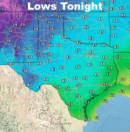
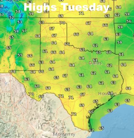
Temps tonight, chilly again with lows in the 30s to 40s across the panhandle and western Texas. Amarillo will likely see a low of around 36, Dallas 47, Houston 55 and Austin around 50. Highs tomorrow will be sensitive to when the clouds begin to move out and how much of a chance the sun has to heat us up. Looks like Lubbock will reach 64, El Paso will get close to 70, Dallas 61, Houston 55, Waco around 63. Things are definitely looking up!


0 Comments