
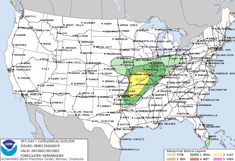
The next two days will feature an active weather pattern with the possibility of strong thunderstorms. A dryline will surge east this afternoon and end up very near Interstate 35. To our north in parts of Oklahoma into Missouri the dryline will light up with severe thunderstorms. In Texas a strong capping inversion with relatively weak lift aloft presents forecast difficulties and low confidence in thunderstorm development. A few weather models do fire off a few isolated severe storms late this afternoon northeast of the D/FW Metroplex towards Bonham. IIt is not out of the question that we may see that occur but the cap will be strong and the chances of storms occuring are relatively low. Should we see any storms break the cap they will have the potential to become severe with very large hail. Should this scenario become more likely then the severe weather outlooks will need to be updated to include the associated increased risk. Any storm that does fire up and break through the cap could be intense.
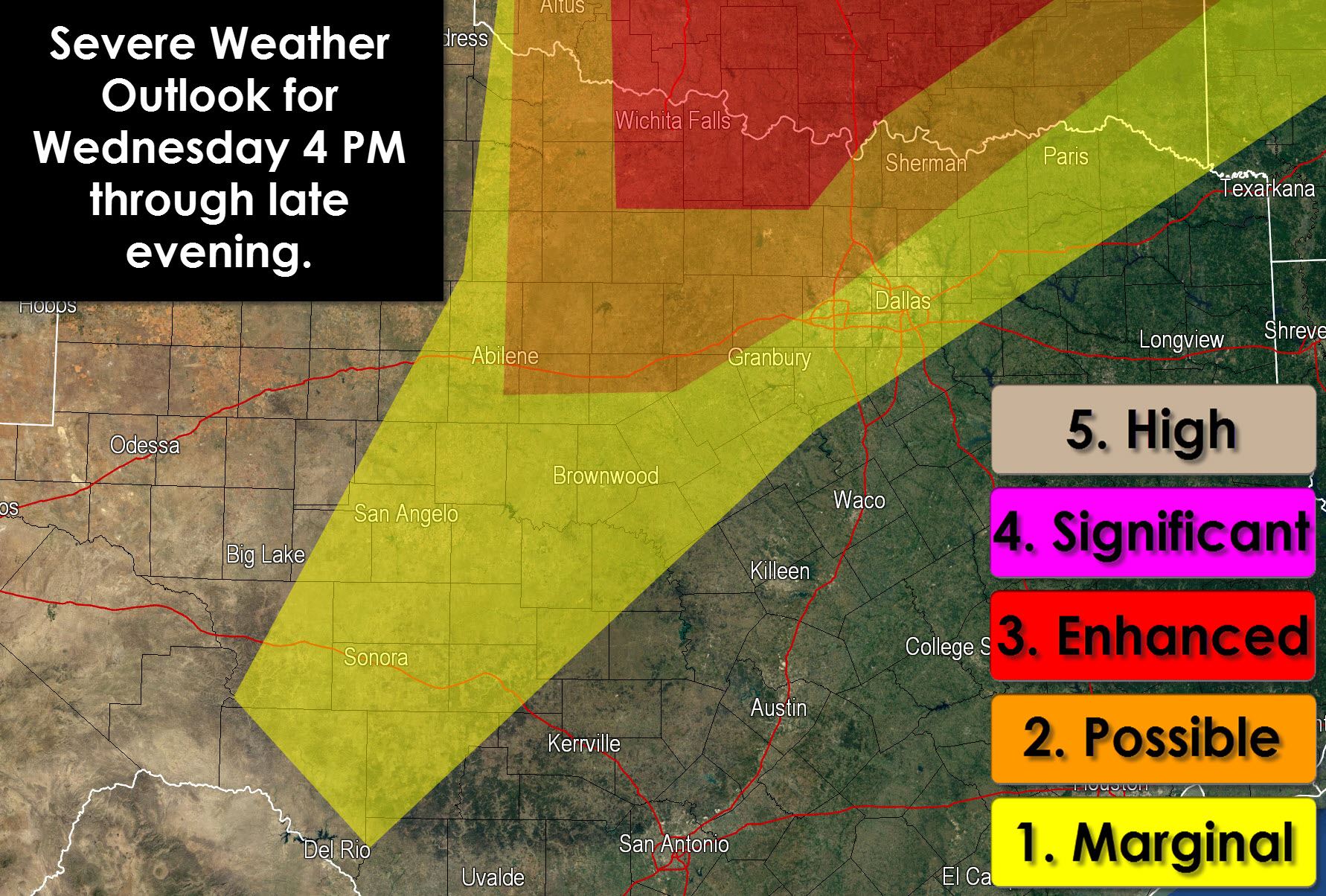
Another upper level storm system will enter the region on Wednesday but will pass further south. Late Wednesday afternoon into Wednesday night will feature the best time-frame for severe weather. The Storm Prediction Center has issued a marginal risk from Southwest Texas north to cover the dryline where one or two storms may fire off. Higher storm chances from Abilene northward mean a relatively higher chance for thunderstorms and associated severe weather. Finally an enhanced severe weather risk includes the Red River Valley north into Oklahoma where the most widespread thunderstorm coverage is expected. The strongest storms will be capable of producing damaging hail up to the size of tennis balls and wind gusts over 60 MPH. A low tornado threat may also exist with the initial discrete thunderstorms. By the evening hours storms will be in the form of a squall line or cluster of storms with a continued threat for large hail (but not as large as the initial storms) along with damaging wind gusts. This threat could extend into North Texas late tomorrow evening. Be sure to check back later today for forecast updates as we continue to refine things.
Keep track of the storms using our free weather radar at texasstormchasers.com/radar


0 Comments