
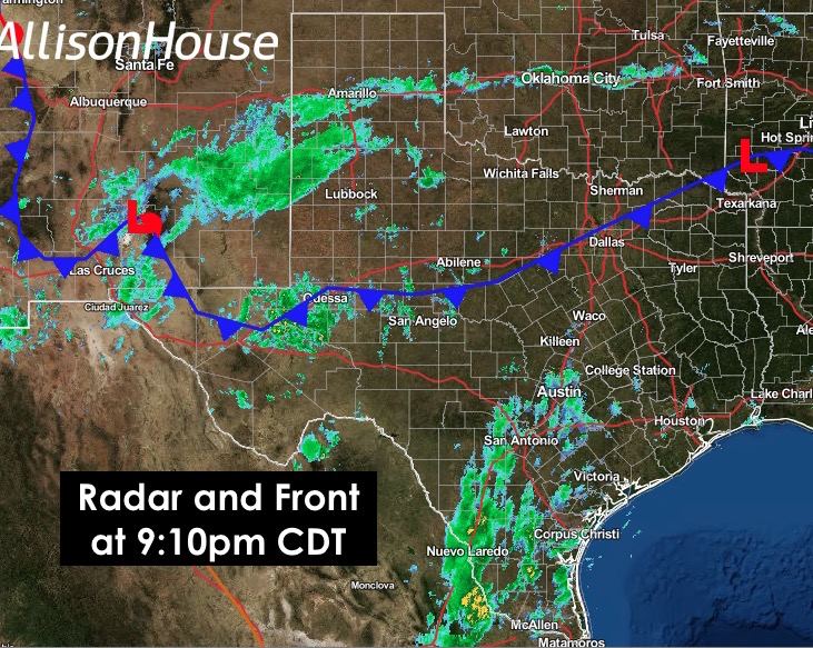
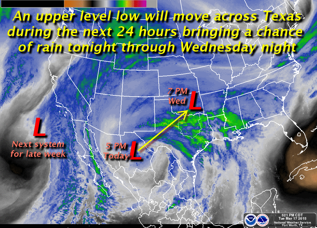
Scattered showers will continue developing this evening as an upper level low approaching tonight and moves northeast across the state tomorrow. This will be the first of two systems and rain events that’s we will have this week, and while I know that many of you are tired of the mud and mess, we still have a rather large portion of the state under drought conditions. I just wish Mother Nature would read the memo on where that is and stop raining on folks that don’t need anymore rain! A cold front pushed through the panhandle earlier this morning and is now creeping through north central Texas. It’s expected to stall out near the I-20 corridor tonight before lifting back north and phasing out by tomorrow afternoon. Once tomorrow’s system moves northeast and out of the state, we’ll have another one on its heels for late in the week.
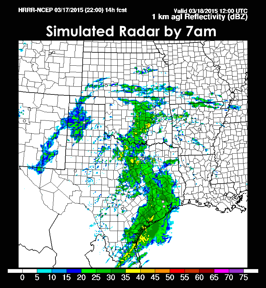
 Rainfall today has not been quite as prolific as expected, so rainfall amounts for tonight through tomorrow have trended downward just a bit overall. Below, we have a look at the latest high-resolution forecast models for tonight through tomorrow morning. This model only goes out about 15 hours, so that gets us through about 8am tomorrow morning. As the low approaches overnight, rainfall will increase, but unfortunately it looks like it will increase mainly across central and coastal regions where additional rainfall is really not needed right now. The unfortunate consequence of this is, if this develops into a large convective rain system across this region, it will basically choke off the heavier rain chances further north where more severe drought conditions remain.

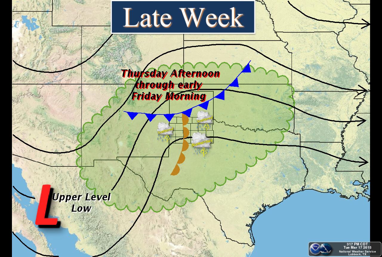
 Once we get past this system, we’ll have another one to bring additional chances for rain, including a chance for a few strong to severe thunderstorms, Thursday afternoon into early Friday. The medium range models are still struggling a bit with the timing of a cold front currently forecasted to drop down into the panhandle and western north Texas by Thursday afternoon. Latest guidance indicates best chances for severe weather will be across the eastern panhandle into Oklahoma and western north Texas Thursday evening and night. A day ago, it was showing that to be along and south of I-20. It will all depend on how far south the front is able to dig by peak daytime heating and where the best dynamics lie at that point. We’ll continue to monitor and bring you the latest as it develops, so be sure to check back!


0 Comments