
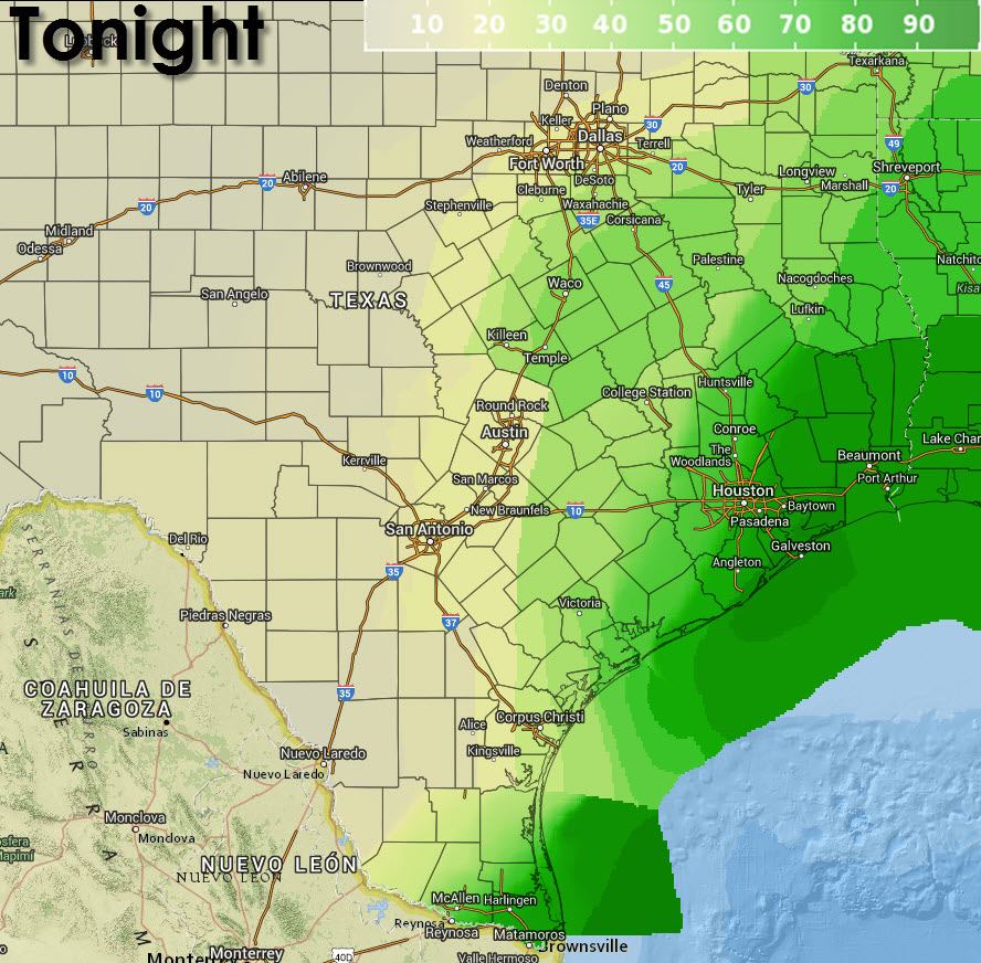
What was supposed to be a low chance of rain has evolved into something much more interesting. An area of low pressure has developed in the western Gulf of Mexico. If this was tropical season this would be a prime candidate to become a tropical storm. However we’re in March and this system is not tropical in nature. Nevertheless an interesting system that will bring another round of heavy rains to Southeast, East, and Northeast Texas over the next few days. The system is about 200-250 miles due east of Brownsville and is moving in a northerly direction. As it moves inland we’ll see a precipitation pattern similar to a tropical system. The heaviest rains will be located along and east of the low while a sharp cutoff will mean a difficult rain forecast for those west of the low. As you might imagine forecasting the track of where the low will move will greatly influence the forecast. Should the low move a little east or west of the forecast track then the area of highest rain chances and totals will change as well. I’ve seen some social media notes suggesting this system will be comparable to a tropical storm – that is NOT true. We won’t be dealing with damaging winds, storm surge, or a widespread severe weather threat as we typically would with a tropical system. What some will have to deal with is the threat for heavy rain. After the soaker this past weekend rivers across Northeast, East, and Southeast Texas are running full. For that reason we’re concerned about an elevated flood risk with any additional heavy rain that falls. While a significant flash flood event is not expected we may have to deal with enhanced river flooding in the days after this system passes.
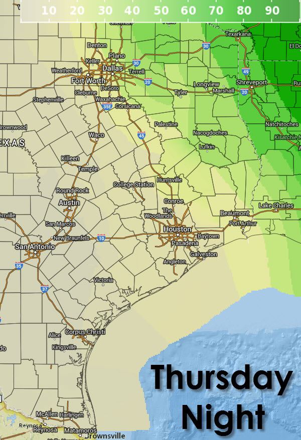
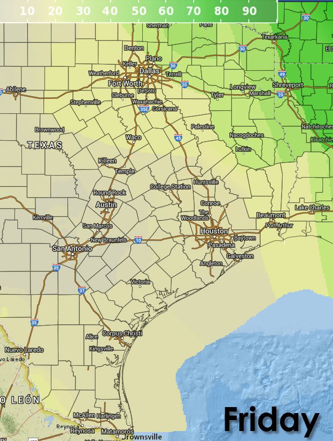
Here is the latest rain forecast from the National Weather Service offices across Texas. You’ll note a sharp gradient on the western edge of the system. Should the system pass further east than the heaviest rains may fall in Arkansas and Louisiana. Likewise if we shift to the west than more of Texas will get in on the heavy rains. I emphasis that because a track shift could have resulted in substantial forecast changes especially for those along the Interstate 35 corridor from the Red River south through Central Texas.

This afternoon’s weather model guidance shows the uncertainty about the low’s track and intensity quite well. The North American Model (NAM) is showing heavier rains extending west to Interstate 35 into Central Oklahoma. Meanwhile the drier Global Forecast System weather model is showing lesser rain amounts with the heaviest rains further east. For now we’ll use a blend of both weather models along with other weather model guidance. The heaviest rains should be well east of I-35 with 1 to 3 inches of rain possible across Northeast, East, and Southeast Texas with up to half an inch closer to I-35. Unfortunately that sharp gradient means folks west of I-35 won’t see much if any rain at all where rain is needed most.
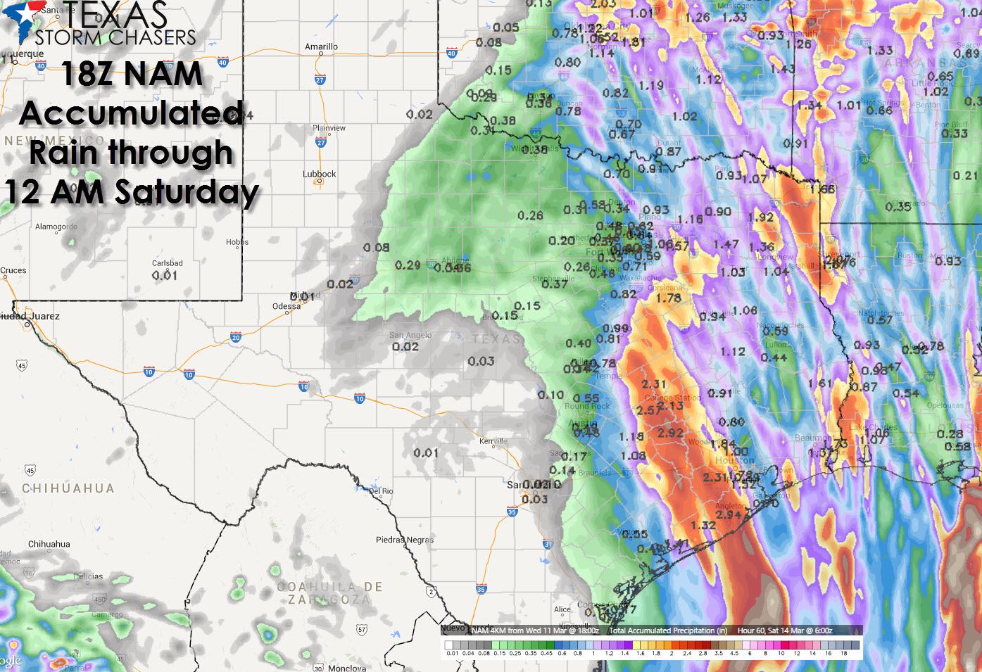
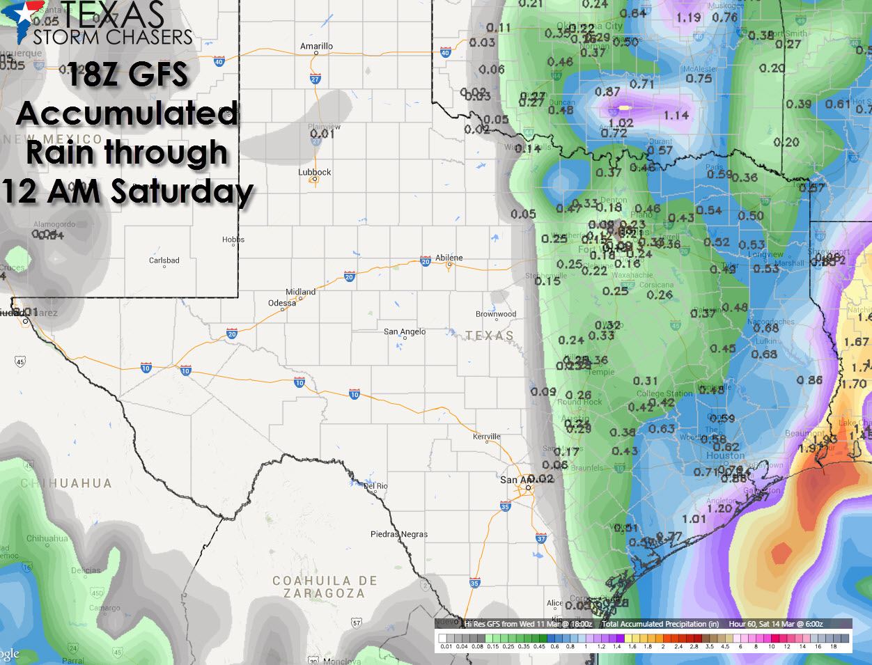
Meanwhile because the ground is already saturated from last week’s rains we could see another round of flooding develop where the heaviest rains fall. Rivers across Northeast, East, and Southeast Texas are running high and additional rains will cause them to rise even more. When all is said and done we could see several rivers enter flood stage. Some may even approach major flood stage should we get several inches of rain. The river flood threat would be something that would continue days after rains fall. That’s why we have several rivers in flood stage today after the rains from this past weekend.

I’ll leave you with this sight from Lake Palestine located in East Texas. We’ll see many more sights like this by the weekend along with some very full rivers across Northeast, East, and Southeast Texas. Unfortunately for everyone else the water shortage continues. It truly is a feast or famine water-wise in Texas right now.
@TxStormChasers Recent rains are causing issues for East TX boat houses. Here is ours on Lake Palestine. pic.twitter.com/i3x98uuZcw
— NateLesniewski (@Nate552) March 12, 2015


0 Comments