
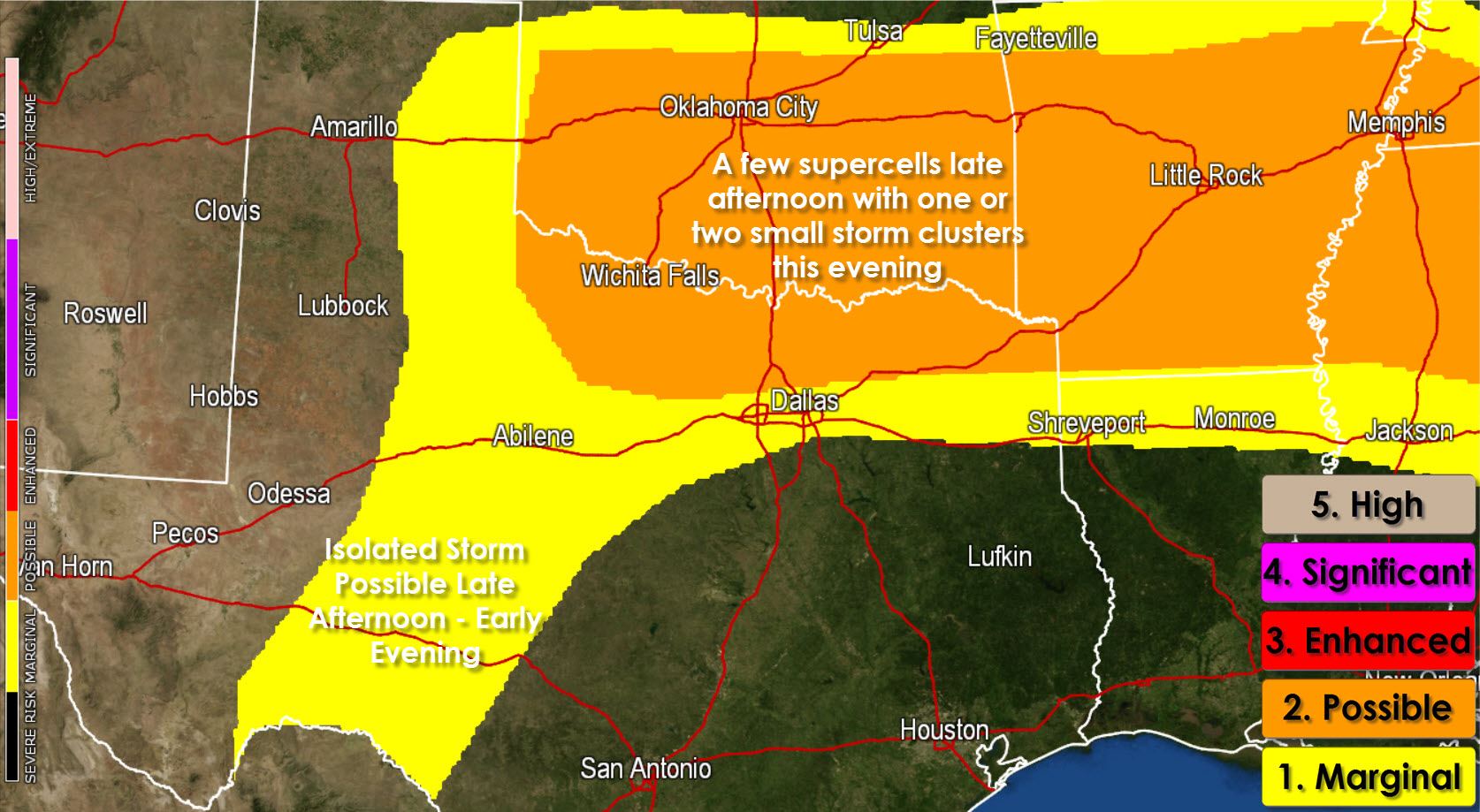
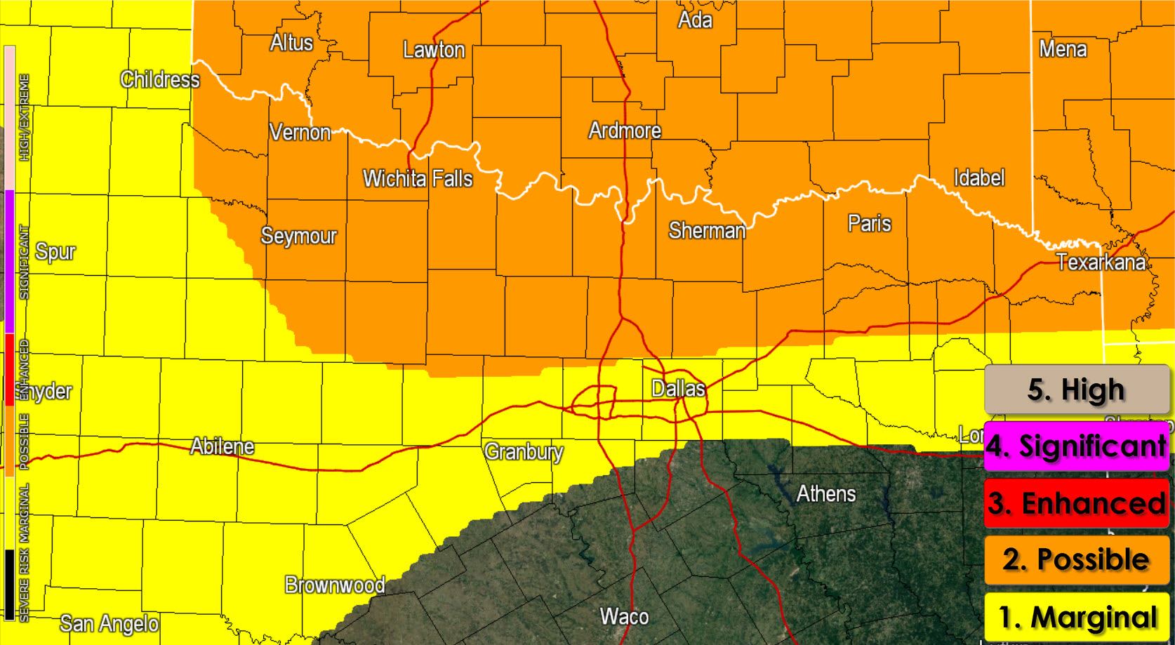

Compared to my morning blog posted around 6:30 AM the forecast hasn’t changed much. I still expect initial thunderstorms to begin developing after 3-4 PM in Southwest and South-Central Oklahoma into Northwest Texas. These initial storms will be in a strongly unstable airmass with marginal wind shear. The primary storm mode will likely be a mix of multicellular storms (small clusters) and a few supercells capable of producing large hail. Storms will move east but as they organize we may see a turn to the southeast. That’s why the Storm Prediction Center has highlighted areas along and north of US-380 from Throckmorton into East Texas in a possible severe weather risk zone. The strongest storms would be capable of producing golfball size hail and localized damaging wind gusts up to 70 MPH. A brief tornado isn’t out of the question but the tornado threat is very low. Most of the severe weather is expected to remain north of the Red River but I can’t rule out a few storms making it across the Red River.
A dryline will be in place from Southwest Texas north through the Concho Valley and Big Country. The atmosphere just east of the dryline will be unstable but capped. A few storms may fire up in the late afternoon heat with slow progression to the east/southeast before dying out a few hours after sunset. Any storm that fires up could be severe with large hail.
Any storms in Texas should be dwindling by 10 PM with another cluster of strong to severe storms impacting Central Oklahoma late this evening.


0 Comments