
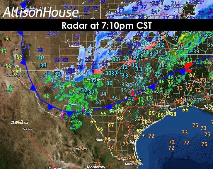
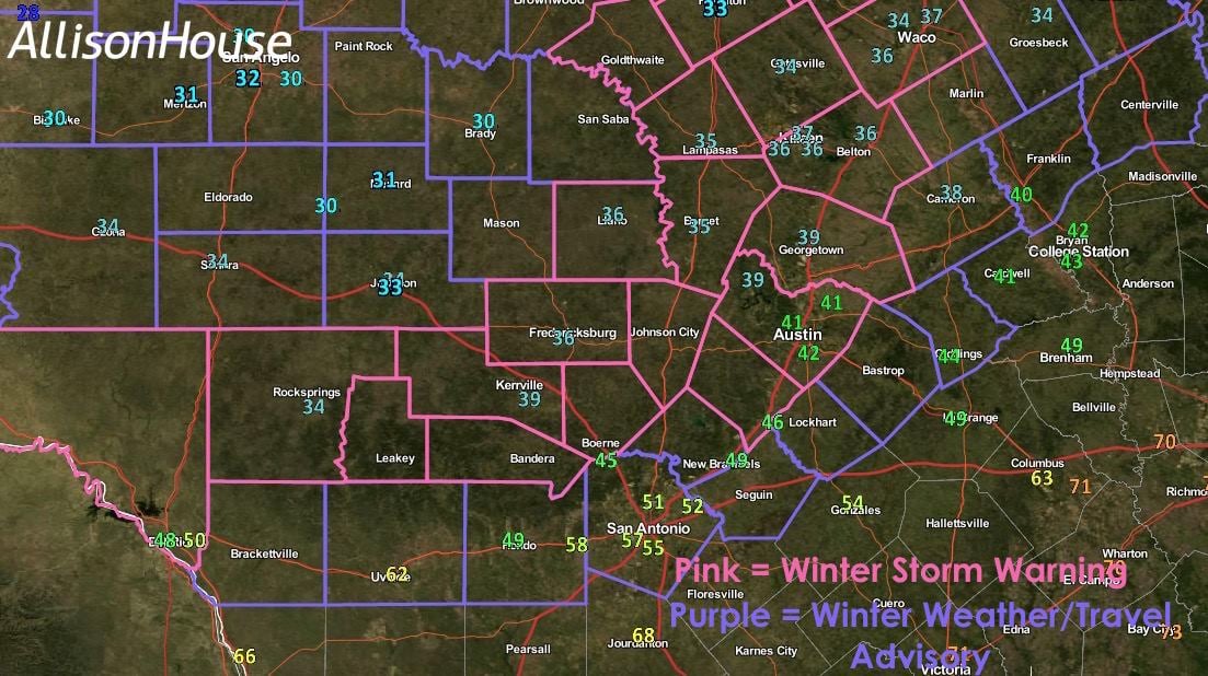
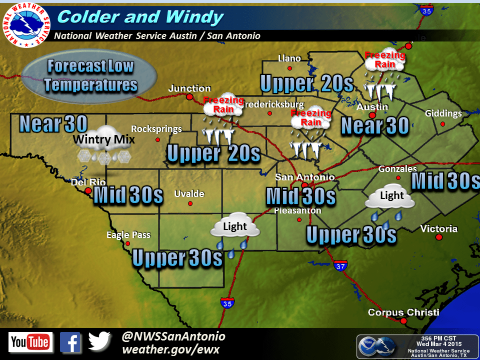
The cold front is currently pushing through Austin and is expected to be south of San Antonio after 8pm. Gusty winds will develop within a few hours behind the front, and if gusts of 30+mph currently across north Texas are any indication of what will transpire for central Texas and the Hill Country overnight, better make sure everything is tied down. Freezing temps will likely arrive around midnight, and it’s after that when conditions will begin to deteriorate. A mix of freezing rain and sleet will develop some time around midnight beginning across the northern Hill Country region and spreading south to the Austin metro area and east towards Del Rio. Ice accumulation of around 1/10th of an inch is most likely along the I-35 corridor around Austin and communities north and west…basically areas currently under a Winter Storm Warning for tonight and early tomorrow. Further south and east or areas currently under Winter Weather/Travel Advisories, icing will be lighter, spottier and will likely impact only elevated road surfaces such as overpasses and bridges. Snow is unlikely. Sorry kids! Regardless, it looks like the commute tomorrow morning across most of the Hill Country will be hazardous, so be sure to check local traffic and roadway conditions before heading out the door, and allow plenty of extra time to arrive at your destination!


0 Comments