
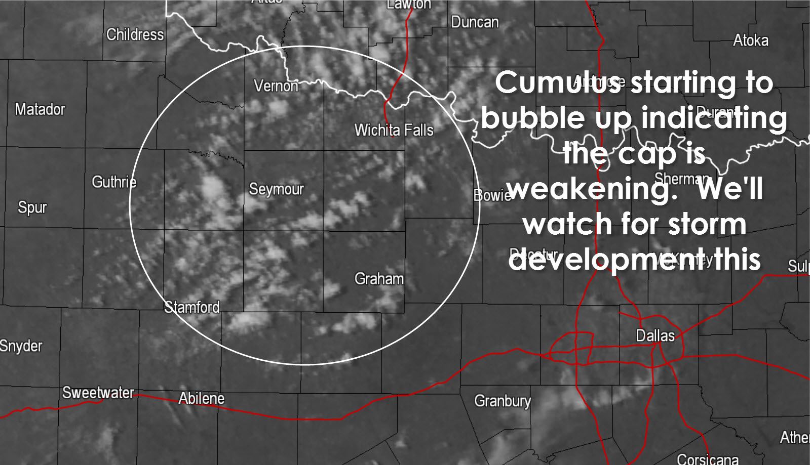
We’re watching an area of cumulus clouds that are popping up ahead of a dryline in western North Texas. These bubbling clouds indicate the cap is starting to weaken and thus we could see a couple severe storms develop in this area through 5 PM. Convective initiation is not a guarantee but the short-range high resolution weather models are indicating we should see the cap break. The atmosphere is unstable and with ample wind shear is place any storm that develops could become severe. The strongest storms (should they develop) could produce large damaging hail up and damaging wind gusts. The tornado threat is low due to high cloud bases. Any storm that develops will move east/southeast at about 25 MPH. We’re not sure how far south the dryline will ‘fire up’ but the best chance to see a few severe storms will be north of Interstate 20. As the storms move east they’ll gradually approach I-35 and could impact the northwestern portions of D/FW around 7 PM if they form. We’ll keep an eye on the situation and post occasional updates. Seeing as the entire team is out chasing we won’t be able to post frequent detailed updates so be sure you bookmark our interactive weather radar at texasstormchasers.com/radar and keep up with the storms yourself!


0 Comments