
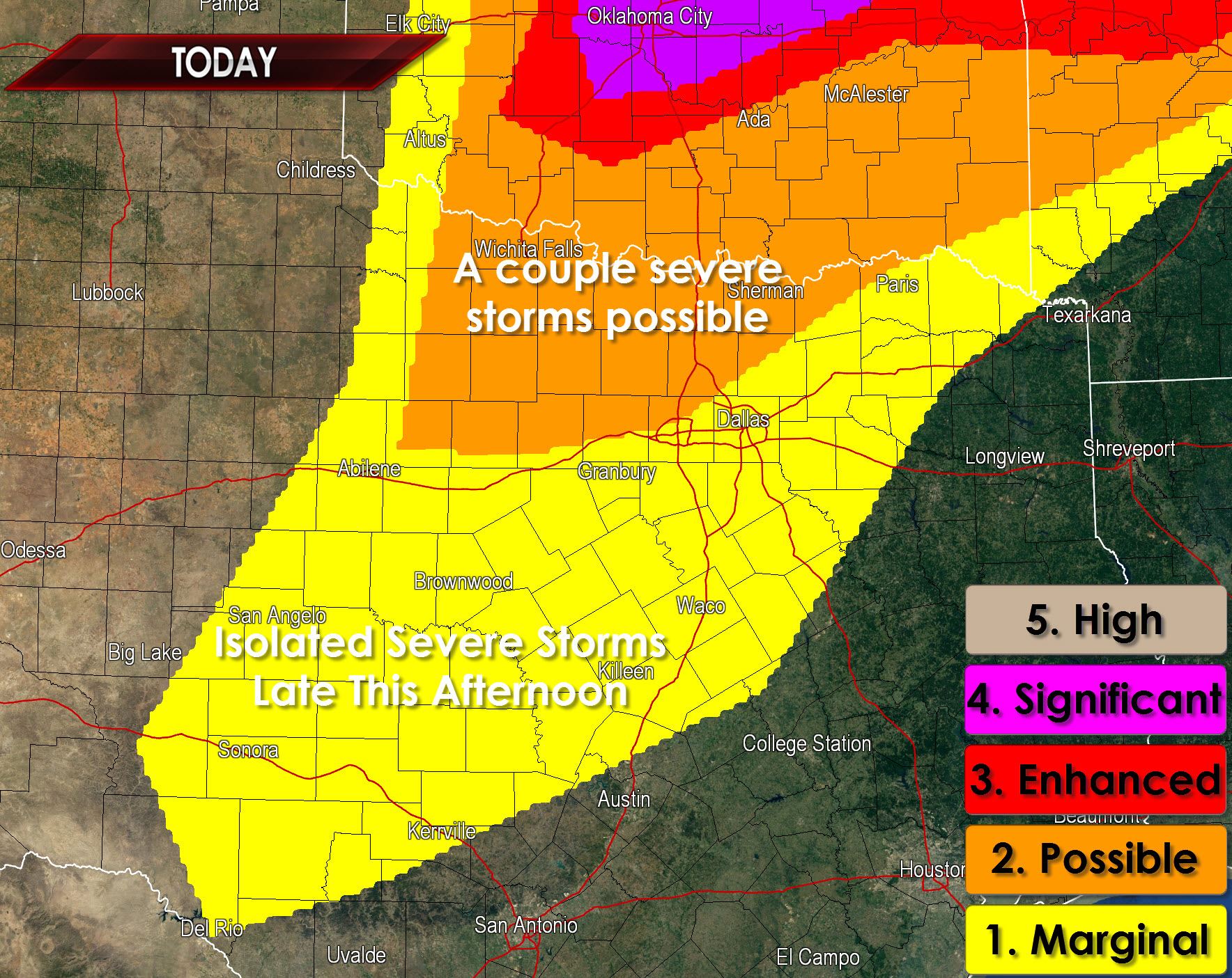
Short-term high resolution weather model guidance continues to indicate the chance for a few severe thunderstorms this afternoon in western North Texas. By far the most widespread and significant severe weather potential will be north of the Red River in Oklahoma. However the cap may become weak enough to allow a few supercells to develop just east of the dryline across western North Texas. Should storms develop they would likely do so after 4 PM. They would move east/southeast at about 25 MPH and would continue for a few hours before weakening after sunset. Should storms develop they would have the potential to impact locations north of the D/FW Metroplex. The strongest storms would have the potential to produce large hail up to the size of golfballs and damaging wind gusts over 60 MPH. High cloud bases would keep the tornado threat minimal but a brief tornado would not be out of the question.
All of that is assuming a storm is able to break the cap in Texas. If the cap holds we’ll have a warm evening with a few clouds without the fuss of any storms. Confidence in the cap breaking is much higher north of the Red River.


0 Comments