
A second cold front will arrive across the northern half of the state tonight. Much colder arctic air will filter in behind the front Sunday afternoon setting the stage for what looks to be a rather significant winter weather event for parts of northern Texas late Sunday night through Monday afternoon.
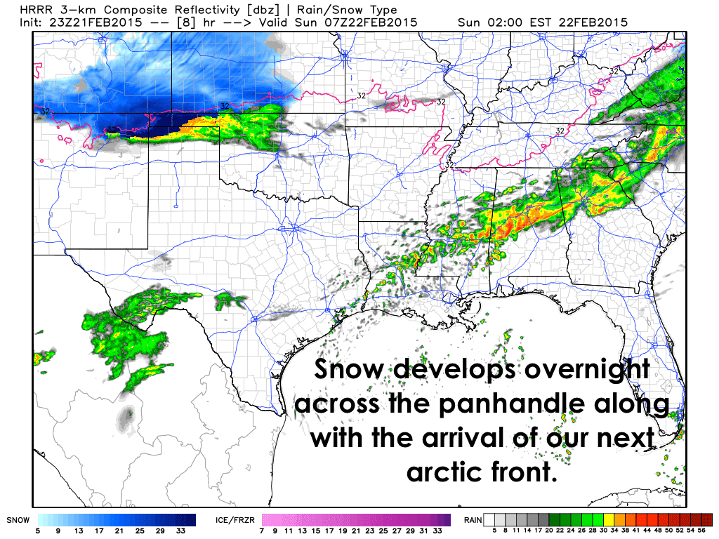
For Tonight….Snow is expected to develop across the northern panhandle with the arrival of the front. The precip will likely fall as rain at first, then transition over to all snow pretty quickly after midnight. A few areas north of Amarillo could see anywhere from 4 to 6 inches, with lesser amounts further south. That will be round 1. Round 2 is expected late Sunday night into early Monday further south across the panhandle.
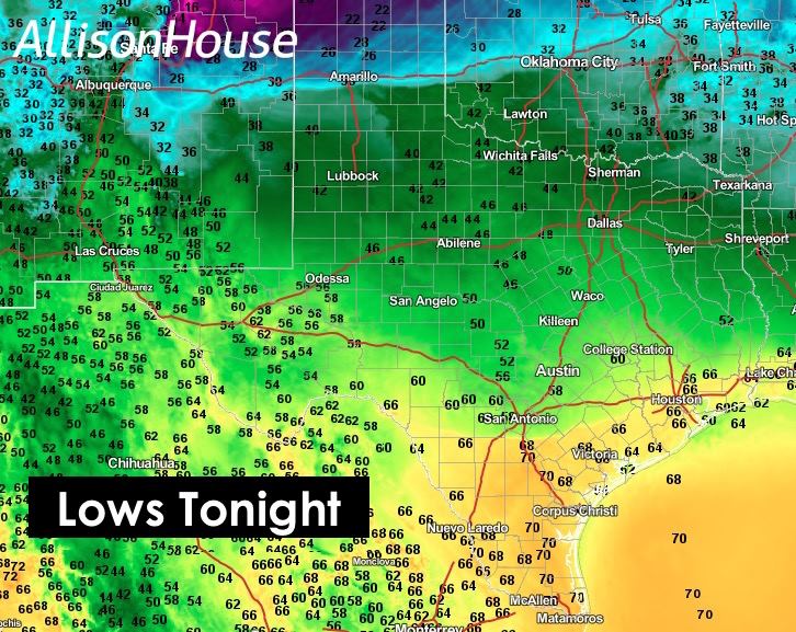
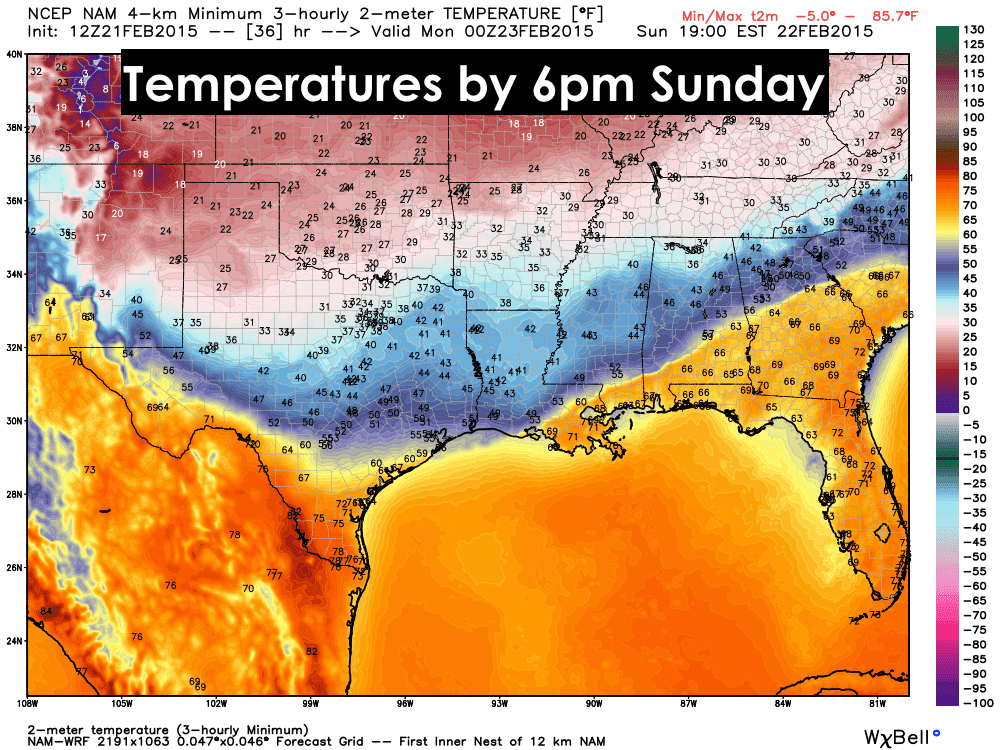
Here’s a look at our overnight lows….
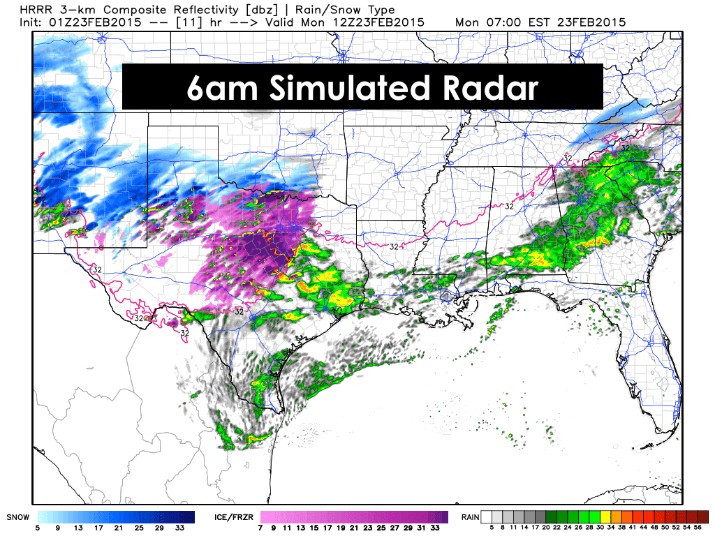
Tomorrow….By mid-day Sunday, rain is anticipated to have become widespread across northern, central and southeastern Texas. Temps are expected to remain above freezing until after sunset, so most of the precipitation will fall as liquid rain throughout most of the day on Sunday.

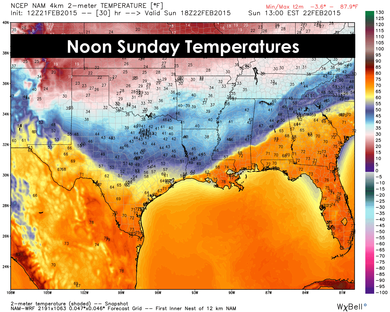
We are anticipating a small break in precip by Sunday afternoon and evening. Not going to say with 100% certainty that it will happen, but that’s how the models have been consistently trending. Temps will continue to fall throughout the day tomorrow as this 2nd arctic front pushes south, with 20s and 30s expected across the panhandle and north Texas by sunset.
That’s it for this short update. David will be hosting a Winter Storm Q&A session at 8:30pm this evening with guest John Burgdorf of DFW Scanner. Click the link at the top of the blog web page to access the live stream and check it out!


0 Comments