
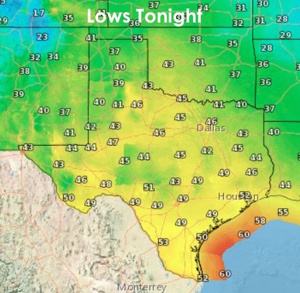
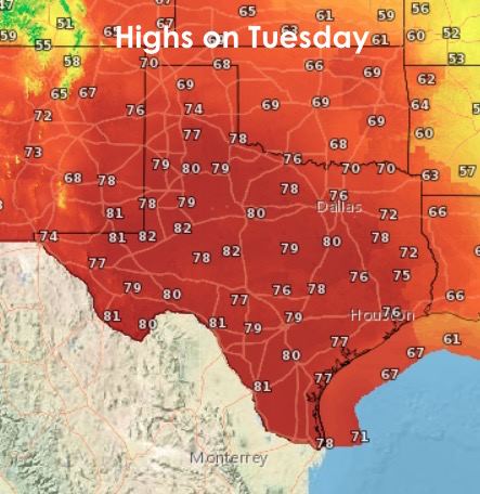
Another gorgeous mid-winter evening is upon us with an abundance of dry air and clear skies across much of the state. Continued clear skies will help temps to drop off nicely into the 30s and 40s across most of the state, with a few 50 degree readings tomorrow morning as you get closer to the coast. Pockets of dense fog may also be an issue early tomorrow across deep south Texas and the Rio Grande Valley, so keep that in mind as you plan to depart on your morning commute. Tomorrow afternoon will be similar to today with highs once again in the 70s and humidity values staying relatively low, and that always helps to keep things feeling great!
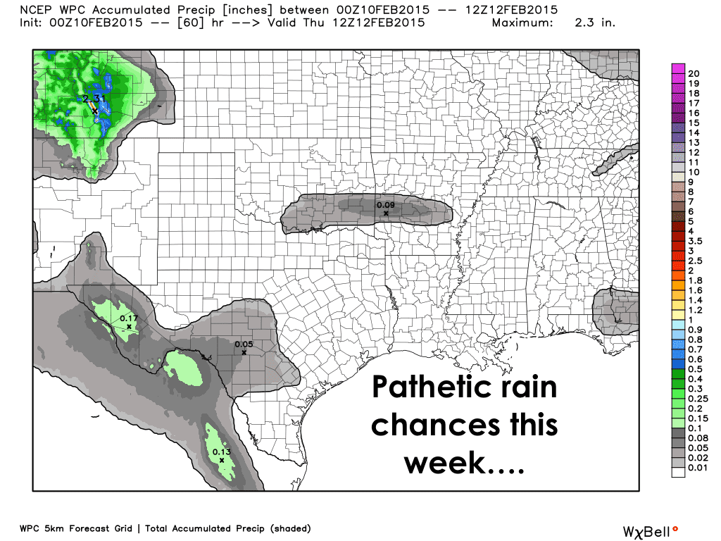
Sadly it looks like our chances of seeing mid-week rain are diminishing. The cutoff low expected to form across the Baja peninsula by Wed/Thurs does not seem to want to materialize with quite the strength or favorable positioning that previous runs of our mid-range forecast models had been showing. Upper level jetstream flow from from the northwest will continue to dominate over the state and keep most of us dry through the week. Only slight chances of rain are forecasted for far west Texas early Thursday, everyone else will remain rain-free. Better chances may arrive by early next week, but considering it will be the result of the same cutoff low formation, I wouldn’t put much stock in what the longer range forecast models are showing at this point.
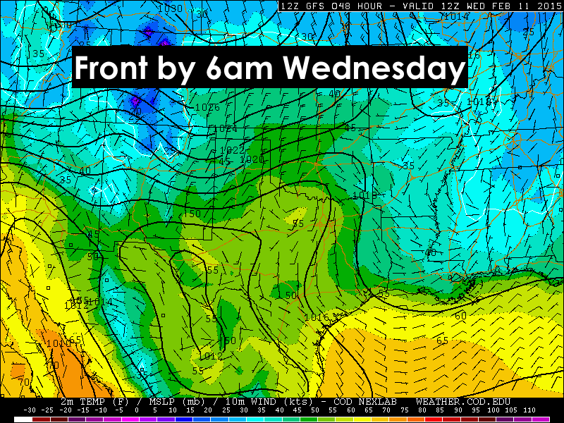
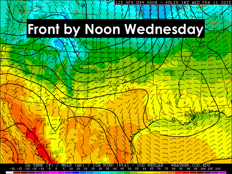
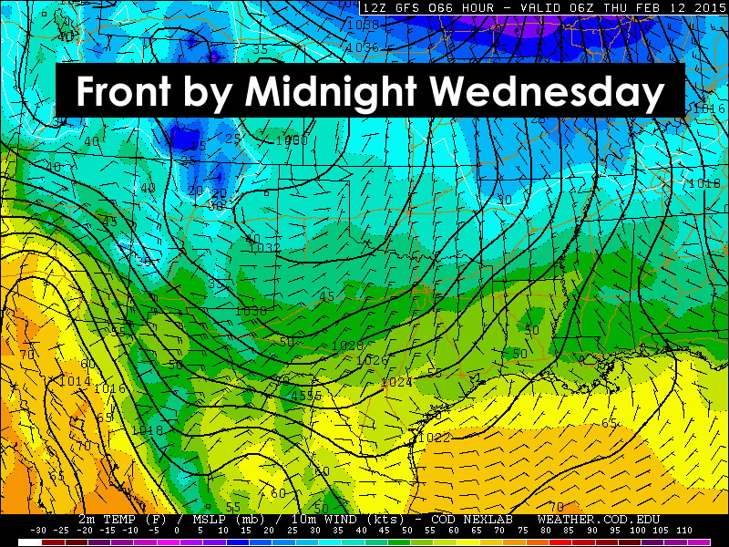
What will happen by mid-week for sure is the arrival of our next strong cold front. The front will arrive across the panhandle early Wednesday, then ooze through northern and central Texas by Wednesday afternoon and into the southern parts of the state overnight into Thursday. A majority of the coldest air will be shunted off to our east, but it will bring our temps back to seasonal normals for a day or so, then they’ll pop right back up above normal as we head into next weekend. Scroll down for a preliminary look at frontal timing.
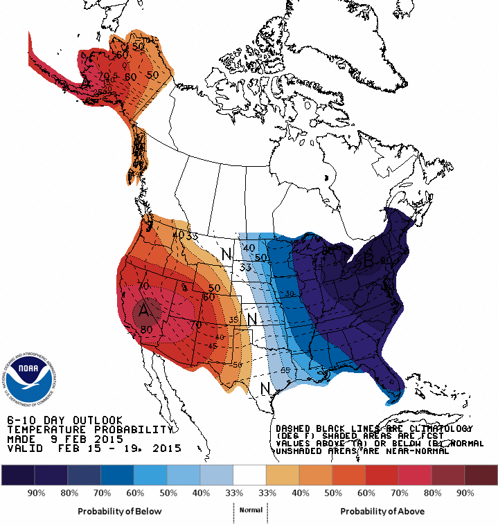
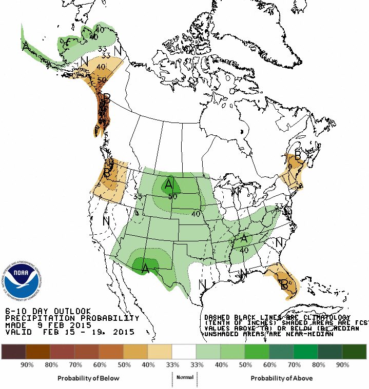
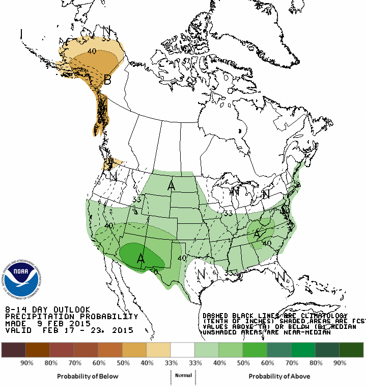
A look ahead….The overall pattern shaping up for the middle to end of the month should offer a variety of weather conditions across the state…but then again, when do we not have a variety of weather conditions across our very large state? As of this blogging, the Climate Prediction Center’s 6 to 10 day and 8 to 14 day Outlooks have us colder than normal across the eastern half of the state, while normal to above normal for central and western portions of the state. Rainfall still looks to be a bit hard to come by with most of it concentrated across the desert southwest and the western half of our state. As we previously blogged, El Nino conditions have yet to materialize, which would tend to keep us rather “meh” when it comes to the formation of a definitive weather pattern one way or the other.


0 Comments