
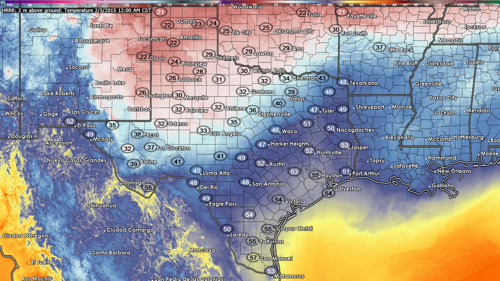
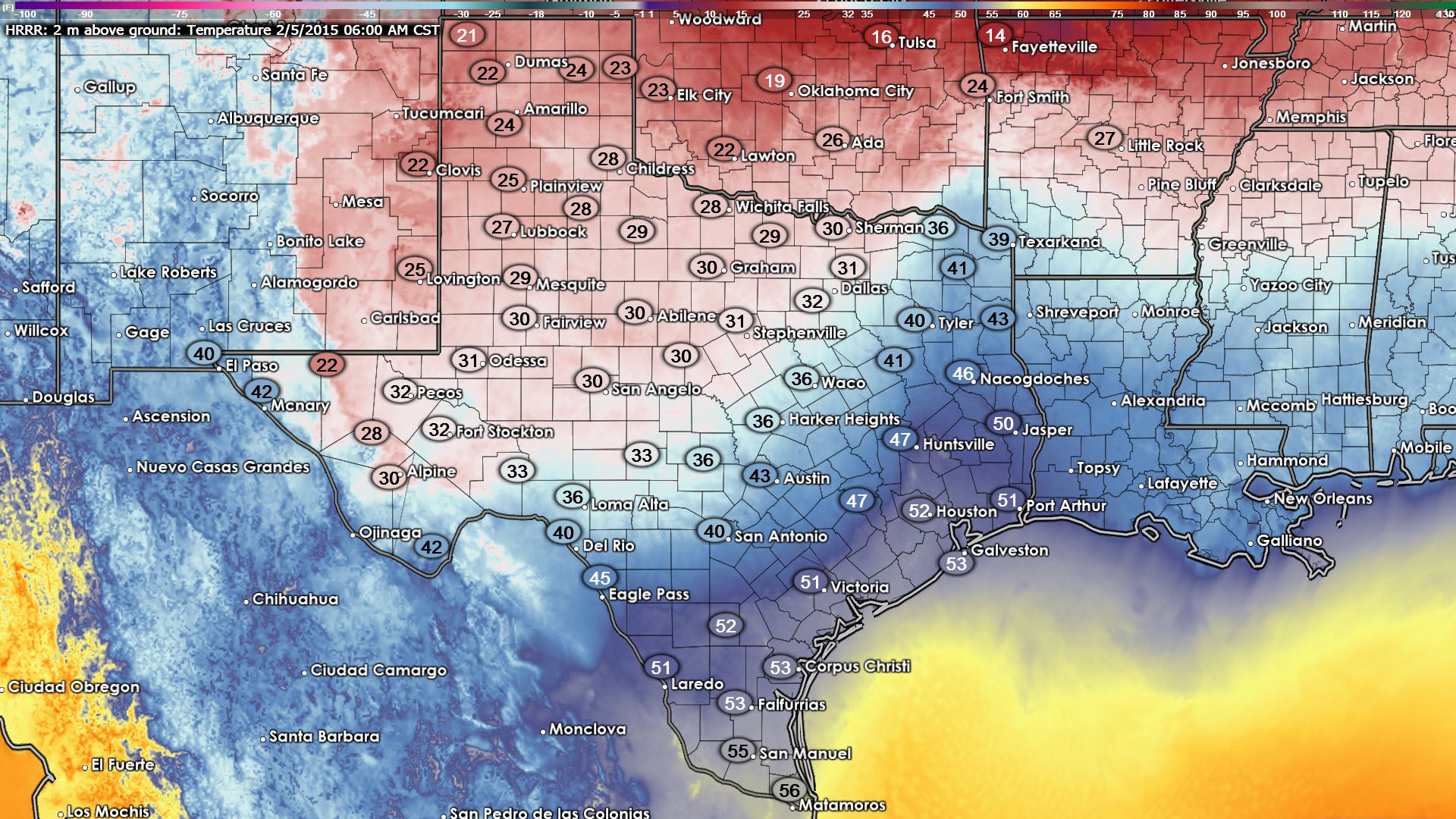
A strong cold front is currently pushing through northern Texas bringing gusty winds and sharply decreasing temps in its wake. Earlier this afternoon as the front moved through the panhandle, some areas were seeing as much as a 30 degree drop in temps within just half an hour. That cold air will modify somewhat on its journey south tonight before it reaches the southern half of the state, but we’ll still be looking at chilly temps overnight for the northern half of the state with wind chills in the teens and 20’s. Here’s a look at the current position of the front and current surface temps.

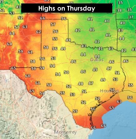
Temps tonight will drop down into the teens and 20’s across the panhandle, 20’s and 30’s across northern and central Texas, with 40’s and 50’s for central and southern portions of the state. The front is not expected to arrive across the central and northern coastal areas until just before daybreak tomorrow, with an early to mid-morning arrival anticipated for deep south Texas. The graphics below represent currently forecasted surface temps at midnight and at 6am. The good news is that temps will rebound nicely across parts of the panhandle and far west Texas by tomorrow afternoon as a surface high begins to move off to the northeast. As the high departs, skies will begin become clear and surface winds come around from the east and then south once again. The eastern half of the state will remain on the cool side with cloud cover and northerly winds remaining through most of the day. Friday will be warmer, and the weekend warmer yet with highs well above seasonal averages Saturday and into Sunday!
 The good news is that temps will rebound nicely across parts of the panhandle and far west Texas by tomorrow afternoon as a surface high begins to move off to the northeast. As the high departs, skies will begin become clear and surface winds come around from the east and then south once again. The eastern half of the state will remain on the cool side with cloud cover and northerly winds remaining through most of the day. Friday will be warmer, and the weekend warmer yet with highs well above seasonal averages Saturday and into Sunday!


0 Comments