
Jenny just published an excellent blog covering the arrival of the arctic cold front along with chances for thunderstorms on Saturday. The purpose of this blog is to discussion the winter weather threats in detail for each region of Texas. We’re a big state and we have a lot of territory to cover. As you might expect the forecast for Amarillo isn’t the same as the one for San Angelo, Dallas, or Texarkana. For that reason I’ve divided this post up into regions. If I didn’t mention your area it means you’re not under the gun for a winter weather threat. Please keep in mind we have a lot of territory to cover so this is more of a broad roundup versus city by city forecast. If you have any questions or comments please feel free to contact us using social media. We have several social media widgets below this post which you can contact us with. As always we’re still 36-48 hours out from this winter storm and there will be forecast refinements made on Saturday. Please check back for the latest and stay tuned to Texas Storm Chasers and your local National Weather Service office.
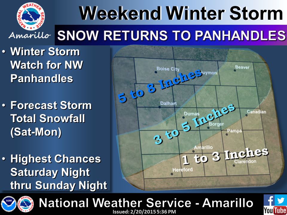
Texas Panhandle
A Winter Storm Watch has been issued for the Northwest Texas Panhandle where 5 to 8 inches of snow are expected. The watch is in effect Saturday Night through Monday Morning. While not under a watch or advisory the remainder of the Texas Panhandle. 3 to 5 inches of snow will be possible across the central and northern Panhandle with 1 to 3 inches of snow across the eastern and southeastern Panhandle. A Winter Weather/Travel Advisory will likely be issued Saturday morning for much of the Texas Panhandle. Slick and snow packed roadways are possible but this is NOT expected to be as bad as the foot of snow that fell last month.
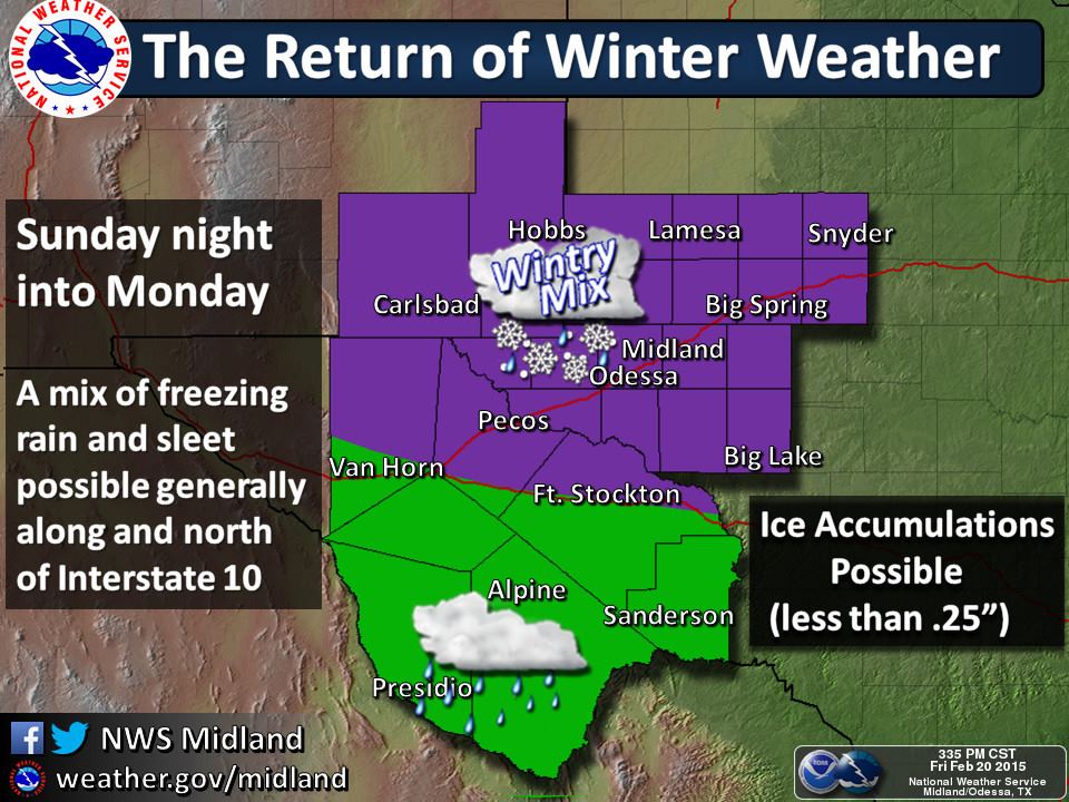
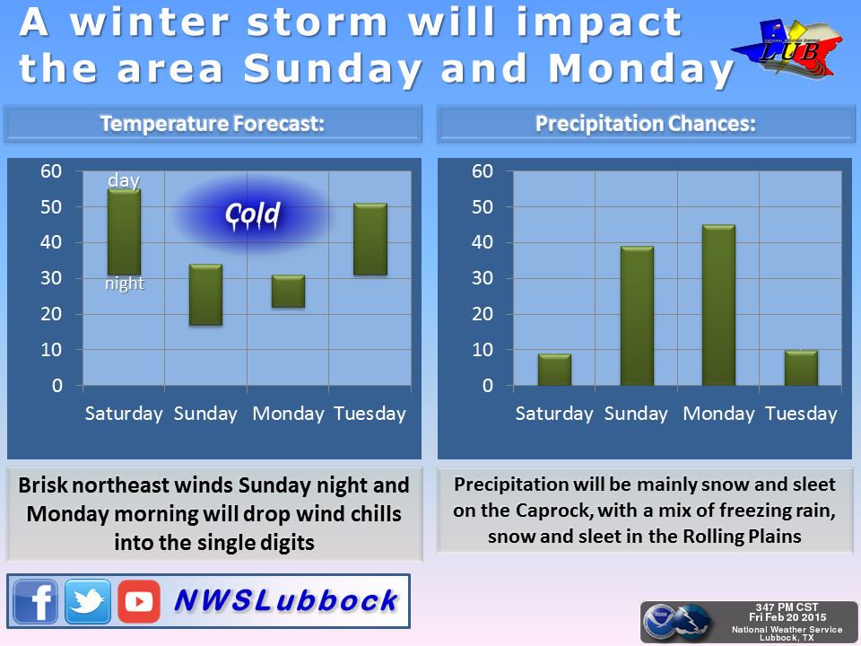
South Plains/Rolling Plains/Permian Basin
No watches or advisories are currently in effect for the South Plains, Rolling Plains, or Permian Basin. I do anticipate winter storm warnings/advisories will be issued later tonight or on Saturday for all three regions. A mixture of sleet/snow is possible across the South Plains with a freezing rain/sleet event in the Rolling Plains and the northern Permian Basin. 1 to 3 inches of snow will be possible in the northern South Plains with significant sleet accumulation possible in the Rolling Plains. Roadways will likely become slick in spots especially where significant sleet accumulations occur.
West-Central Texas into the Concho Valley
A significant winter weather event is expected to begin Sunday Night and continue through Monday across West-Central Texas and the Concho Valley. Sleet accumulations combined with freezing rain may produce accumulations near or exceeding half an inch. That amount of accumulation would result in all roadways becoming extremely slick and hazardous. Localized power outages would also be possible. Localized higher amounts are possible. A Winter Storm Watch is in effect for much of the area and will likely be upgraded to a Winter Storm Warning on Saturday.

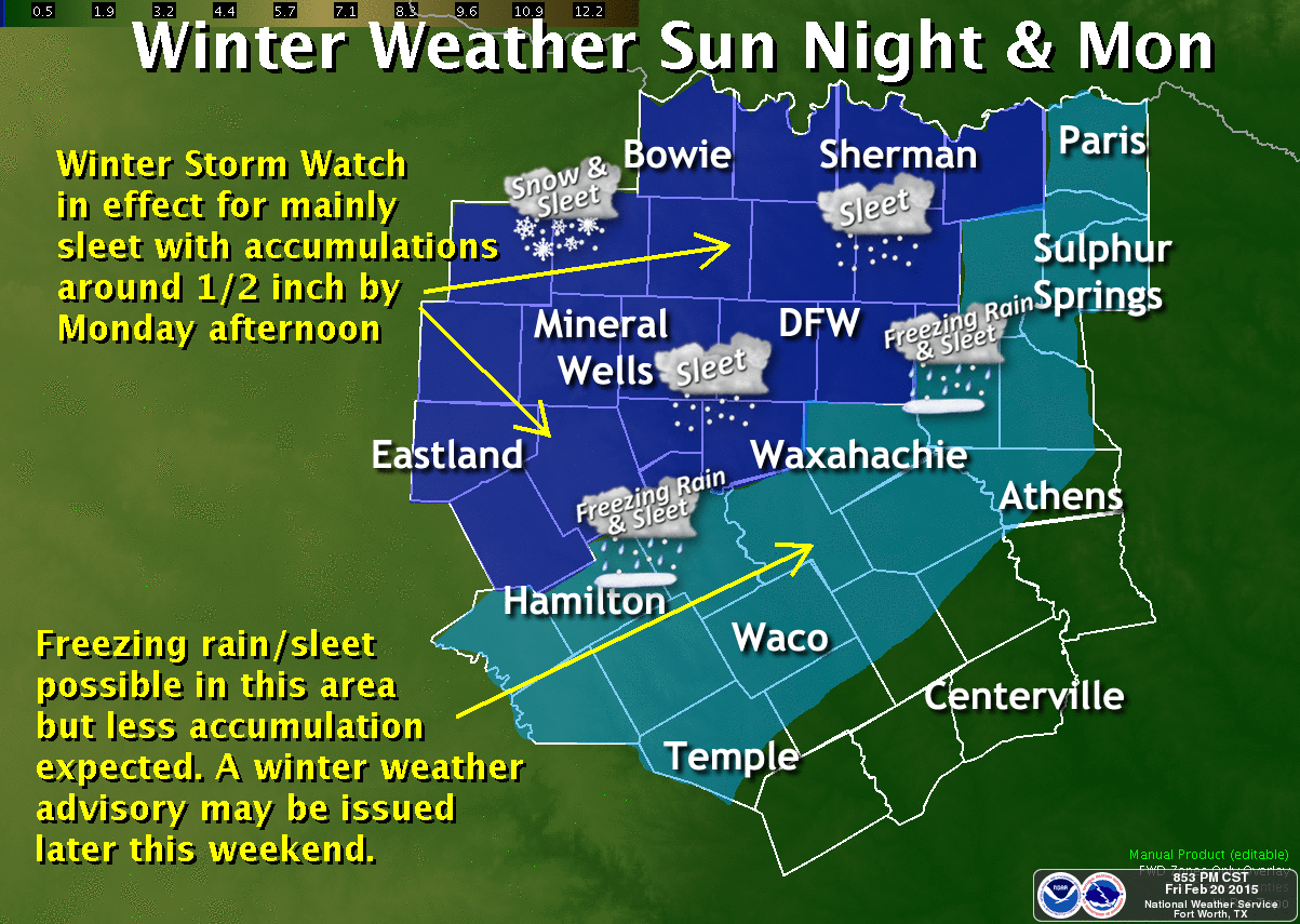
North Texas
A Winter Storm Watch is in effect for the northwestern half of North Texas including the D/FW Metroplex. A mixture of freezing rain and sleet is expected to start falling late Sunday night and continue into Monday. Significant accumulations of sleet and freezing rain are expected in the Winter Storm Watch area. Some have asked if this event looks like the one that occurred back in December of 2013. That was a once in ten year event. At this time this upcoming storm looks like a moderate-level event and the most significant so far this winter. With temperatures falling into the 20s by Monday morning road conditions are expected to become slick and hazardous with sleet/ice accumulations. Isolated power outages will be possible but could become a bigger concern if we end up with more than half an inch of freezing rain/sleet accumulation.
Northeast Texas
A mixture of freezing rain and sleet is possible across Northeast Texas on Monday. We’ll likely see winter storm advisories issued at some point tomorrow for parts of Northeast Texas and possibly East Texas as far south as Interstate 20. Travel conditions could deteriorate and become slick. Check back on Saturday for the latest forecast.
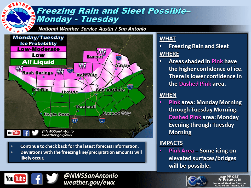
The Hill Country, Central Texas, Brazos Valley, and Southeast Texas
As temperatures fall below freezing on Monday rain may change over to freezing rain and/or sleet across portions of the Hill Country roughly north of a Rock Springs, Kerrville, Burnet line. Some accumulation of ice and sleet will be possible and a winter weather advisory may be issued tomorrow or on Sunday. Please check back for forecast updates as we continue to refine the forecast. Little to no accumulation is currently expected in Austin or San Antonio although a little sleet may mix in at times.
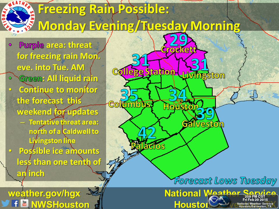
Likewise we may see rain change over to freezing rain Monday Night across the Brazos Valley with some light ice accumulation possible. Once we get closer to Monday Night we’ll be able to provide more accurate information so please check back for forecast updates.


0 Comments