
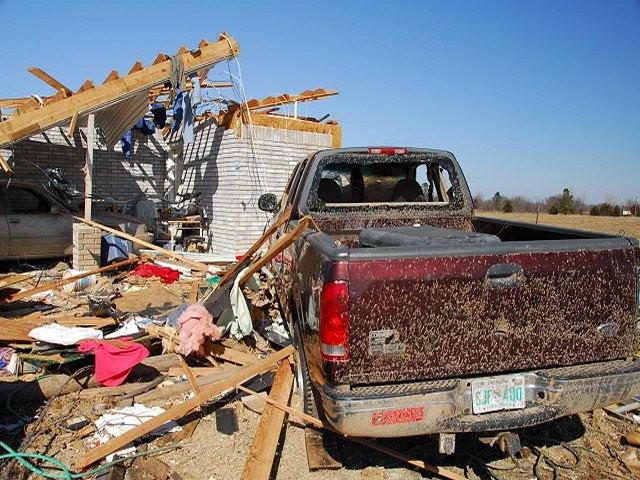
Damage in Lone Grove Oklahoma | Photo taken by National Weather Service Norman, OK
Six years ago today at about this time I was heading north on Interstate 35 for what would become my first real significant storm chase. I had been chasing since the fall of 2008 on mediocre storms here and there but February 10, 2009 would be my first day dealing with the worst of what mother nature had to offer. It’s a day I remember well six years later and still look back on.
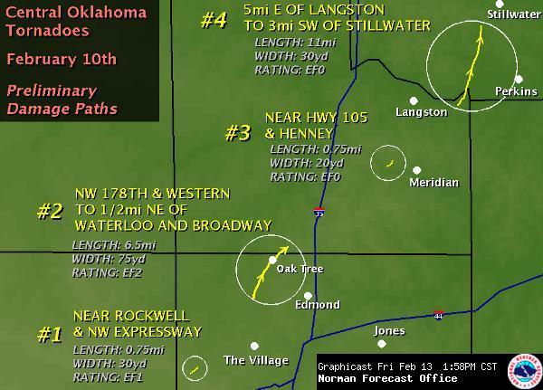
The February 10, 2009 severe weather outbreak was well forecasted by the Storm Prediction Center several days in advance. A negative tilt shortwave centered over New Mexico during the afternoon hours bringing strong lift and upper level dynamics to Central Oklahoma south into North Texas. Meanwhile a powerful low level jet with screaming southeast winds just above the surface helped pump in rich moisture straight from the Gulf of Mexico. Reminiscent of an April severe weather setup Mother Nature didn’t care that it was early February. Just after lunchtime the first tornadoes touched down in the northern Oklahoma City metro near Edmond where one strong tornado caused quite a mess but fortunately no fatalities.
By the late afternoon additional thunderstorms were developing in our target zone near Bowie, Texas. These storms were initially elevated in nature and struggling to strengthen with powerful upper level winds blowing the updrafts over. One discrete thunderstorm eventually developed a sustained updraft near Bellevue, Texas where a rotating wall cloud rapidly developed. This storm was quickly moving northeast and we struggled to keep up with it as it continued to intensify and come closer to producing a tornado. With evening twilight starting to wane the storm produced its first tornado just northeast of Ringgold, Texas near the Red River. We lost the storm as it crossed the river due to the lack of a suitable river crossing and the fast storm speed.
The bellevue storm continued to move northeast after the sun set. With a strengthening nocturnal low level jet a powerful, long-track tornado developed on the Red River and continued as the storm moved northeast into Love County, Oklahoma. At 7:30 PM on February 10, 2009 a large and violent tornado moved northeast into the city of Long Grove, Oklahoma. The sun had set over an hour before and the tornado was obscured by rain and darkness. It finally became visible as it moved into Lone Grove with power flashes backlighting the tornado. Eight individuals tragically were killed by the tornado with over 45 folks injured. The tornado ended up traveling 37 miles over the course of 57 minutes from the Red River northeast through Long Grove to just north of Ardmore where it crossed Interstate 35. The tornado was mostly wrapped in rain and invisible in the night sky but the damage it left was most certainly visible.
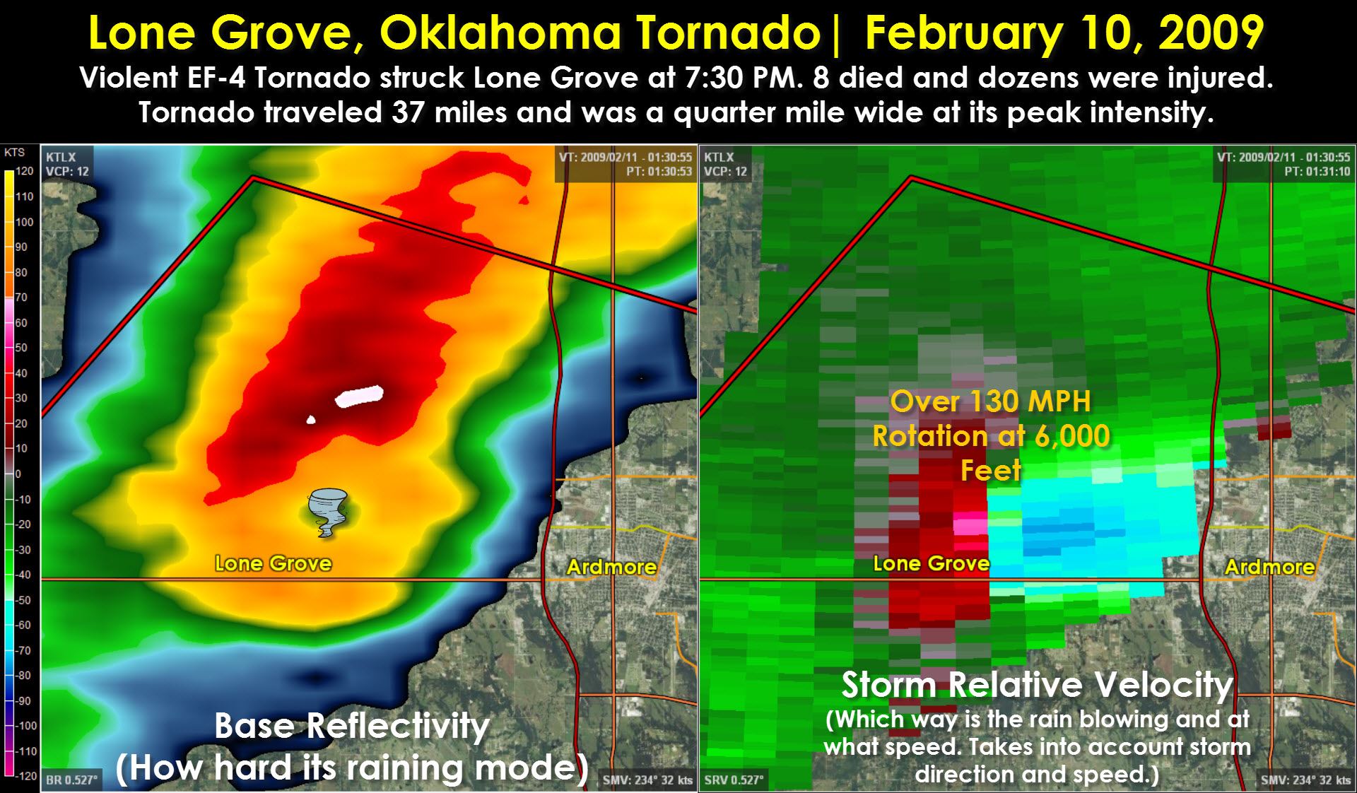
This weather radar look at the storm was taken moments after the tornado had moved through Lone Grove. The radar, located in Oklahoma City, was nearly 90 miles away from the storm and looking around 6,000 feet above the ground. Even with that elevated height a strong rotational couplet and ‘donut hole’ known as a Bounded Weak Echo Region (BWER) was clearly visible. This tornado would be the one and only one to claim a life that night. Shortly after the tornado crossed Interstate 35 it dissipated and the storm was overtaken by a squall line. That would be the last tornado in Oklahoma for the event.

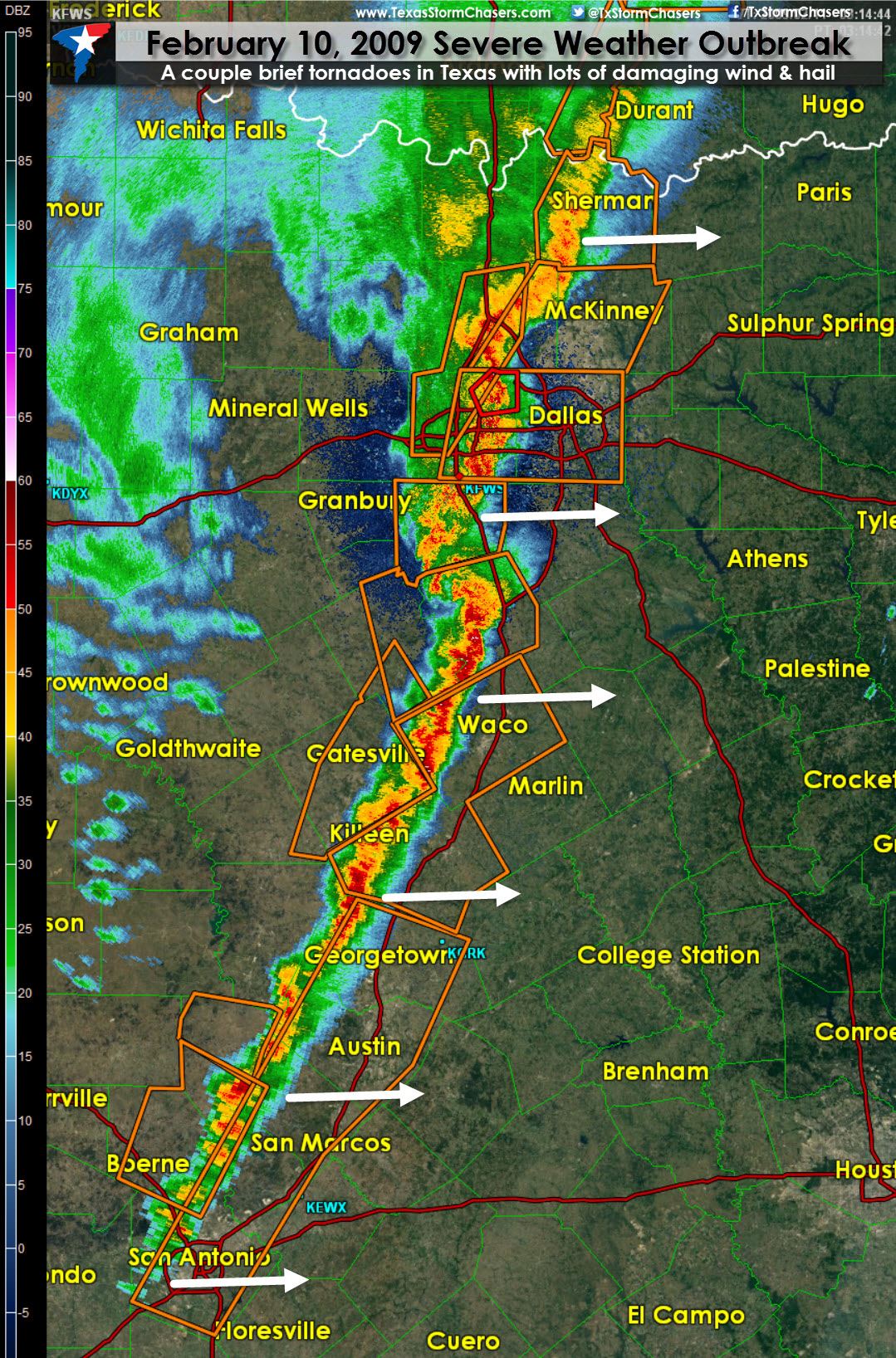
While the show was starting to wind down in Oklahoma it was just ramping up in Texas. After storms struggled to develop most of the day the upper level forcing finally arrived and caused a squall line to rapidly fire about 50 miles west of Interstate 35. By 9:30 PM the squall line extended from southern Oklahoma south into North, Central, and South-Central Texas. Damaging straight-line winds and large hail were the widespread threats however several brief tornadoes did occur including one in the D/FW Metroplex. Several injuries were reported from flying debris caused by the strong winds.
While today’s weather will be calm and sunny the severe weather outbreak on February 10, 2009 is a clear reminder to all those who inhabit Oklahoma and Texas that severe weather can and does occur outside the peak spring season. Now is the time to develop and practice a severe weather safety plan with your family. Taking the time while the weather is nice to practice your plan means you’ll be ready once severe weather returns to the state. Dealing with storms is just a part of living in Texas just like earthquakes are a part of life in California. You prepare, you practice, and you enact your plan if the time comes. The point is that you know your plan ahead of time instead of trying to come up with one ten minutes before a tornado hits your location.


0 Comments