
It’s a beautiful day across Texas with warm temperatures and mainly sunny skies. Don’t let the nice weather deceive you though we do have major changes on the way. Unless you’ve been hiding under a rock this week you know we have much colder air arriving on Sunday and continuing into the early part of next week. That hasn’t changed but the timing of the front has moved up a bit. As I’ve explained before these arctic cold fronts tend to move faster than we expect. Weather models have been playing catch up and we now expect the cold front to arrive on Sunday into Monday versus Monday into Tuesday. Temperatures north of the cold front will drop into the 30s and 40s with blustery north winds creating uncomfortable wind chill temperatures.


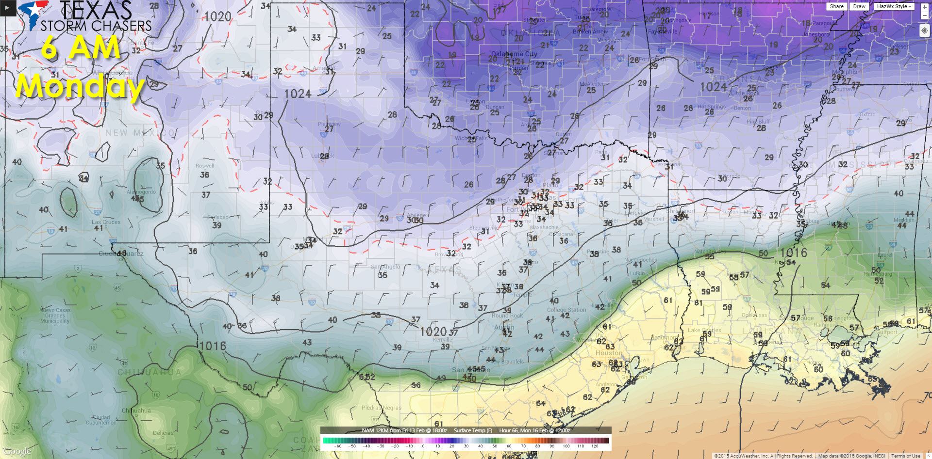
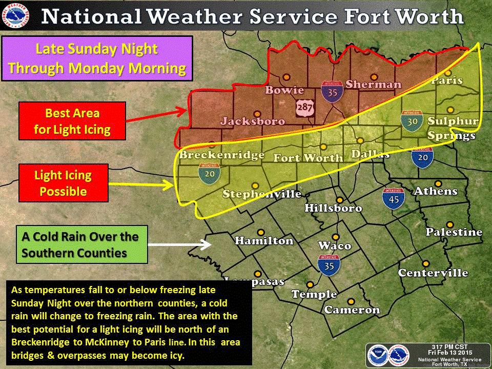
I know many of you are really here wondering if we’ll see any winter precipitation come into play. Over the past day weather models have been in decent agreement that we may see very light freezing rain or freezing drizzle across the Red River from Wichita Falls eastward along US-82 to Texarkana Sunday Night. Precipitation amounts look very light here in Texas as the main energy of the storm system should remain just to our north across Oklahoma into Arkansas. While any sort of freezing rain will be very light it only takes a trace to cause some icy bridges once temperatures fall below 32 degrees. Typically we need to see temperatures drop below 28-29 degrees to see ice problems on surface roads and highways. If we can keep temperatures in the 30-32 degree range than we may see a few icy spots on bridges but overall it will be a very low-end event. Let me be clear here – we’re still 48 to 72 hours away from all of this happening. We have big problems forecasting winter weather in Texas outside 24 hours because so many factors can make or break a forecast. There WILL be changes to the forecast so please check back this weekend. Here is what the National Weather Service in Fort Worth is expecting based off the latest model data.
Another storm system may bring accumulating snow to the Texas Panhandle and West Texas Monday Night into Tuesday. At this time it looks like snow amounts would remain on the lower end of the spectrum. However we’ll focus on the first system for now and keep tabs on what transpires in model data land this weekend.


0 Comments