
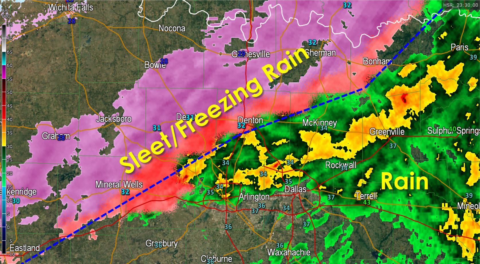
Mother nature always throws a curve ball and I think we now know what that one is for this event. The freezing line is booking it south into the D/FW Metroplex. Rain is now mixing with or has changed over to freezing rain north of a Sherman-Denton-Mineral Wells line. That freezing line will continue to move southeast and the D/FW Metroplex could be at or below freezing by 7 PM. This complicates things because we thought this would happen closer to 10 PM tonight after the first round of precipitation moved out. However because the freezing line is moving in now we have to adjust the forecast. The Winter Storm Warning has gone into effect early and now runs through 6 PM on Monday. Because temperatures are falling below freezing with freezing rain and sleet still falling we have to mention the potential for icy bridges developing this evening. We thought that would happen early Monday morning, but we can’t ignore the trends. I still believe the major impacts with all the roads going icy will still happen during the morning rush hour. However we could see icy bridges as soon as this evening across the northern parts of the D/FW Metroplex. I-35 just north of the Red River is already a block of ice with numerous accidents.
Once again: A few icy bridges will be possible in the northern D/FW Metroplex by 8 PM as the freezing line continues to move south and light precipitation continues. This is not the ‘big’ event but we may have some problems tonight. We expect heavy sleet, possibly from thunderstorms, to enter the D/FW Metroplex around rush-hour monday morning.


0 Comments