
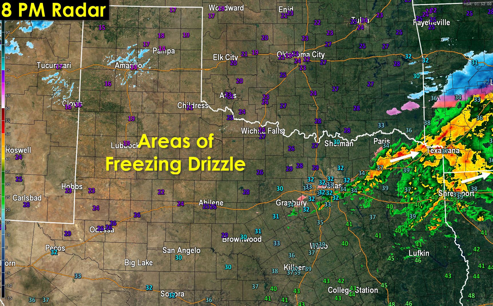
Most of the freezing rain and sleet has now moved east of the D/FW Metroplex. We expected this would all fall as pure liquid rain but the freezing line decided it wanted to be about 5 hours early to the party. Temperatures north and west of the D/FW Metroplex are now falling into the upper 20s with most sites in the immediate D/FW at 32 degrees and slowly falling.
All of the Texas Panhandle, South Plains, Rolling Plains, the northern Permian Basin, the Big Country, and the Concho Valley are below freezing. Locations not mentioned are above freezing.
Rain continues to move east/northeast across Northeast and portions of East Texas where temperatures are in the upper 30s to lower 40s. No freezing issues are expected there this evening from this round of precipitation.
The real show will begin after midnight as our next upper level storm system moves into West Texas. That lift will cause another large area of precipitation to develop after midnight. This batch of precipitation will move northeast and where temperatures are below freezing will cause winter weather accumulations. We’ve highlighted this potential well over the past few days and it is shown below with the watch/warning advisory.
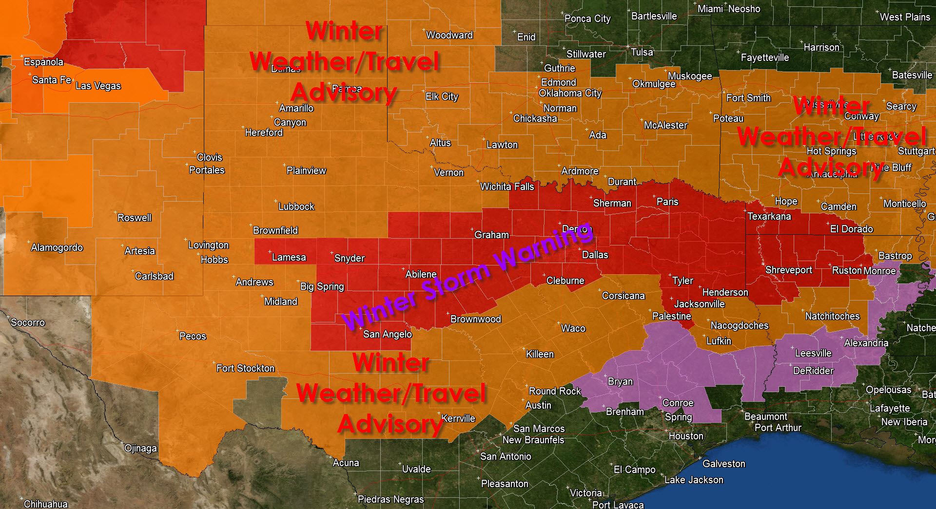
* WINTER STORM WARNING for the Big Country, North Texas, Northeast Texas, and portions of East Texas through Monday Night. This includes Lamesa, Snyder, San Angelo, Abilene, Brownwood, Graham, Gainesville, Denton, Fort Worth, Dallas, Sherman, Paris, Tyler, Texarkana, Tyler, Henderson, Jacksonville, and Canton. A Winter Storm Warning means significant accumulations of sleet and possibly freezing rain are expected to cause widespread travel disruptions with dangerous travel conditions.
* WINTER WEATHER ADVISORY through Monday Night for the Texas Panhandle, West Texas, Permian Basin, Hill Country, Central Texas, and parts of Deep East Texas. This includes Nacogdoches, Lufkin, Corsicana, Waco, Killeen, Round ROck, Austin, San Marcos, Kerrville, Fort Stockton, Pecos, Midland, Big SPring, Andrew, Brownfield, Lubbock, Plainview, Hereford, Canyon, amarillo, Dumas, and Pampa. A Winter Weather Advisory means winter precipitation is expected to produce accumulations that may result in slick bridges and overpasses. Some roadways may also be impacted.
* FREEZING RAIN ADVISORY for portions of the Brazos Valley and Southeast Texas Monday Night into Tuesday Morning. This includes Jasper, Huntsville, Bryan, College Station, and Conroe. There is the potential that temperatures may fall below freezing Monday Night with light precipitation in the area. The concern mainly involves a few icy spots on bridges – but this is not expected to be a high-impact or widespread event.
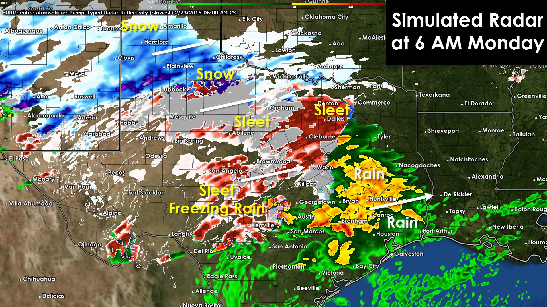
Here’s what the radar may look like by 5 AM.


0 Comments