
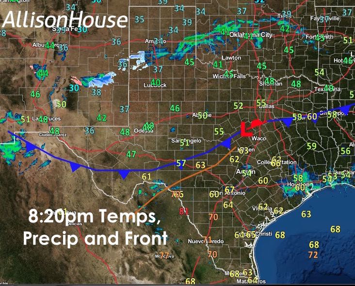
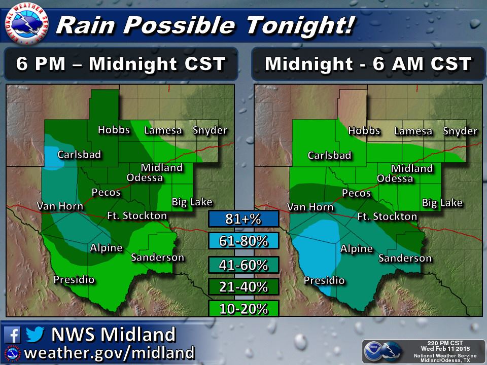
Our latest cold front continues to slowly drift south this evening. A few patches of precip have been observed across portions of the panhandle this evening with some light flurries showing up on radar since this afternoon, although much of it has not been sticking around. A few flurries are possible overnight across the southwestern panhandle, but most of it will be eaten up by dry air above the surface; therefore, no accumulations are expected. Accumulating snow is possible by tomorrow morning for the higher elevations for the Davis and Apache mountains, and for the lower elevations of far west Texas, mainly rain and drizzle. The front is not expected to arrive along the coast until around daybreak. Fog will be possible overnight and just after dawn ahead of the front along the coast and inland from Corpus Christi up to around Victoria. Could see some patches of dense fog develop, so keep that in mind as you plan your morning commute.

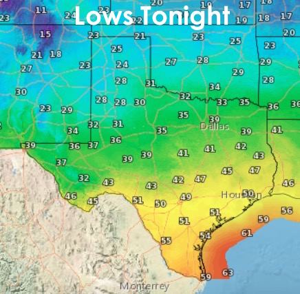
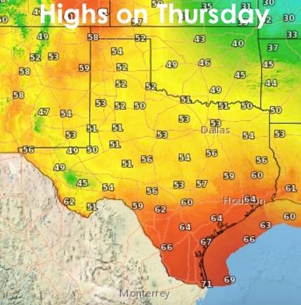
Temps behind the front will drop off into the 20s and 30s across the northern half of the state, 40s across much of central Texas, with 50s across south central and coastal regions. As the cold front will be arriving tomorrow morning across the southern portions of the state, highs for the day will likely be reached early on with temps dropping off as we head into the afternoon hours. Temps will rebound quickly by Friday and back above normal for the weekend. By early next week, we’ll see a rather big changeup in our weather pattern. David will have a blog out shortly about that, so stay tuned! You’ll definitely want to read it!


0 Comments