
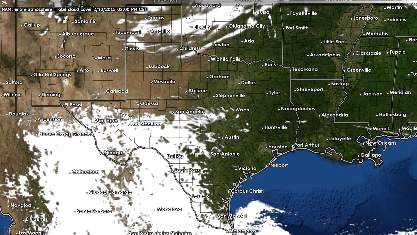
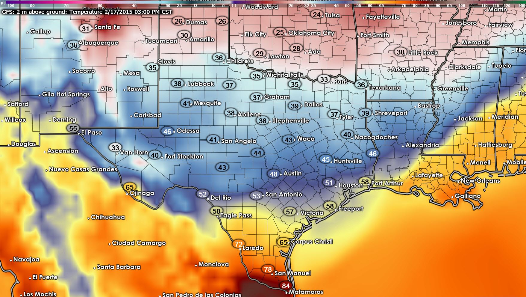
Temperatures across Texas this afternoon will end up being the coolest we’ve seen in a few days. You can thank a cold front for today’s cooler weather. The break from above average temperatures will be short as we’ll rebound quite nicely on Friday. High temperatures for your Thursday will be in the lower 50s across the Texas Panhandle, West Texas, Permian Basin, North, and Northeast Texas. We’ll see mid 50s across Central and East Texas with lower 60s closer to the coast in Southeast Texas down through the Coastal Plains into the Rio Grande Valley. It won’t be a bad day weather wise for February but I think most folks have been spoiled by the spring-like weather. Mostly clear skies will be commonplace this afternoon east of Interstate 35. Patchy clouds will be possible across the Texas Panhandle and Northwest Texas with more widespread overcast expected in the Permian Basin eastward into Southwest Texas and the Hill Country.

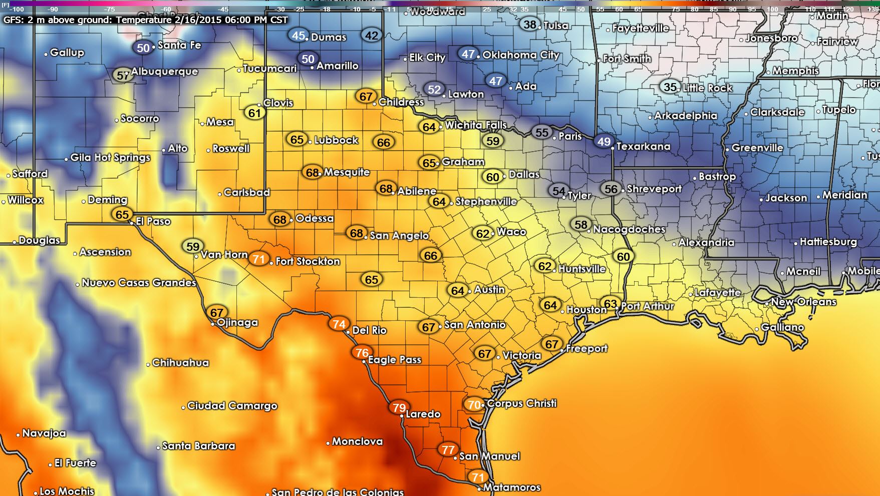
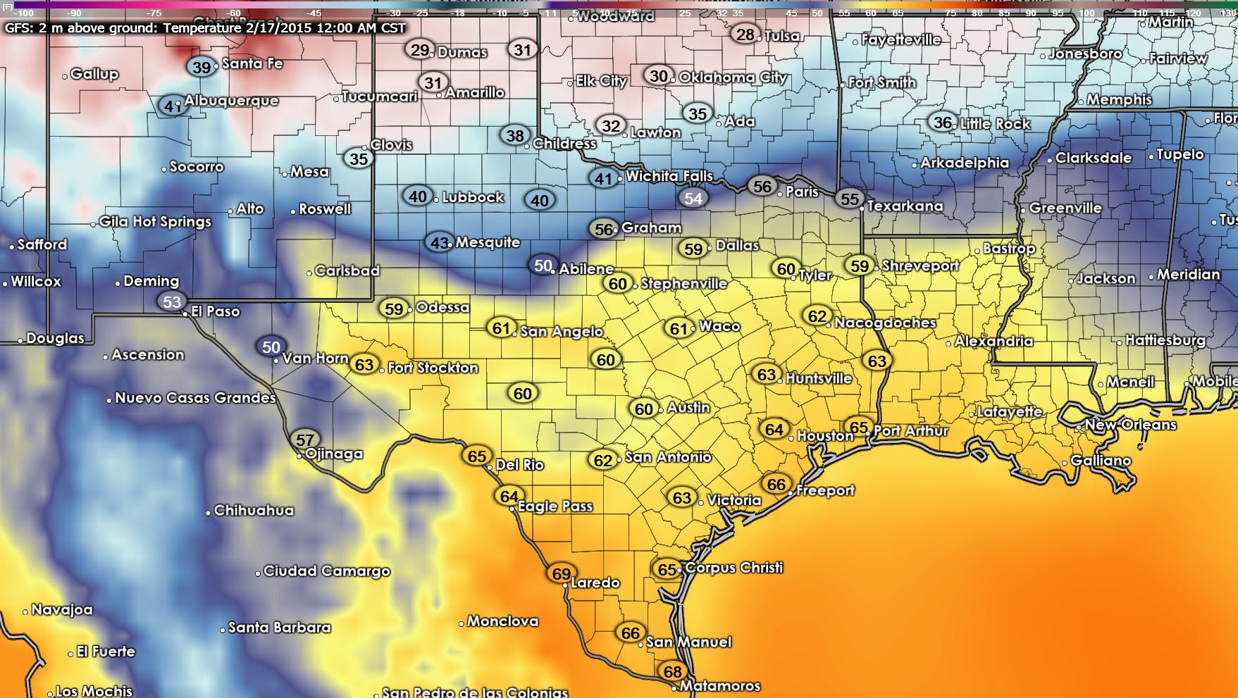
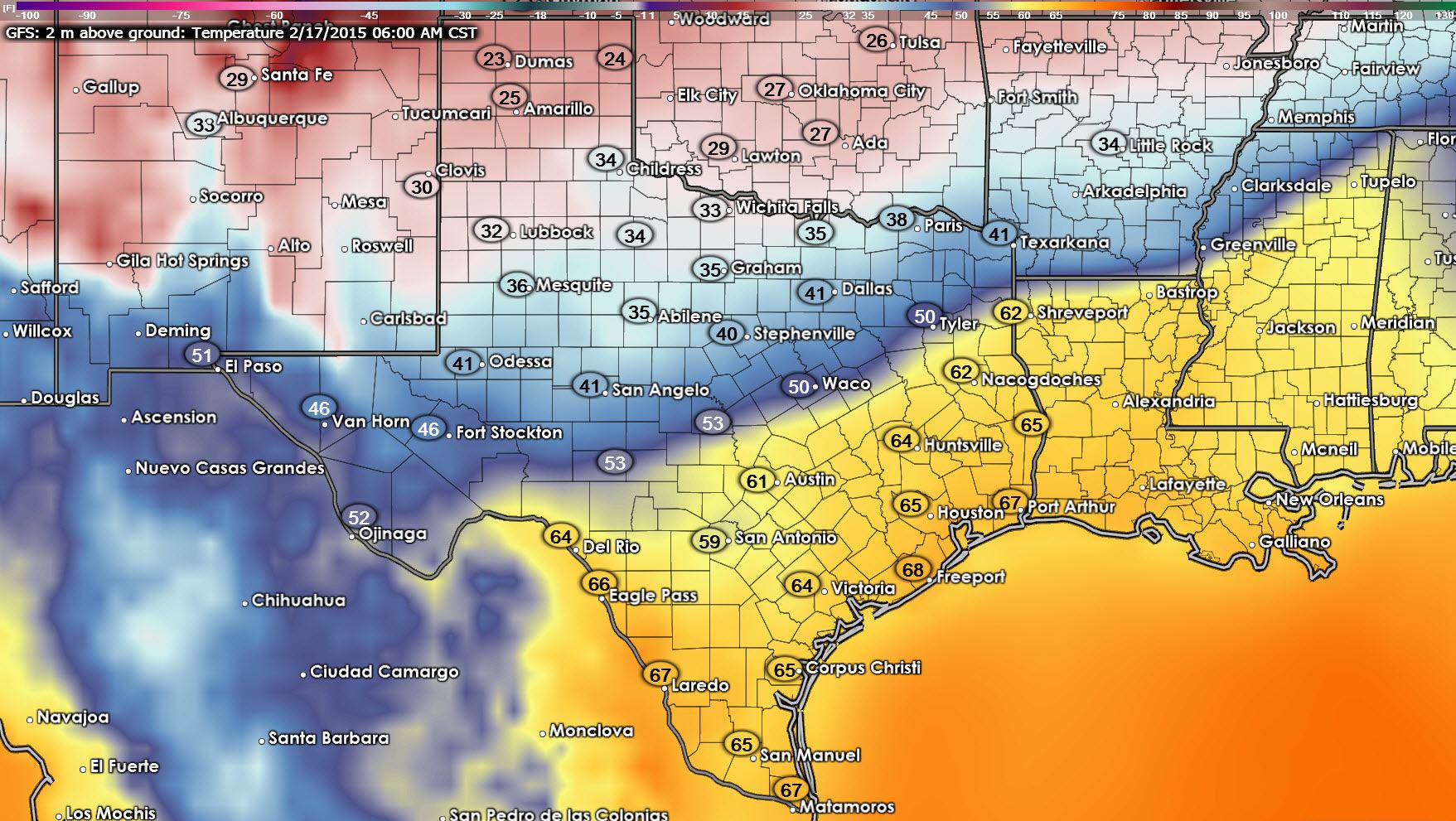
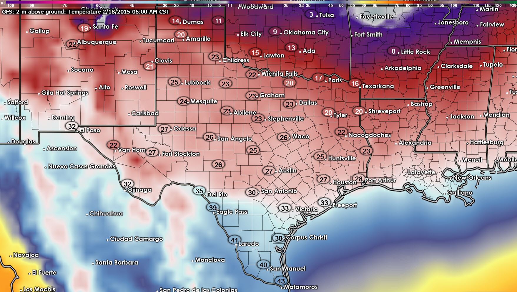
Our main focus continues to reside in next week’s arctic air invasion and related impacts to Texas. We have not made any radical changes to the cold front’s timing this morning but as always we have to watch for these fronts to run south more quickly than anticipated. Here are a few graphics from the 0Z evening run from late last night’s Global Forecast System (GFS) showing what it believes will be the cold front’s timing. Dates and times are in the top-left portion of the graphics and we’ll start out at midday on Monday. Temperatures south of the cold front will still be above average as will most of Texas this weekend. Once the front arrives at your location winds will become gusty out of the north and temperatures will drop noticeably. This is a classic blue northern coming on down.
Our coldest temperatures will likely be experienced on Wednesday during the morning hours. The GFS continues to show freezing temperatures across all of Texas with the exception of Deep South Texas and the Rio Grande Valley with this run. As with the cold front’s timing we’ll have to refine the forecast as new data arrives and we see different scenarios evolve. Keep in mind we’re still four to six days out from this pattern chance and a lot will change between now and then.
It still looks like we could see one to four inches of snow across the Texas Panhandle on Monday as precipitation changes over to snow with cold air filtering in. As of now the prospect for winter precipitation across Northwest and North Texas is uncertain due to the time distance between now and next week. However it does seem feasible we could see light rain change over to a winter mix or light snow across parts of Northwest and North Texas later in the day on Monday. Right now it does not look like we’ll see anything significant in the accumulation department south of the Red River but things will change significant between now and this potential event.
0Z GFS: Wednesday Morning Low Temperatures

0Z GFS: Wednesday Morning WInd Chill Temperatures (What it will feel like)


0 Comments