
Not much has changed with regards to the icing and snow potential for the northern portions of the state tonight and Monday night/early Tuesday. A cold front is currently seeping from northeast to southwest across the northern portion of the state. It’s not expected to advance very far south during the day today, but it will get a stronger push of cold air overnight which will carry the front further south overnight and tomorrow. The temperature gradient between areas ahead of the front and behind the front will be pretty steep. As the front is expected to bisect the Dallas/Ft. Worth metroplex by around noon today, persons traveling across the area could see as much as a 20 degree difference west to east. The panhandle has already experienced frontal passage with temps currently in the 20s and 30’s from around Amarillo and northward. Scroll down for the latest on frontal timing this evening and into Monday.
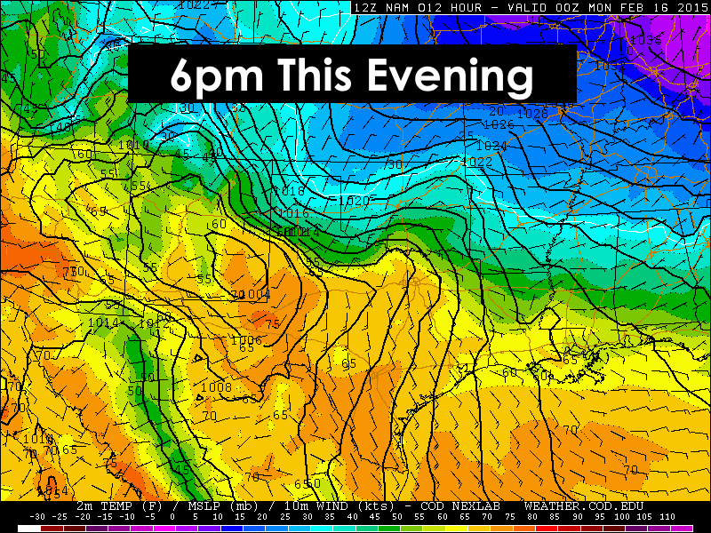
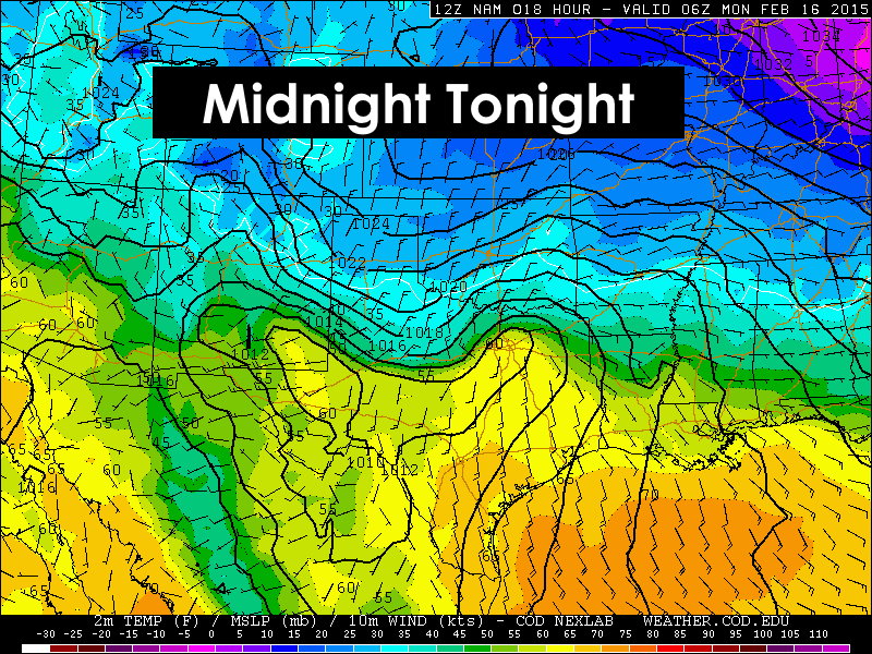
 Highs today across the northern half of the state will obviously be strongly influenced by the position of the front. For folks across the rolling plains, west Texas, central and south Texas…another day of warm temps. As the front is pushed south overnight, lows are expected to drop into the 20s and 30s across the panhandle, northern and central Texas, with 50s and 60s across south central and coastal regions.


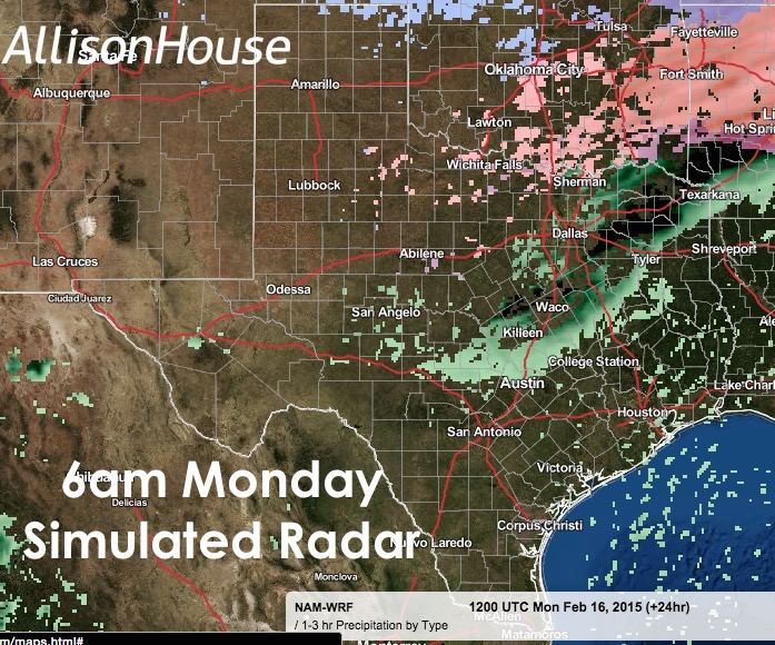
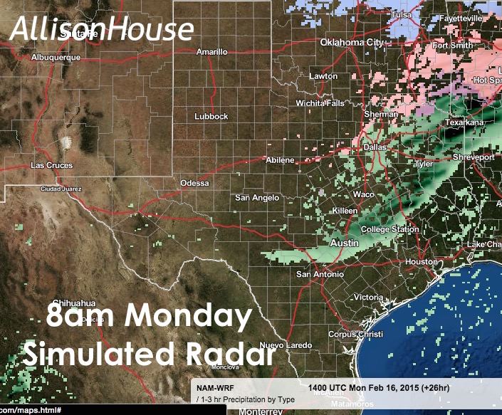
Chances for light to moderate rain will be on the increase today and overnight from west central Texas and spreading north/northeast into parts of the southeastern panhandle and northwest/north central Texas. There’s even a chance for a couple of rumbles of thunder across northwest Texas tonight, but nothing severe. By Monday morning, rain is expected to be fairly widespread across northern and central Texas. The biggest concern over the next 24 hours will be the potential for some icing across northwest and north Texas overnight and into Monday morning as colder arctic air arrives. At this time, the best chances for icing with impacts to bridges and elevated roadways will be along the Red River in and around the Wichita Falls area and the counties north and west of the Dallas/Ft. Worth metroplex. Here, ice accumulations from a trace to 1/10th of an inch are possible by the time you head out on your morning commute. No major impacts are expected in Dallas or Ft. Worth as air and ground temperatures are expected to be too warm for any sleet or freezing rain to cause issues. Monday night into Tuesday will bring chances for light snow across the panhandle, northwest and north central Texas. We will have more details out on that later this evening, but at this point, we are not concerned that this snow event will present much of an impact either.


0 Comments