
With a large variability in the forecasts over the past 24 hours it looks like the rumor mill is running rampent on social media this afternoon. Let me take the time now to clear up a few things and hopefully get the record set straight regarding tomorrow morning’s winter weather forecast.
At this time it looks like we will see snow fall across the D/FW Metroplex (North Texas area as well, not just D/FW) and Northeast Texas. Temperatures in the D/FW Metroplex should be at or above freezing while snow is falling tomorrow morning.
Tomorrow morning’s snow will be a quick-hitting event with about 2-4 hours of snow expected. After that temperatures will quickly rise above freezing and the sun may even come out during the afternoon hours on Wednesday.
Snow that falls will be wet with large flakes tomorrow morning. With temperatures at or just above freezing and the wet nature of the snow I don’t believe widespread ice will form again. Some bridges will likely have slick spots. With the heavy wet snow combining with all the sand on roads I do believe that things could get quite messy tomorrow morning. We may not have slick roads from ‘ice’ but things will probably be slick from the wet snow combining with the sand and turning into a slushy mess.
Unlike Monday’s event we may see some power outages because the heavy wet snow could weigh down power lines.
This is NOT expected to be a high-impact event like we saw on Monday. Even if for some reason we ended up with widespread travel problems tomorrow morning (which I don’t think we will at this time) it would quickly calm down by the afternoon hours tomorrow.
The heaviest snow will be located in a relatively narrow corridor in conjunction with where a low pressure system moves. If it ends up moving 20 miles north or south compared to the current forecast the accumulation/snow forecast will have to be adjusted as well.
Even though we’re about 12-18 hours out from this winter weather event we still have uncertainties. Unlike the system on Monday there are a lot of unknown or marginal factors that could alter the forecast as we go into this evening and even early Wednesday morning. We’ll be here all night keeping up with the latest and sharing that information with you.
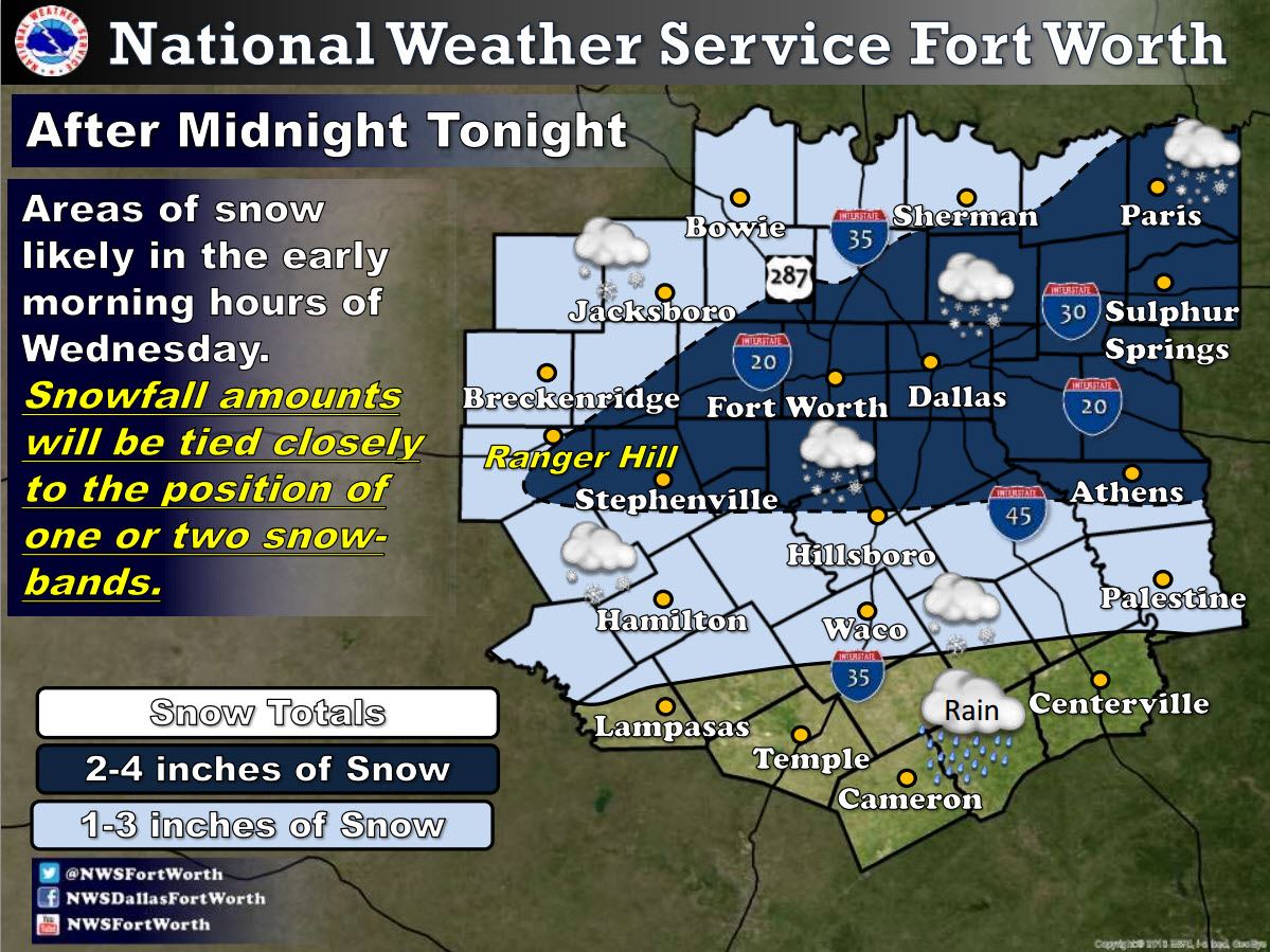
Here is the latest snow accumulation forecast from the National Weather Service in Fort Worth. Once again let me emphasis this will be a quick-hitting event with a relatively short period of locally heavy snow. Once it all moves east of the D/FW Metroplex late Wednesday morning temperatures will rise well above freezing and snow will melt rather quickly during the afternoon hours. Roads may not become icy but all that melted water/moisture will combine with the sand on roads to make for a mess.


0 Comments