
Snow has begun flying across the northwest Texas Panhandle from north of Dalhart to Stratford. Precipitation continues to fall in the form of liquid rain across the remainder of the northern Texas Panhandle. As cold air filters in precipitation will change over to snow this morning with precipitation coverage increasing.

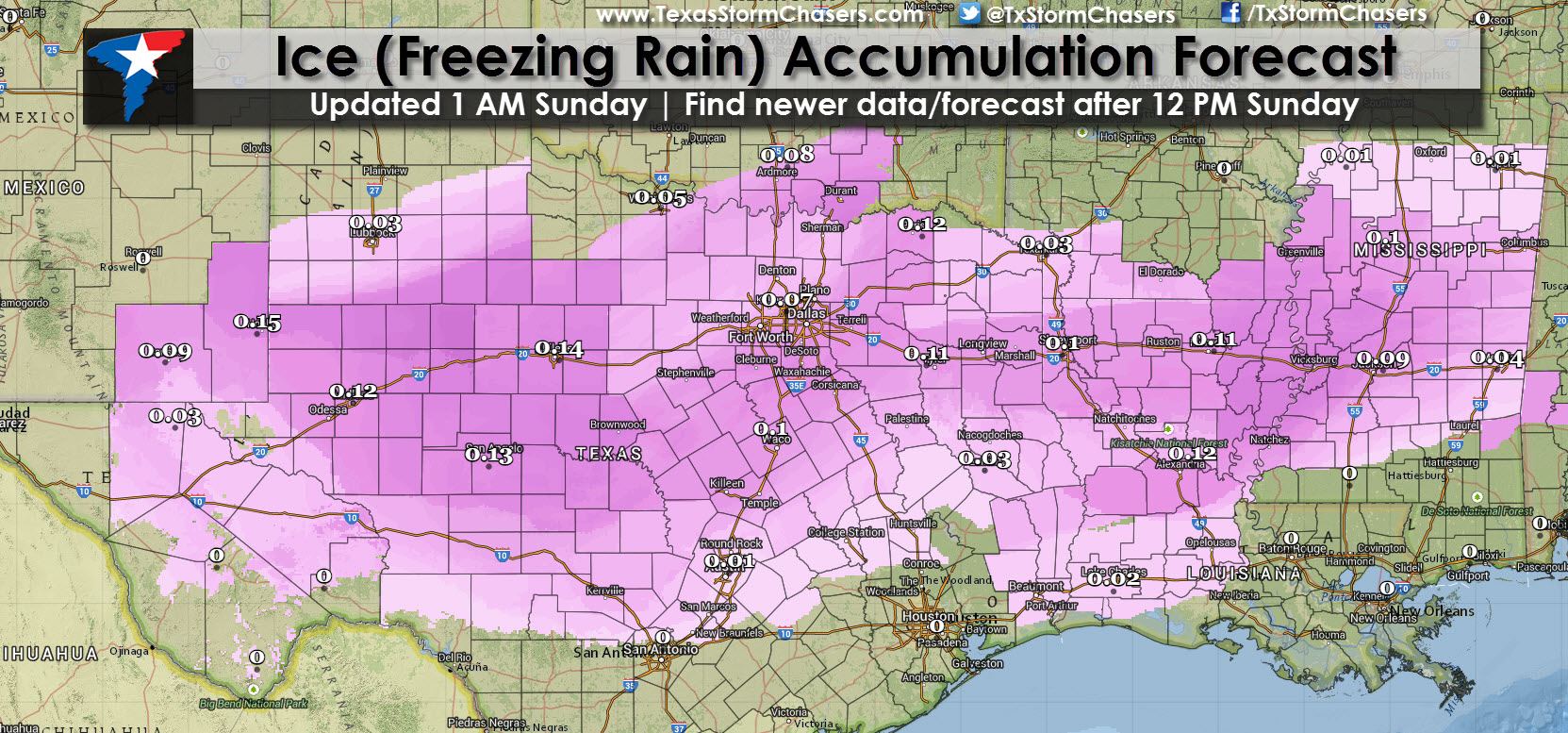
Not much has changed early this morning from what we’ve already told you in previous blog posts. We’ll likely see the Winter Storm Watch across parts of Central, Northeast, and East Texas converted into a Winter Weather/Travel Advisory for Sunday Night through Monday Night. The freezing line may be running one or two hours ahead of schedule but that won’t result in any critical forecast adjustments in all likelihood. Jenny has an excellent blog from 11 PM that goes over what we’re expecting today and into tonight. Here are two graphics from National Weather Service forecast data for snow/sleet and freezing rain accumulations. The snow/sleet graphic is a bit deceiving for the Concho Valley and North Texas because all of that will be sleet versus snow. Half an inch to one inch of sleet is much more significant than one inch of snow because it turns roads into a block of ice. Jenny will be up around 7 AM and should have an update around 8 AM. I’m going to get to sleep early so I can rest up ahead of what will probably be an all-nighter as we go into Monday.


0 Comments