
The process of changing over from rain to snow is a complicated one this morning across North Texas. Unlike other events where our winter weather chances would be tied to surface temperatures this morning’s event is not. We’ve had a warm layer of air at about 5,000 feet this morning that has been melting snow and resulting in the widespread and beneficial rains across the Concho Valley into North Texas. About two hours ago an aircraft reported the temperature in the warm layer was about 42 degrees fahrenheit. A new report from about 45 minutes ago indicates that warm nose is now down to about 36 degrees and becoming more shallow. Based on the current rate of cooling we expect the rain across North Texas to almost uniformly change over to a wet snow. We’ve already seen signs of the warm layer weakening with heavy sleet reported in Denton County (north side of D/FW). This complicated process is being caused by a cold core upper level low. As this low continues to slowly move east into North Texas it is bringing very cold air with it. The result is cooling the atmospheric column enough to change the rain over to snow. Even with surface temperatures in the 32-35 degree range we’ll still see a heavy wet snow. The low itself has been moving more slowly than expected and that has delayed our changeover to snow. Should the current rate of cooling continue we should see the changeover to snow occur around or just after 6 AM CST (about an hour from now).
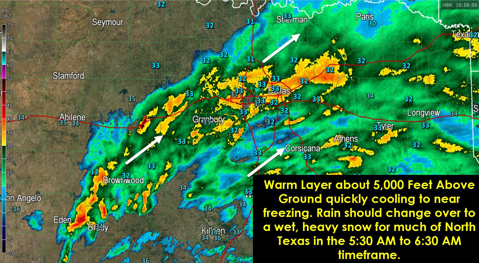
There’s a lot of moisture in the atmosphere and when we see the change over to snow it’s going to start falling quite heavily with large flakes. Even though we’ve seen the start of the snow delayed the forecast of 1 to 4 inches of wet snow accumulation in the D/FW Metroplex into Northeast Texas remains on track. It’s going to fall in about a 3-4 hour timeframe and could fall at over 1 to 2 inches per hour under the heaviest snow bands. Isolated thundersnow will also be possible because of the amount of lift and energy we have in place this morning. I know that looking out your window this morning is making you question the forecast. I’ve been questioning it too, trust me. However once the snow starts falling its going to do so in an impressive manner. Even with surface temperatures at or just above freezing it should fall heavy enough to accumulate on bridges and elevated surfaces. Hopefully we’ll be able to keep it as more of a slush layer than anything ice but regardless it will still likely cause problems for the morning commute in D/FW. Should a heavy snow band set up on one of the interstates than its not going to end well for traffic under it with pretty quick snow accumulations.
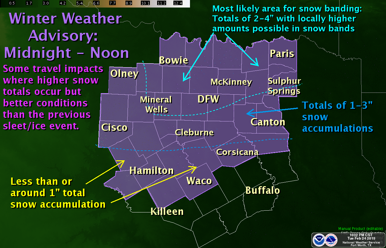
With the slightly slower low movement we will also see precipitation move out about an hour later than previously thought. We should see the snow clearing out of the D/FW Metroplex by 11 AM and moving out of Northeast/East Texas by 3 PM. Snow amounts of 1 to 4 inches will be possible in Northeast Texas this morning into early this afternoon with localized higher amounts up to 6 inches. We should see about 1-2 inches of snow along Interstate 20 from Canton east to Tyler, Longview, and Marshall with winter weather chances declining further south from Interstate 20.


0 Comments