
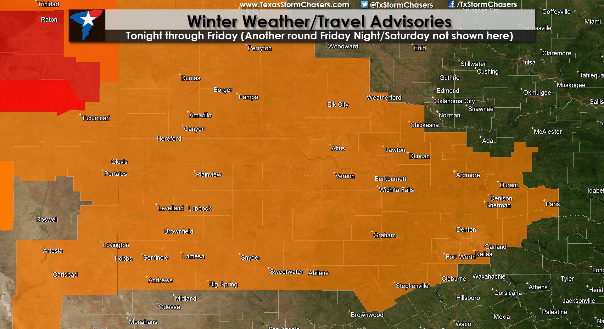
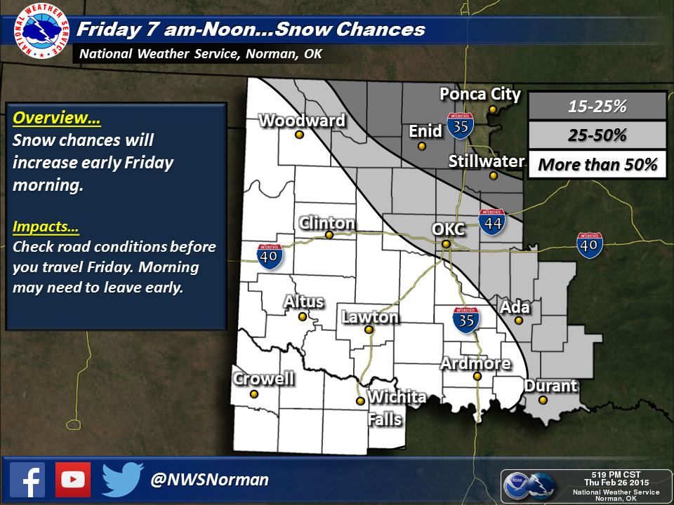
A Winter Weather Advisory is in effect Tonight through Friday Afternoon for the Texas Panhandle, South Plains, Rolling Plains, portions of the Big Country, Northwest Texas, and portions of North Texas. Perryton, Dumas, Pampa, Amarillo, Hereford, Plainview, Lubbock, Brownfield, Seminole, Lamesa, Big Spring, Snyder, Childress, Vernon, Wichita Falls, Sweetwater, Abilene, Graham, Bowie, Gainesville, Sherman, Paris, Greenville, McKinney, Dallas, Denton, Fort Worth, Cleburne, and Stephenville are a few towns included. The primary precipitation mode for tonight/Friday’s event will be a dry, fluffy snow.
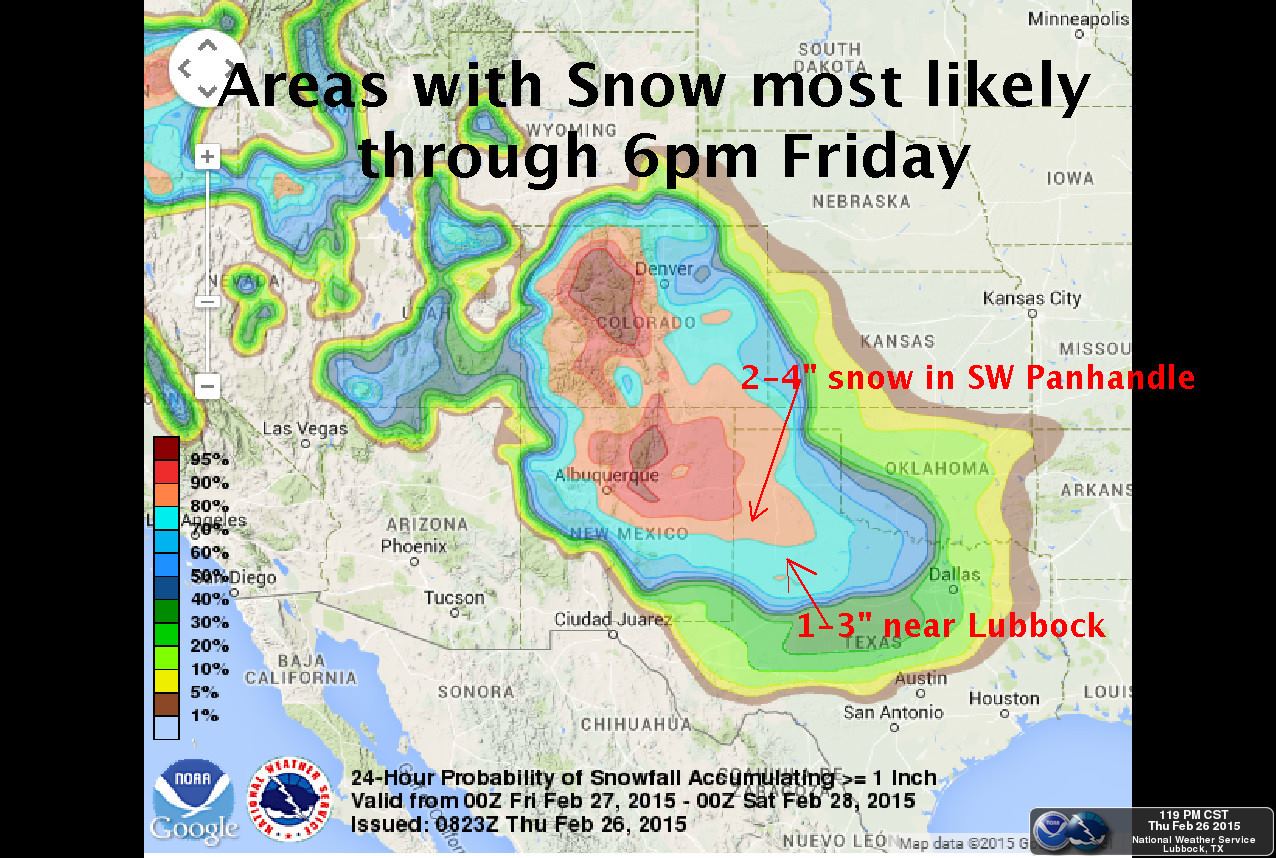
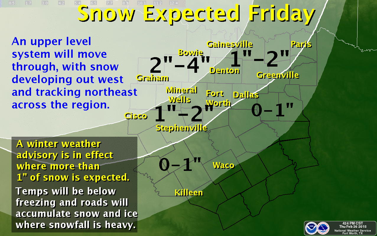
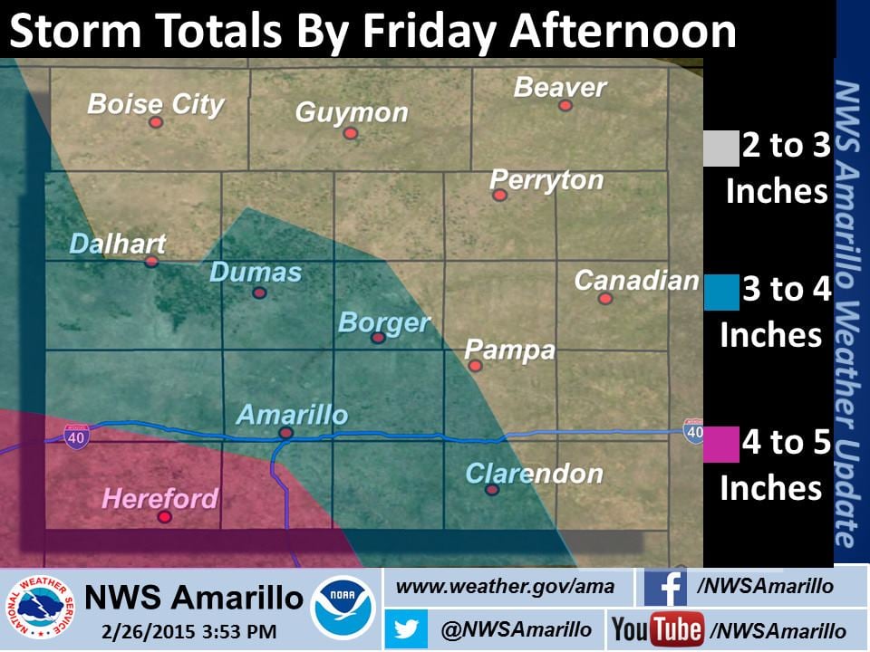
As usual we still have a few uncertainties that may require forecast adjustments later this evening. Moisture available in the atmosphere, the location of the heaviest snows, along with a few other meteorological factors mean we’ll continue to see some adjustements. We’ll have a more comprehensive update after 9 PM this evening. For now I’ll leave you with the regional accumulation forecasts from local National Weather Service offices across the impacted regions.

Simulated Radar/Timing Forecast
Here is a radar animation from the 4 PM CT run of the High Resolution Rapid Refresh. Timing is in the top-right part of the graphic in Eastern time. You can get a pretty good idea of timing and location of snow. As always this is only a weather model so it probably won’t have it down 100 percent correctly.
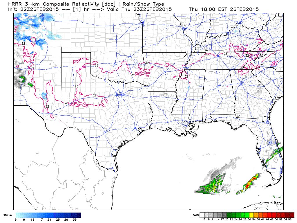
From weatherbell.com


0 Comments