
After a relatively warm January Mother Nature sure has been getting back at us. We’ll be dealing with our fourth winter weather event this week starting late tonight and on Friday. We’ll be dealing with a fifth event Friday Night and on Saturday. For now I want to focus on the fourth system but the fifth system will likely cause issues with icy roads/bridges on Friday Night and Saturday. We’ll have more about that at the end of this post. For now lets go ahead and catch you up on what we think will happen with tonight’s system into Friday.
A Winter Weather Advisory is in effect Tonight through Friday Afternoon for the Texas Panhandle, South Plains, Rolling Plains, portions of the Big Country, Northwest Texas, and portions of North Texas. Perryton, Dumas, Pampa, Amarillo, Hereford, Plainview, Lubbock, Brownfield, Seminole, Lamesa, Big Spring, Snyder, Childress, Vernon, Wichita Falls, Sweetwater, Abilene, Graham, Bowie, Gainesville, Sherman, Paris, Greenville, McKinney, Dallas, Denton, Fort Worth, Cleburne, and Stephenville are a few towns included. The primary precipitation mode for tonight/Friday’s event will be a dry, fluffy snow.
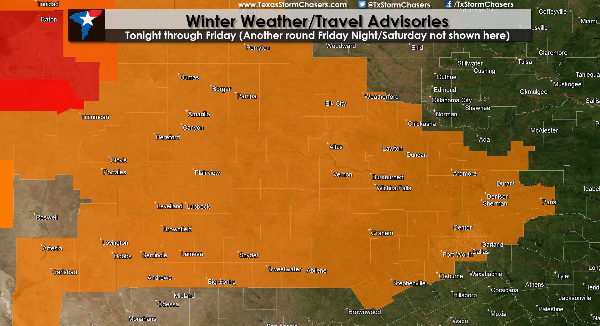
Another round of arctic air has pushed south for the umpteenth time this month. Temperatures at the surface are not really going to be a concern for the winter weather event tonight into Friday. Temperatures are at or below freezing across the Panhandle, West Texas, Permian Basin, Northwest Texas, the Big Country, and the northwest half of North Texas. The system we’ll be dealing with tomorrow is a rather unusual one for us in Texas. The ingredients will be in place for efficient-snowfall production with a dry, fluffy snow. That’s nearly the opposite of what we dealt with on Wednesday. Strong upper level lift will help bring us the chance for snow. A negative factor is that we have a layer of dry air again just above the surface. One big question for North Texas is how much of that snow will evaporate before it can actually reach the ground. That will greatly impact the potential for accumulating snow in North Texas. Out in thE Panhandle, South Plains, Permian Basin, and Big Country the atmosphere will be more supportive of snow at the onset so it won’t matter as much. With temperatures expected to be below freezing where the snow falls it does have the potential to accumulate on bridges and roads with some slick spots. The most widespread travel possible will be across the southwest Panhandle, South Plains, into Northwest Texas into the Big Country where snow accumulations of 2 to 5 inches will be possible. At this time it looks like 2 to 4 inches of snow will be possible west of the D/FW Metroplex out towards Abilene with 1 to 3 inches possible in the D/FW Metroplex. Just like on Wednesday the placement of the heaviest snow bands will determine where the heaviest accumulations set up. If Wednesday wasn’t enough of a reminder let me emphasis we won’t have the placement of the heaviest snow band down until we actually get started with the event. The morning rush hour in the D/FW Metroplex should not be impacted by winter weather with snow starting just after rush hour. The afternoon rush hour may have a few issues but I’m not forecasting a widespread/high-impact event with regards to travel problems in D/FW unless we get a heavier band of snow. That’s something we’ll be monitoring for tonight and will post updates as necessary.
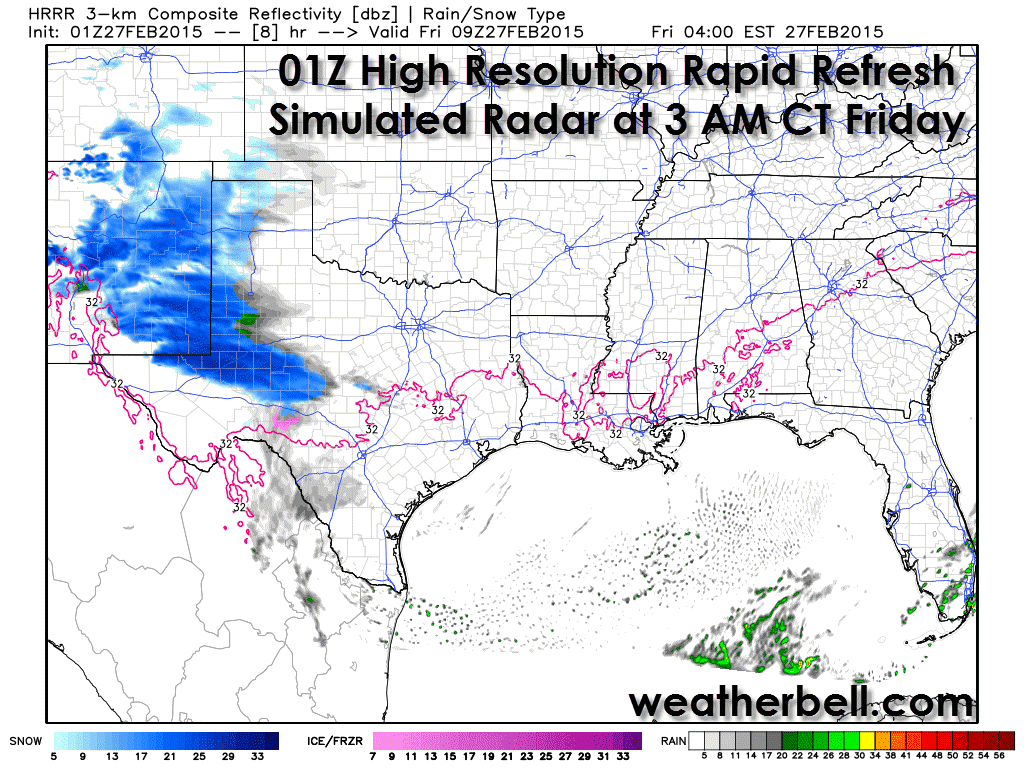
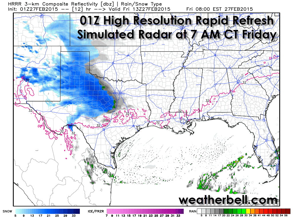
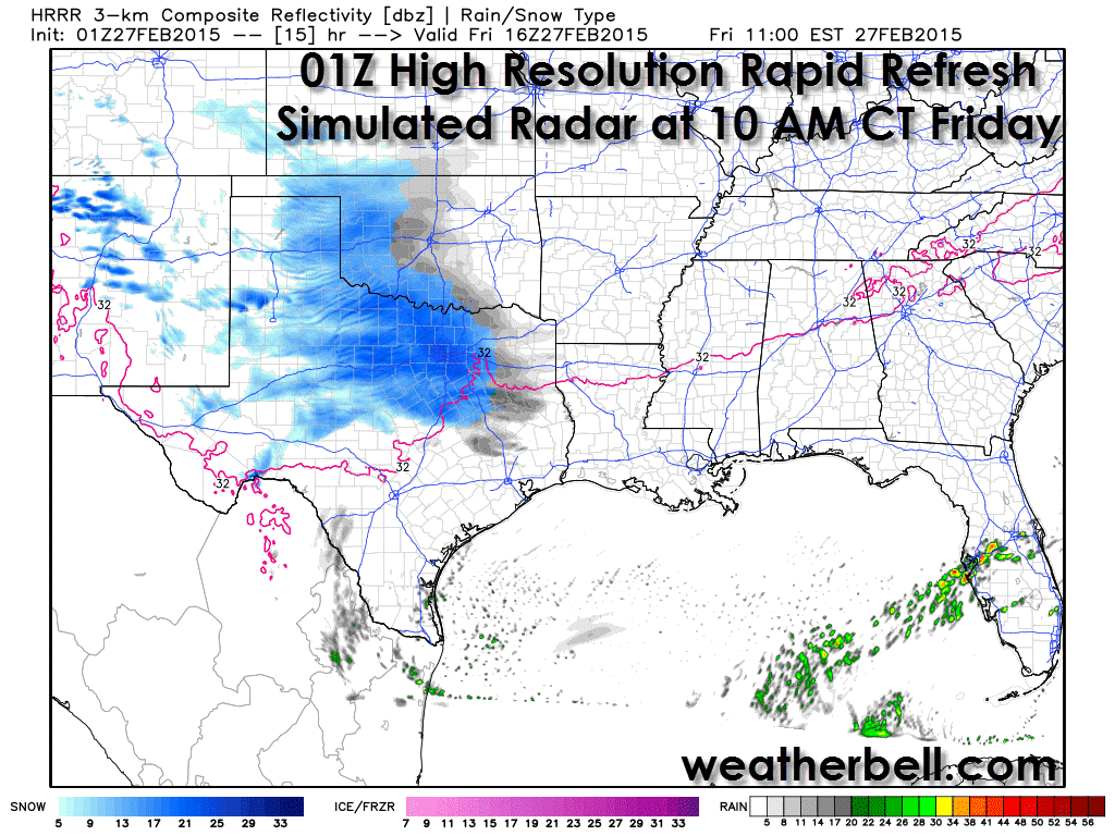
Here’s the latest timing and trends from the 01Z High Resolution Rapid Refresh weather model. Keep in mind this is weather model data and probably doesn’t have it down 100 percent correctly. Still I think it gives a good estimate on timing and location of snow. Most snow will be light, but there will be bands of moderate to locally heavy snow.
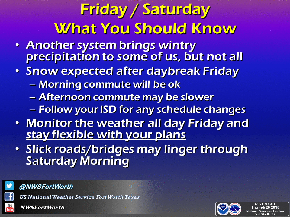
A few of you have asked us about impacts specific to the D/FW Metroplex tomorrow. The National Weather Service in Fort Worth put together this informal graphic to help answer a few of those questions. Keep in mind we don’t have anything to do with school closings nor do we typically speculate on such things.
The winter weather event will start winding down tomorrow afternoon from west to east but we won’t be done yet. Surface temperatures will remain below freezing through Saturday morning across the Big Country, Concho Valley, and North Texas. At the same time we may have enough lift in the atmosphere for light freezing rain/freezing drizzle to develop. Should that occur we would likely see a very thin, but problematic layer of ice develop on most surfaces. Overall accumulations would be very light but with temperatures in the 20s any freezing drizzle we see would likely make roads and bridges slick and hazardous. This potential does include the D/FW Metroplex with roads maybe being worse Friday Night and Saturday Morning than what we see with snow tomorrow afternoon. It goes without saying a big mess is in store and we’ll try and keep you updated with it all.
As this evening’s weather model data continues to arrive we may see a few minor adjustements to the forecast. Don’t be surprised if you wake up tomorrow morning to a few changes. As usual forecasting winter weather in Texas is difficult even within a few hours of an event. Mother Nature always throws a surprise in with each event so we’ll be watching for that as well.


0 Comments