
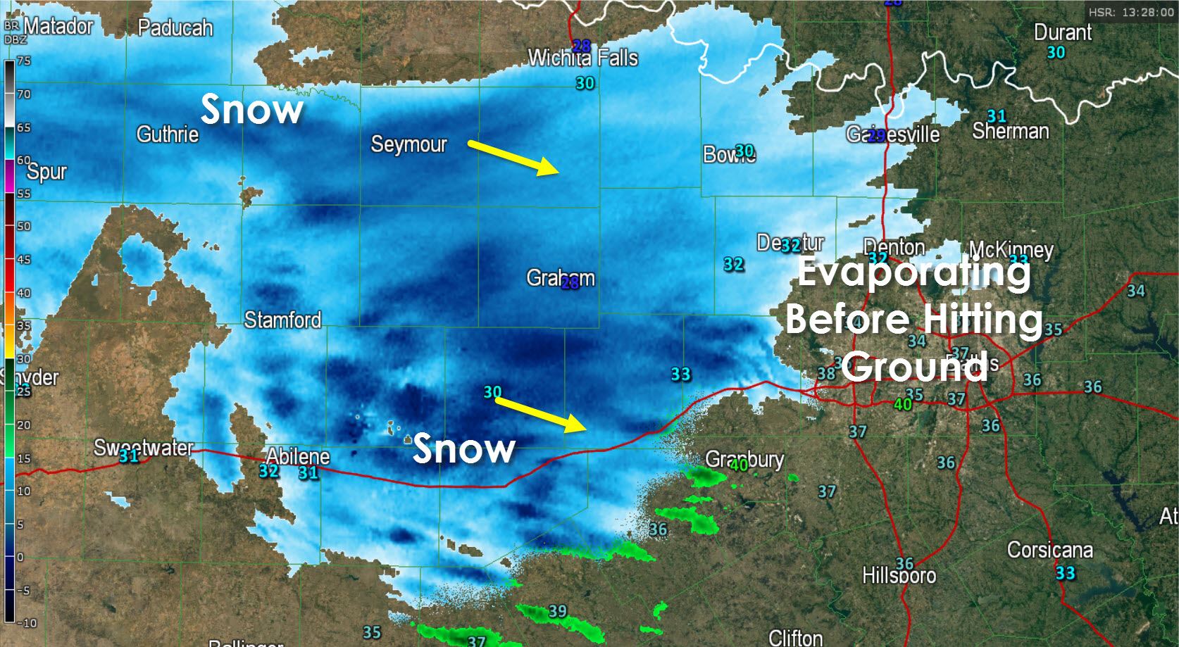
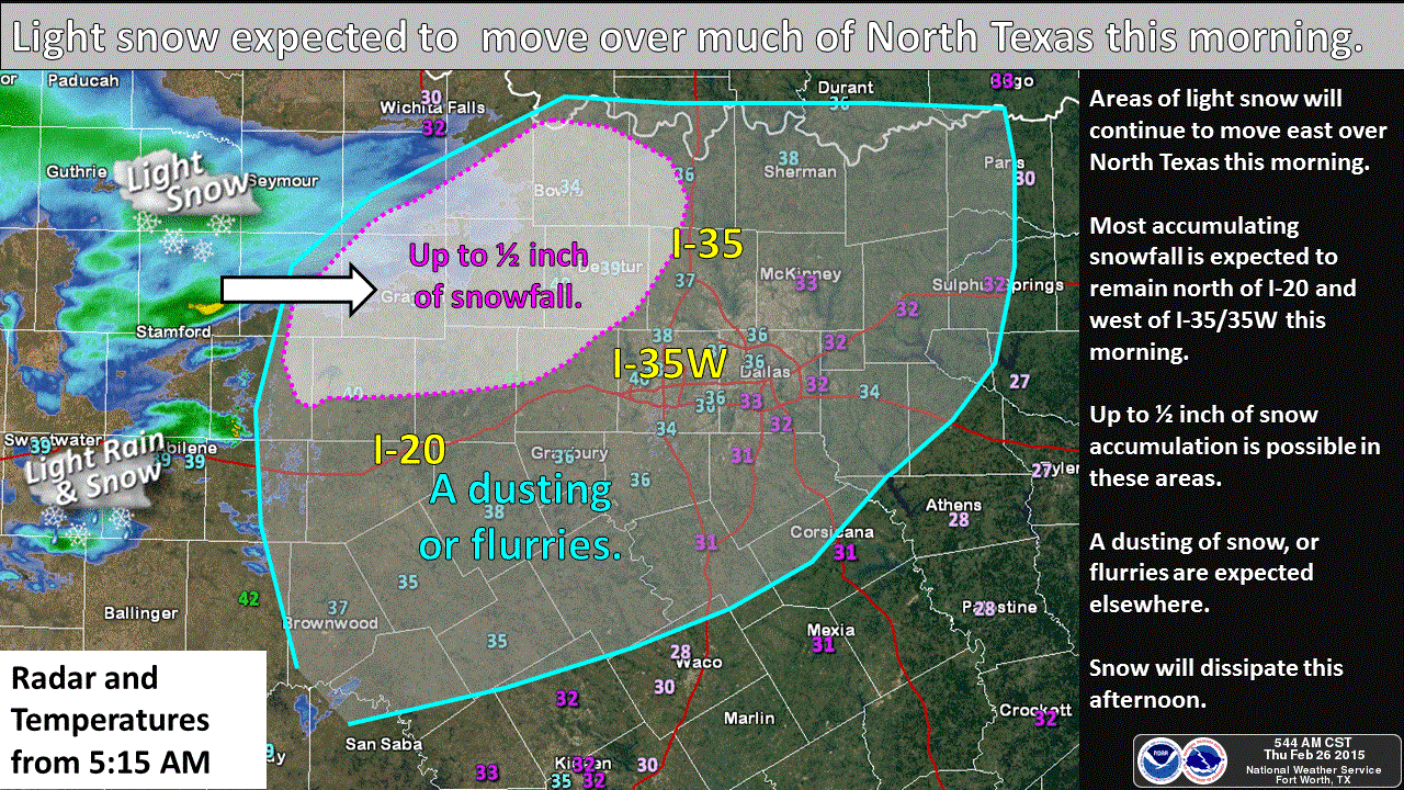
An area of snow has moved into western North Texas this morning. While the radar image may look a bit scary some of the snow is evaporating before reaching the ground due to a layer of dry air in place. Nevertheless we do now have snow being reported in Graham, Breckenridge, and Abilene. This batch of precipitation is moving east/southeast and may dump up to half an inch of snow in western North Texas. As the snow moves east into the D/FW Metroplex it is having to deal with a layer of increasingly dry air. This will prevent any significant accumulation of snow. However we could still see a dusting in the remainder of North Texas, including the D/FW Metroplex, this morning.
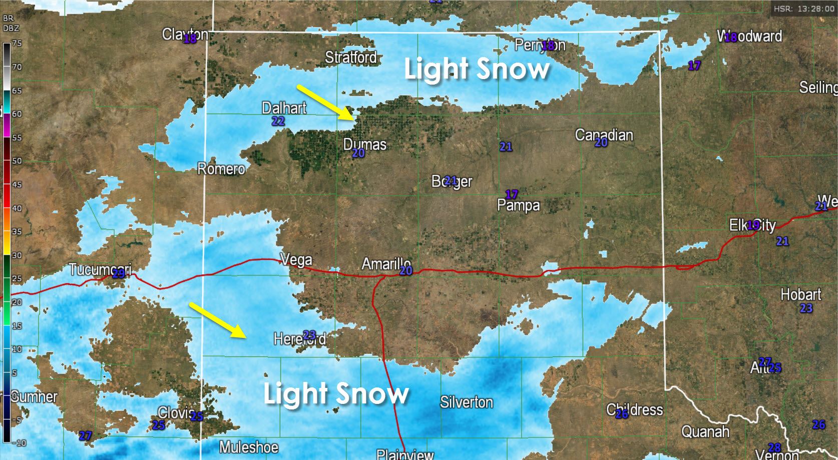
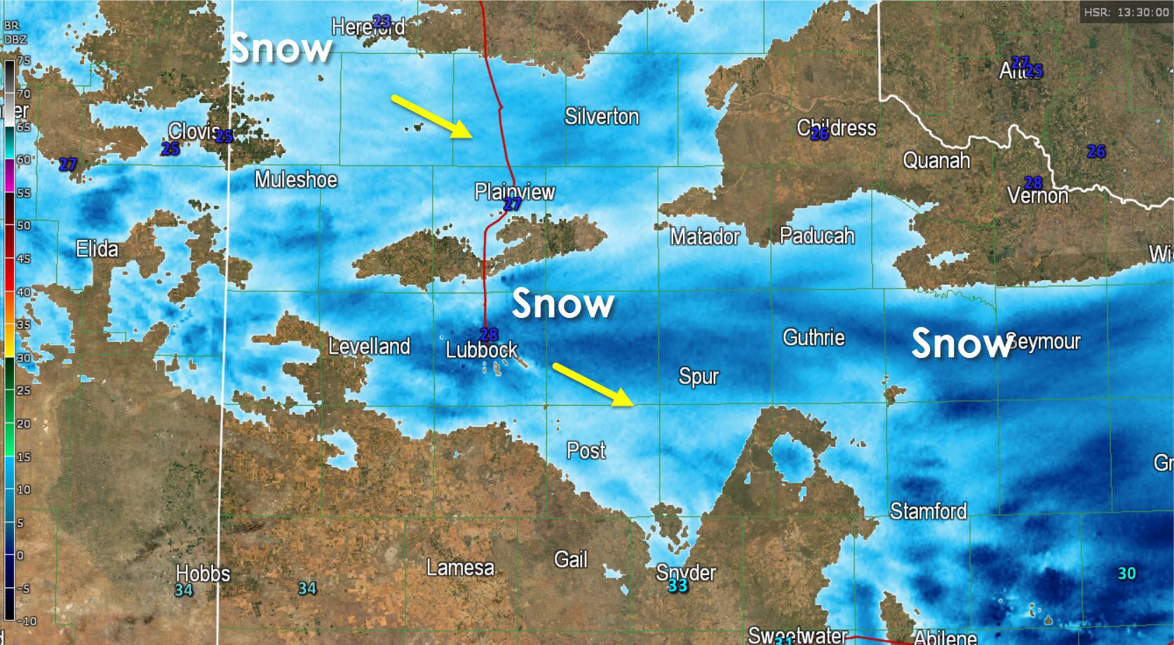
The snow extends west into the South Plains where it has reduced visibility in Lubbock this morning. The snow will gradually diminish this morning with a dusting to half an inch possible. Likewise light snow also continues across the Texas Panhandle this morning. A more substantial winter weather threat will develop late tonight into Saturday across these areas with accumulating snow a good bet. We’ll talk more about that once we’re done with this morning’s snow.


0 Comments