
* Rain is in the process of changing over to sleet and eventually snow in the D/FW Metroplex. We now have sleet falling across the northern and northwestern portions of the D/FW Metroplex. This rain/sleet line is quickly spreading into the core of the metro and most folks should start seeing sleet mix in over the next 30 minutes. Snow is now falling across parts of Parker, Denton, and Collin Counties.
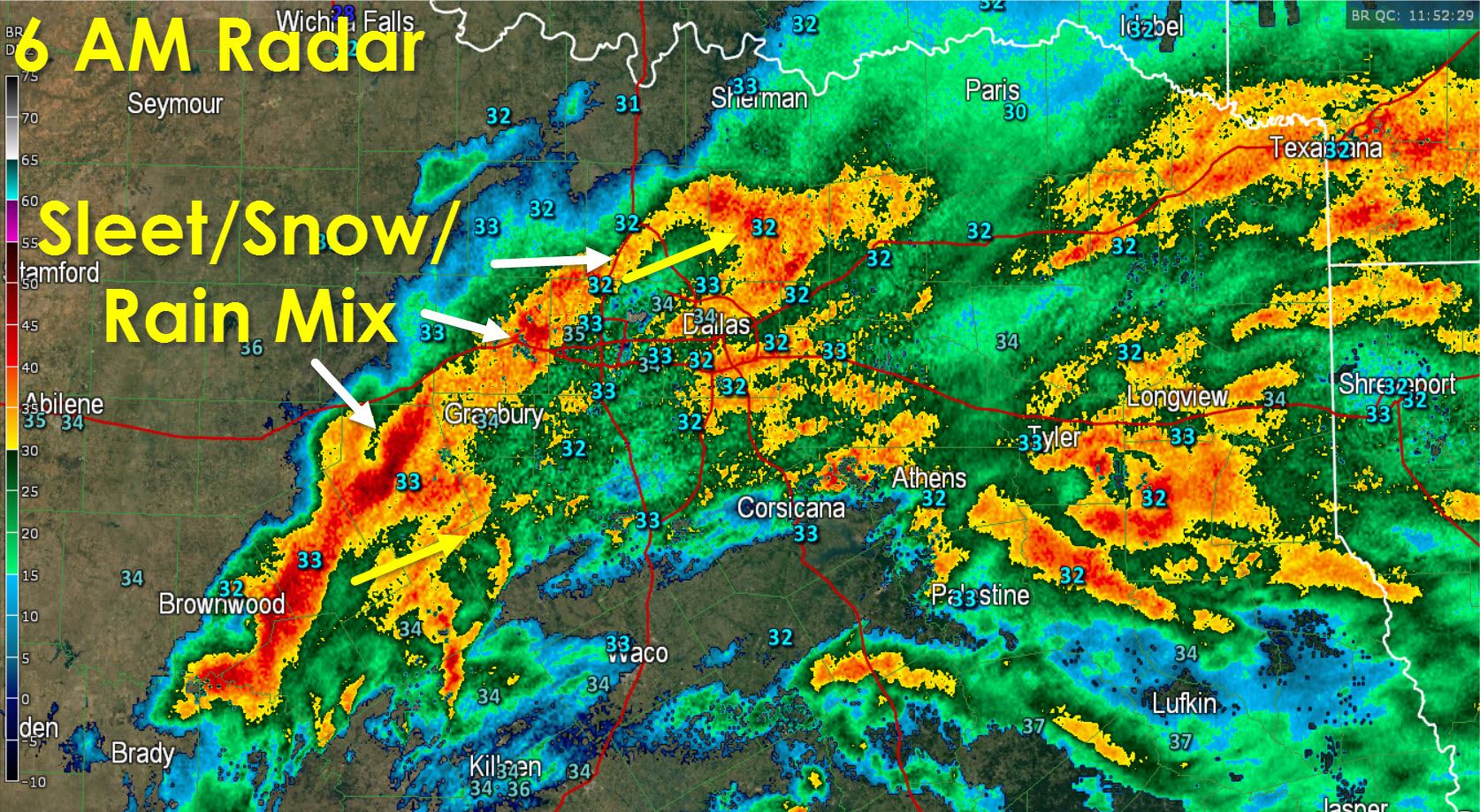
* We have an updated snow accumulation forecast which features a few changes. This will not be a long-duration event but there is concern because once we switch over to snow these heavy bands of rain could easily end up producing up to one or two inches of snow per hour. That kind of snow will cause blizzard-like visibility conditions and plenty of issues for those stuck under one while in rush hour. These training bands of convective snow will definitely be something we’re watching for this morning.
* We do not expect widespread travel issues because surface temperatures are at or above freezing. That said we could see slushy spots on roads and some issues on bridges. Traffic issues will be significantly worse where heavy snow bands pass over a given location.
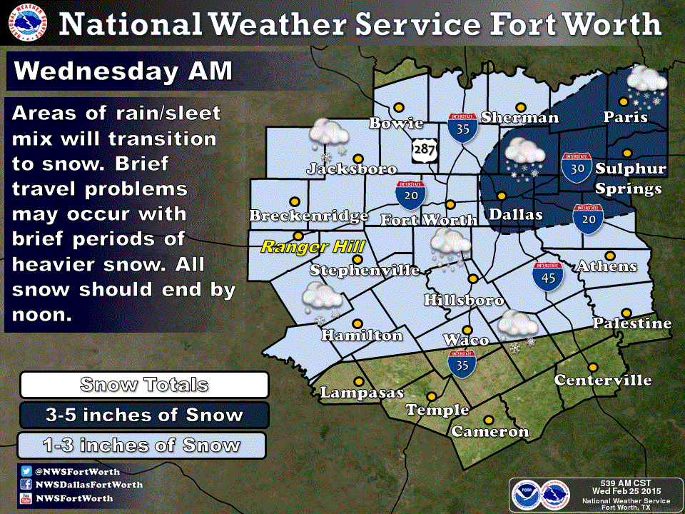
* Snow amounts of 1 to 3 inches will be possible in the D/FW Metroplex. We could see up to 5 inches of snow northeast of the D/FW Metroplex up into Northeast Texas. All snow will melt this afternoon as temperatures climb into the 40s and we see a few breaks in the clouds. We anticipate all this mess to be out of D/FW by 11 AM and out of Northeast Texas by 3 PM.


0 Comments