
Quick Summary
* Light snow continues to fall across portions of the Texas Panhandle where temperatures range from 15 to 19 degrees. It goes without saying wind chills are near 0. Watch for some slippery roads from earlier snow today.
* We’ve seen patches of light sleet develop just southwest of Lubbock and that’ll move northeast into town shortly. That sleet will accumulate on roads, bridges, and most surfaces which will cause them to become slick.
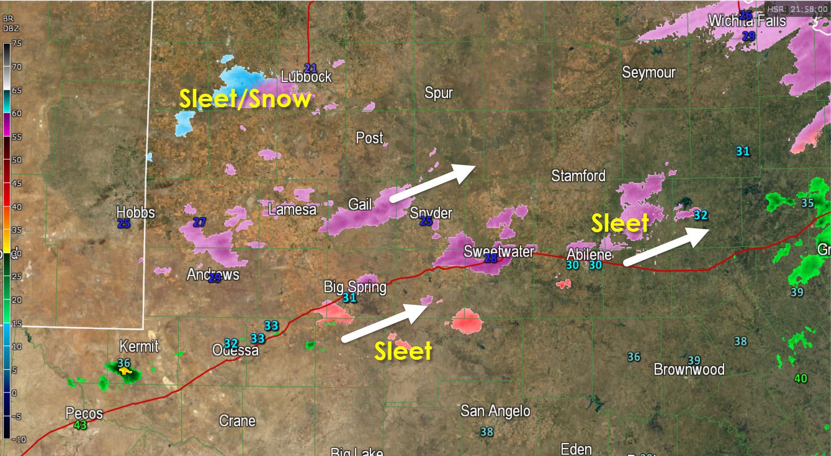
* Patches of sleet and freezing rain are falling across the northeast Permian Basin into the northern Concho Valley. Midland, Odessa, Sweetwater, and Abilene are all below freezing with light winter precipitation falling. Icy bridges will become a hazard soon and we could even start seeing icy spots on main roadways after sunset.
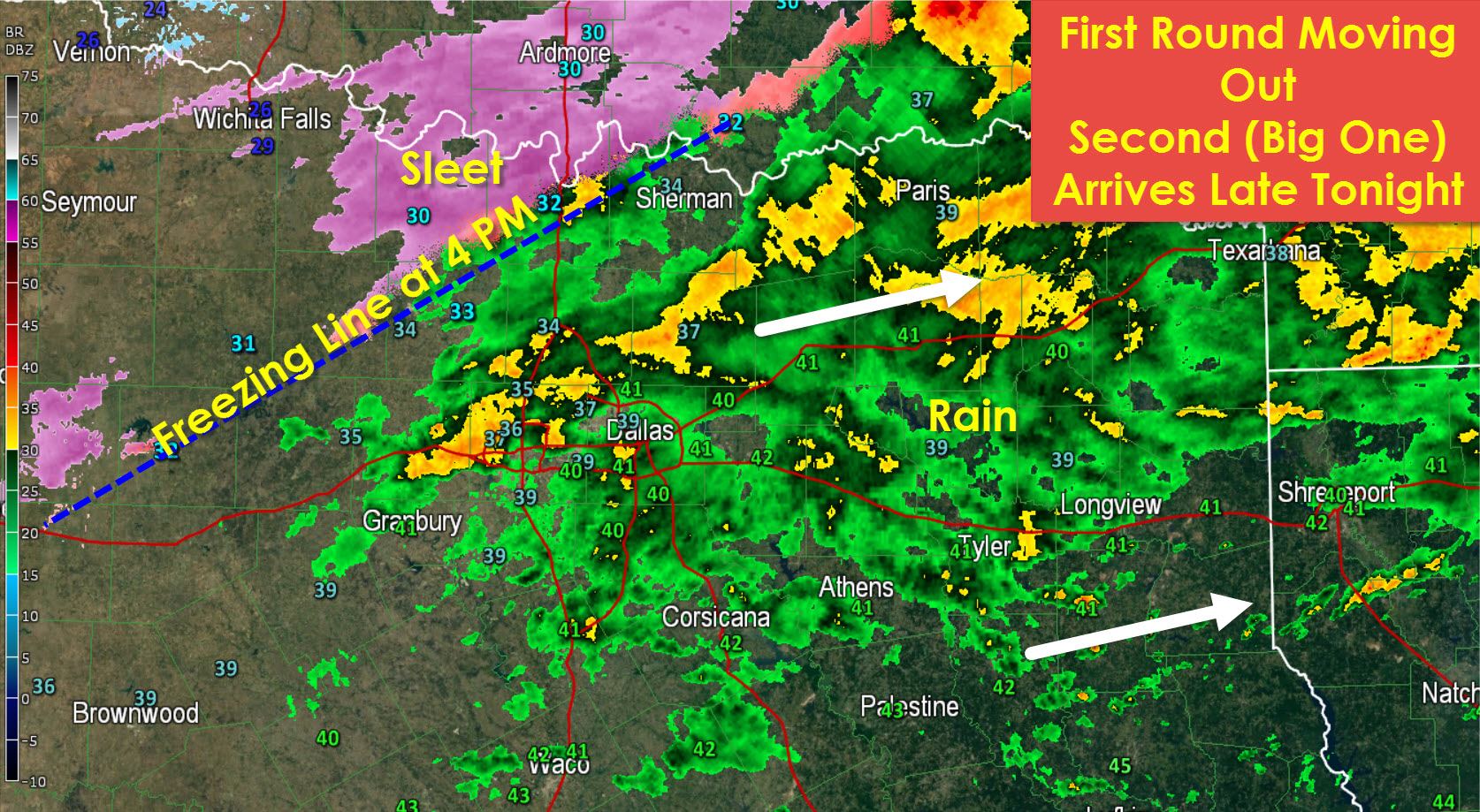
* The first round of rain continues to move northeast across North Texas and Northeast Texas. For the most part temperatures are above freezing in the mid to upper 30s. The freezing line now extends from Denison southwest to Gainesville, Decatur, to Breckenridge. North of that line there is some sleet and freezing rain being reported (although it is light). Be mindful of icy spots developing on bridges in those areas over the next few hours. The freezing line will continue to move southeast this evening.
We’ll see patchy areas of light freezing drizzle, freezing rain, and sleet continue across West Texas, northeastern parts of the Permian Basin, northern parts of the Concho Valley, and parts of North Texas where temperatures fall below freezing. This precipitation will be light and is not the main show. It does, however, have the potential to cause local icy spots on bridges and roadways. The primary travel problems will not develop until after midnight into the pre-dawn hours on Monday.
Here is what the High Resolution Rapid Refresh model is shown for around 5 AM on Monday. I think it has a pretty good idea. This activity will be moving northeast.
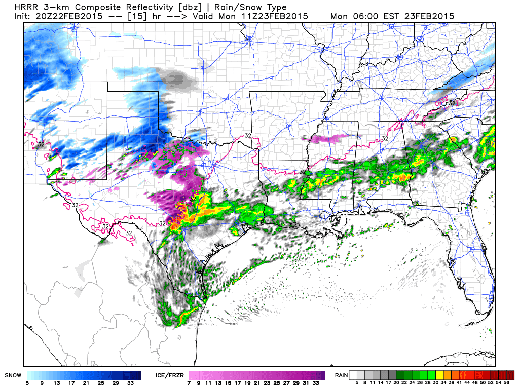
Simulated Radar from HRRR at 5 AM CST Monday Attribution: WeatherBell
Regional Winter Weather Forecasts for your area


0 Comments