
* Light to locally moderate snow is falling across the Texas Panhandle, South Plains, northeastern Permian Basin, and the Concho Valley at 4 AM. This activity as a whole is spreading east towards Northwest Texas and the Big country.
* Snow accumulations of a half inch to one inch have likely occurred across the areas mentioned above this morning. This is not a moderate/high level winter storm but any snow that falls is accumulating on all surfaces including roads.
* Latest projections have snow moving into western parts of the D/FW Metroplex between 7 and 8 AM and into the core of D/FW between 8 and 9 AM. The morning rush hour should be in good shape but road conditions could go downhill after 8 AM in the D/FW Metroplex. This is not expected to be a high-impact event like Monday but some slick/snow-covered/slushy roads are a good bet once we really get going.
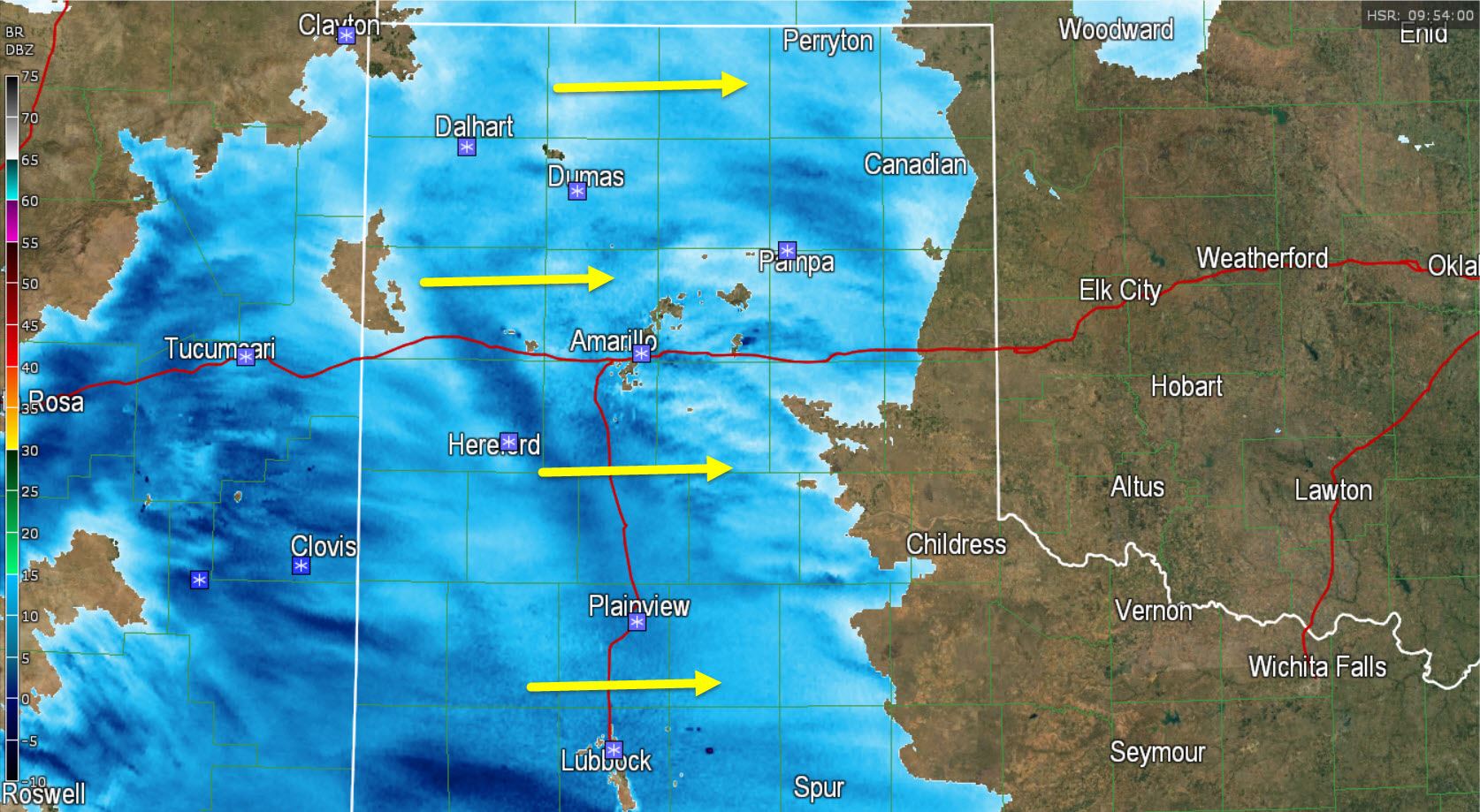
The area of snow will continue to slowly push east this morning. There is a layer of dry air at about 3,000 feet that will need to moisten up across North Texas before snow starts making it to the ground. That process will take a little time and is why accumulation forecasts are not particularly aggressive. Around 7 AM we expect an area of light to locally moderate snow to extend west of a Wichita Falls-Graham-Stephenville line. Snow should still be falling across the Texas Panhandle, West-Central Texas, and Northwest Texas. Light snow will also be possible in the Concho Valley. Most locations mentioned above will see 1 to 3 inches of snow on average this morning with isolated totals up to 4 inches possible.
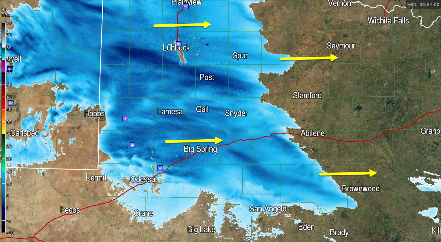
By 10 AM snow will be winding down across the Texas Panhandle and West Texas. Light to locally moderate snow will be falling in North Texas, including the D/FW Metroplex, into Northwest Texas. This is the time where snow may be accumulating on all surfaces, including roadways, in the D/FW Metroplex. We expect 1 to 2 inches of snow in D/FW with locally higher amounts up to 3 inches northwest of the D/FW Metroplex. With temperatures well below freezing and staying that way all day any snow that does fall could stick to roads. Once snow starts sticking to roads and bridges take them carefully and don’t assume the driver next to you has ever driven in snow before. That mindset has saved me from getting ran into many a times during winter weather events.
Snow will start winding down in North Texas around lunch time with light snow continuing into the mid-afternoon hours. Locally moderate snow may still be falling in spots with roads and bridges likely have some snow on them. With temperatures below freezing all day today we won’t see much in the way of melting. By 4 PM we could still have areas of light snow in North and perhaps even Northeast Texas. Snow intensity will be light and we shouldn’t see too much new accumulations after early afternoon. Spotty snow flurries will remain possible today across the Texas Panhandle, West Texas, Big Country, Northwest Texas and North Texas after the main snow ends today.
The winter weather event will continue tonight when a new area of light snow/light sleet/light freezing rain develops across the Big Country, Concho Valley, and North Texas. While the precipitation will be very light it does have the potential to coat everything in a thin layer of ice. This may end up being our most problematic time for travel and slick roads versus the snow today. Road conditions are not expected to improve until Saturday when we get above freezing. This will not be a high-impact event like Monday but black ice could be a real issue tonight.
Here is a simulated radar animation beginning at 7 AM CT and ending at 4 PM CT in 3 hour increments. Blues are snow as you might expected. This comes from the 2 AM run of the High Resolution Rapid Refresh.

412AM: Heavy snow with visibility under 1/2 mile in Lubbock. Roads are all snow-covered and slick. #txwx #lubwx pic.twitter.com/ywddY989jv
— Texas Storm Chasers (@TxStormChasers) February 27, 2015


0 Comments