
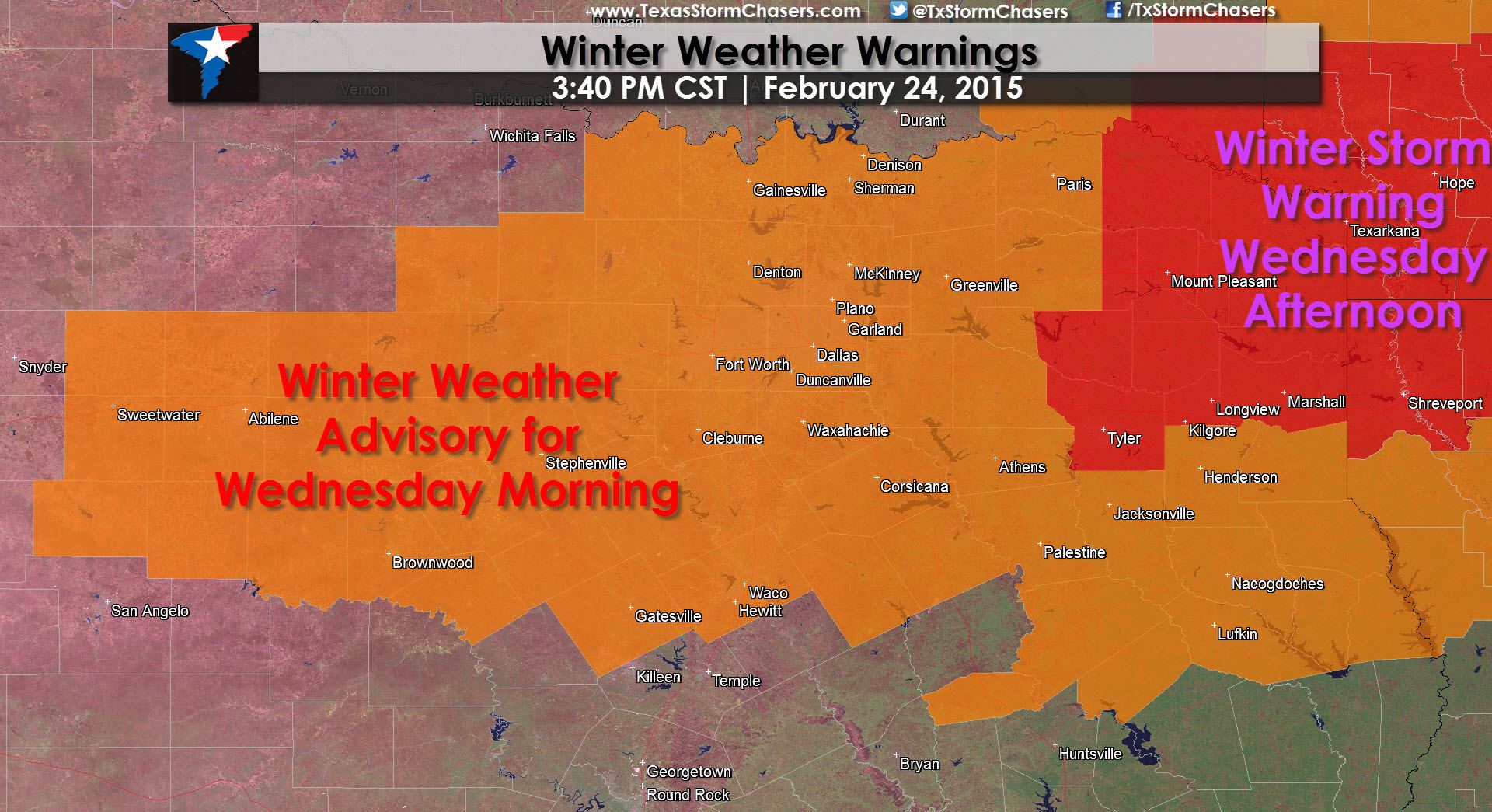
Winter Weather Warnings Summary
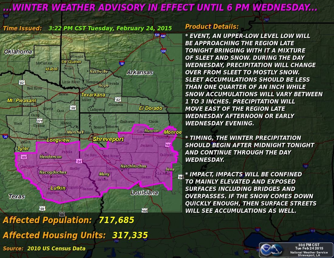
A Winter Storm Warning is in effect from Wednesday Morning through Wednesday Afternoon for Northeast Texas including Mt. Pleasant, New Boston, Texarkana, Marshall, Longview, and Tyler. Snow accumulations of 2 to 5 inches will be possible along with minor sleet accumulations. Elevated surfaces including bridges and overpasses could become slick. Some surface roads will be impacted by slushy snow combining with sand from the past few days.
A Winter Weather Advisory is in effect late tonight through Wednesday Morning for parts of the Big Country and North Texas. Rotan, Sweetwater, Abilene, Brownwood, Comanche, Graham, Gainesville, Fort Worth, DAllas, Cleburne, Corsicana, Waco, Greenville, Paris, and Palestine are a few cities included. This is an upgrade from the Winter Storm Watch previously in effect. Snow accumulations of 1 to 3 inches will be possible with up to 4 inches of wet snow possible northeast of the D/FW Metroplex. Elevated surfaces including bridges and overpasses could become slick. Some surface roads will be impacted by slushy snow combining with sand from the past few days.
A Winter Weather Advisory is in effect from late Wednesday Morning through Wednesday Afternoon for East Texas including Henderson, Nacogdoches, Lufkin, and Crockett. Up to one inch of wet snow will be possible on grassy and elevated surfaces. Little to no travel problems are anticipated.
Discussion
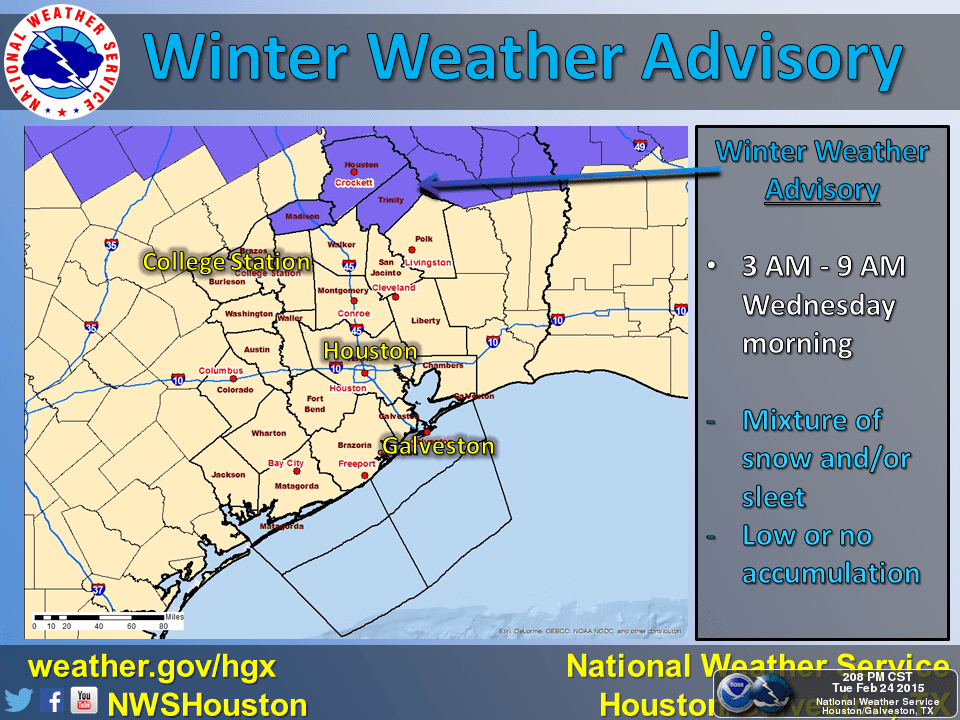
An upper level low pressure system will pass over Texas tonight resulting in widespread precipitation from the Concho Valley eastward into Southeast Texas. As cold air from the upper low filters down we expect rain to change over to a wet snow across portions of North and Northeast Texas on Wednesday. This will be a quick-hitting storm system with only a few hours of snow anticipated. We should see snow moving out of the D/FW Metroplex by 10 AM and exiting Northeast Texas by 4 PM. For the most part temperatures will be above freezing at the surface. This is not going to be a high-impact event like Monday thanks to warmer temperatures. What we’ll see is the potential for a wet snow to accumulate on bridges and overpasses. Snow should mainly melt on surface roads but could create slushy conditions if it falls quickly enough. While snow will only fall for a few hours it does have the potential to be heavy at times hence we are expecting accumulation on grassy surfaces. Regardless of whatever falls Wednesday morning we’ll quickly warm well above freezing during the afternoon hours on Wednesday. We may even see the sun come out so any snow that falls will rapidly melt tomorrow afternoon. We will not see ice develop since temperatures will be above freezing but the snow could create slick conditions on bridges with slush on roads. Another thing to think about is that the slush could combine with any sand left on roads creating a rather slushy/sandy mess. The Texas Department of Transportation has been working hard today to get any residual ice off roads since its warm enough to plow it. This is a dynamic system and we could see some forecast adjustements as we head into the evening hours. We’ll keep an eye on it and post updates as needed!
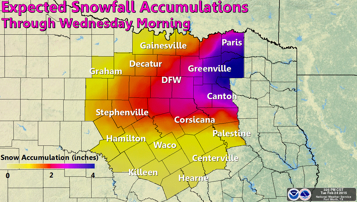
Regional Accumulation Forecasts
Storm Ramps Up East of Texas
The winter storm will only begin here in Texas. Once it moves east of our state it will really ramp up bringing a variety of impacts to the Southeast United States.


0 Comments