
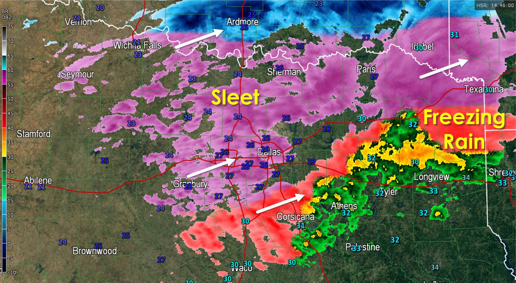
* Sleet continues to fall across North Texas at 9 AM. Roads have accumulated sleet and are slick. The good news is folks have heeded the warnings and roads are mainly empty. I want to emphasis that road conditions will not improve this afternoon after the sleet stops. Don’t think you can go out and about when the sleet is over because the roads will be in bad shape until late Tuesday morning. Activity is moving northeast but until we get rid of the upper level lift over the region we’ll continue to see redevelopment of sleet. At this time it looks like we should see precipitation moving out of the D/FW metroplex around 1 PM. Areas of thundersleet (thunderstorms with sleet) are also possible which will produce enhanced sleet accumulations.
* Sleet continues to fall across Northeast Texas and into northern parts of East Texas this morning. As activity over North Texas moves east we should begin to see accumulations of sleet across Northeast and East Texas into the late morning and early afternoon hours. Slick road conditions are possible. Another band of sleet/freezing rain may move along I-20 from D/FW into East Texas during the early afternoon.
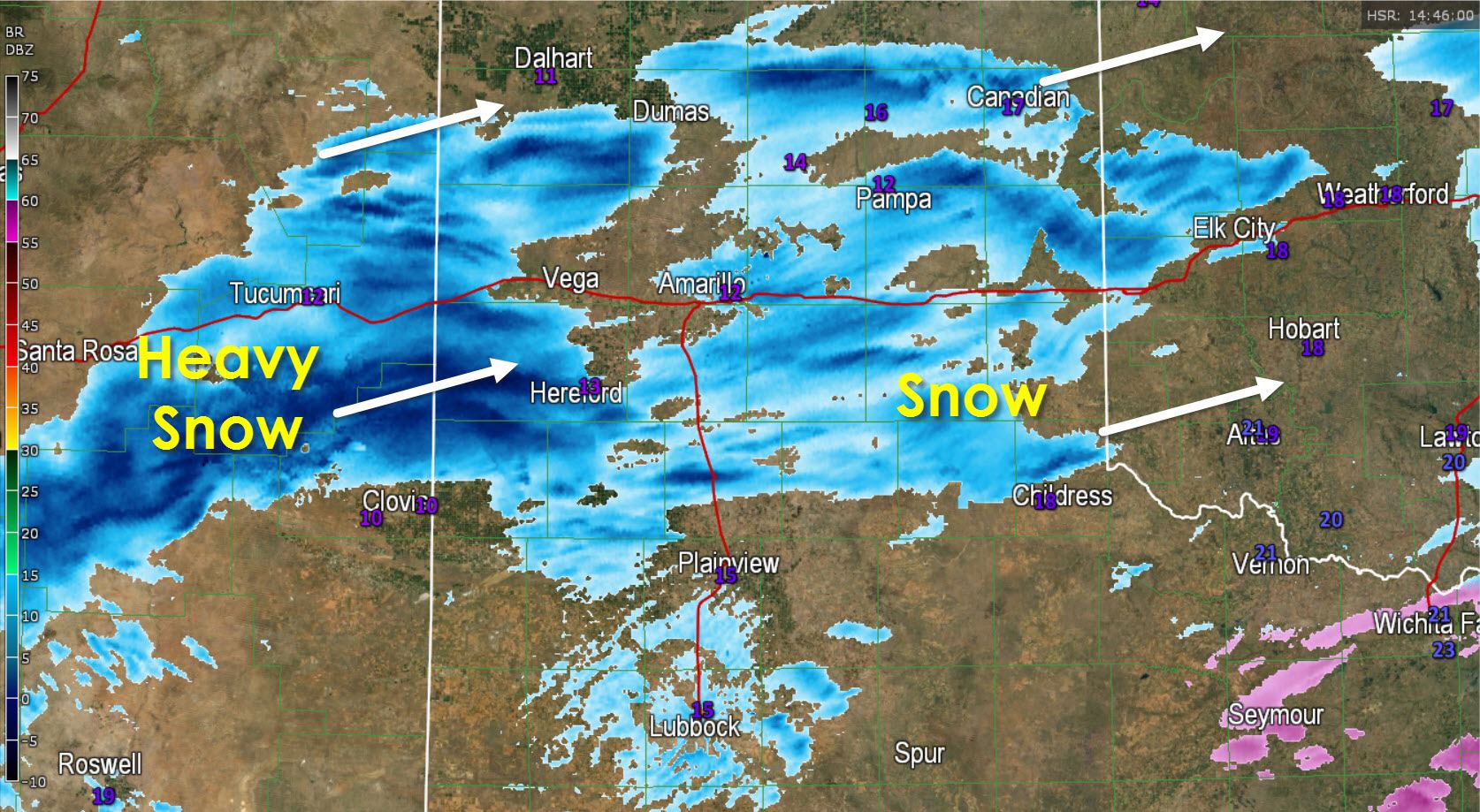
* Snow is increasing across the Texas Panhandle. A band of moderate to heavy snow just moved into Hereford and will continue to move east/northeast into the Amarillo area. 1 to 3 inches of additional snow may occur from this band of heavy snow. We also have other spotty snow is moving northeast across the Panhandle. It’s cold with temperatures in the low teens with wind chills below zero.


0 Comments