
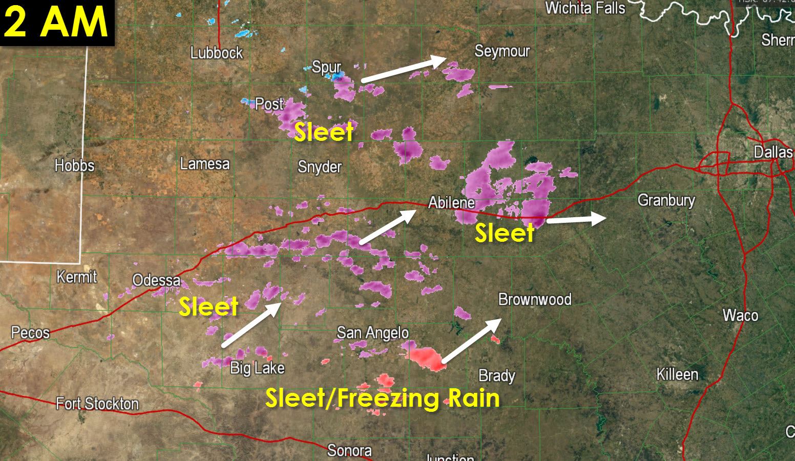
Patches of sleet have continued developing across the Concho Valley and Big Country since midnight. THis activity is becoming more widespread but has not yet formed into a single large area of precipitation. As upper level forcing continues to increase we should see precipitation became fairly widespread through 5 AM. This activity is producing sleet in an area where temperatures are in the low 20s. That means accumulations are likely on elevated surfaces along with plain old roads. Movement of this mess is generally to the northeast and it will enter western North Texas by 4 AM with more widespread activity moving in around 6 AM as it progresses northeast/eastward.
The freezing line now extends along and north of a line from Paris-Corsicana-Mexia-Temple-Marble Falls-Kerrville-Rock Springs. Folks north of that line are at or below freezing. Folks south of that line are above freezing. Assuming precipitation were to develop everywhere this morning the locations below freezing would be susceptible to assuming winter precipitation.
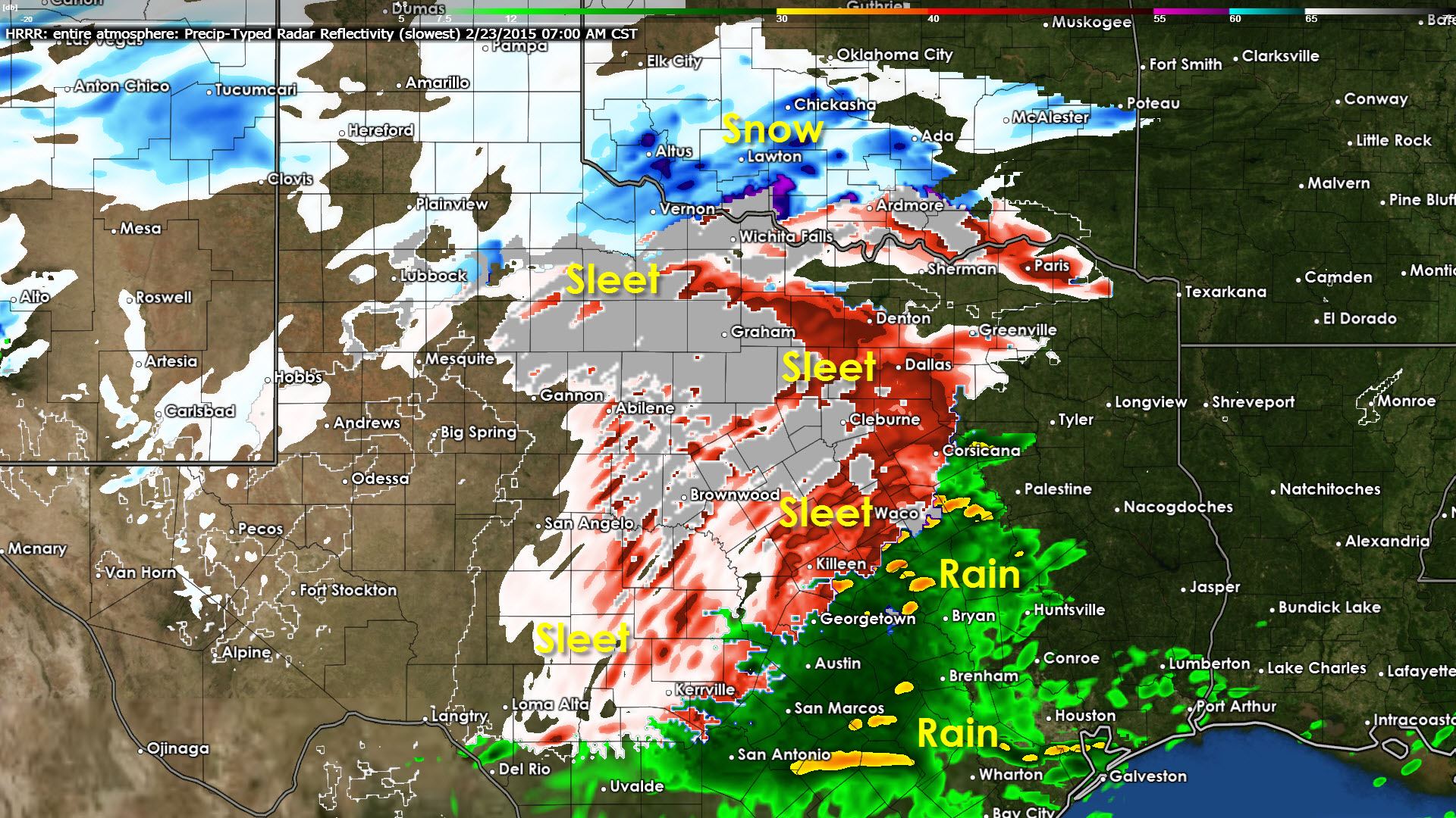
Here’s what the latest HRRR is showing. It may be overdoing the precipitation across the southern half of Texas but I think it’s a good candidate for the northern half of Texas. This graphic shows the simulated radar at 7 AM this morning.


0 Comments