
There have not been any adjustements to the current winter weather advisory or winter storm warning areas. We may see a portion of North Texas upgraded to a winter storm warning later tonight. Regardless it doesn’t really matter at this point.
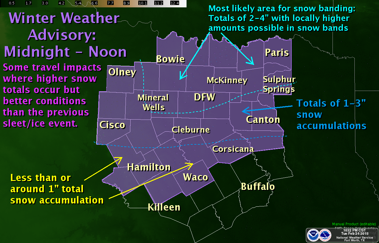
Not everyone in North and Northeast Texas will see heavy accumulating snow tomorrow morning. What we’ll end up having is one or two bands of heavy snow that move over parts of the area. Folks under those heavy bands of snow will likely see 2 to 4 inches of snow. Some isolated locations could see up to 6 inches of snow. Otherwise the widespread amounts of 1 to 3 inches of snow for North and Northeast Texas seem good.
Temperatures will be very near or just above freezing in areas that receive snow tonight. Even if temperatures are right above freezing the heavy wet nature of the snow will likely cause it to accumulate on bridges, overpasses, and even some surface roads during the morning commute. The result will be slushy roads and slick spots. Give yourself plenty of extra time in the morning because it’s not going to be a pleasant ride into work.
Snow will move east of the D/FW Metroplex by 10 AM and should exit Northeast Texas by 3 PM. Clouds will thin behind the exiting snow and temperatures should warm up into the 40s quickly melting any snow that has accumulated. Roads may still be wet for the evening drive home but roads will be in much better shape than the morning.
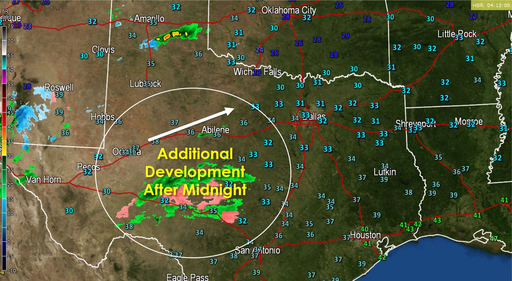
We do note that a large area of light rain and sleet has developed in the Concho Valley. This is indicative of the increasing lift ahead of the storm system. We’ll see precipitation expand across the Concho Valley and Big Country after midnight as the storm system moves in closer. We’ll also see some of that rain change over to snow especially east/northeast of a Sweetwater to San Angelo Line. All that rain/snow will move northeast into North Texas before sunrise.
Regional Accumulation Forecasts


0 Comments